Enable Location

We need your location to show you interesting places around you

Discover nearby places

Find interesting locations and hidden gems around you

Precise directions

Get accurate directions and distances to places

Your location is never shared with other users. It's only used when you tap the location button.

Tabeguache Peak

Log in to your account

Start exploring — it's free

Trusted by 62,189 travelers worldwide

Continue with Google
Continue with Apple
or

We will send you a code to connect

By continuing, you accept our Terms and Conditions and our Privacy Policy

Check your inbox

We've sent a pincode in your inbox. Please enter the code below.

Tabeguache Peak

Tabeguache Peak, Mountain summit in Chaffee County, United States.

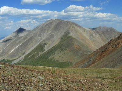
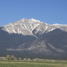
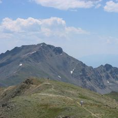
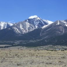
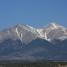
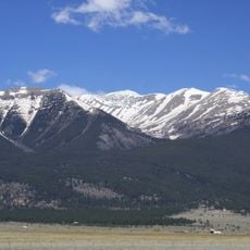
Tabeguache Peak is a 14,157-foot (4,318-meter) summit in Colorado's Sawatch Range, surrounded by alpine tundra vegetation and coniferous forest zones at lower elevations. The climb demands technical skill and proper mountaineering equipment due to steep terrain and exposure on upper sections.

The region was home to the Tabeguache, a Ute Indian band, long before European settlement in Colorado. The peak's name honors these original inhabitants who used the mountain ranges for hunting and trade routes.

Local communities maintain a network of trails and facilities around the peak, supporting mountaineering traditions throughout the changing seasons.

The southwest-facing route from Highway 50 is technically challenging and requires experience with climbing gear and high-altitude conditions. Start early to allow time for acclimatization and choose stable weather windows for your attempt.

The summit sits so close to Mount Shavano that skilled climbers can reach both peaks in a single day. This pairing attracts many mountaineers seeking to accomplish multiple fourteeners efficiently.

The community of curious travelers

AroundUs brings together thousands of curated places, local tips, and hidden gems, enriched daily by 60,000 contributors worldwide.

Start exploring
Location
GPS coordinates
38.62541,-106.25088
Latest update
December 12, 2025 09:03
« Tabeguache Peak - Mountain summit in Chaffee County, United States » is provided by Around Us (aroundus.com). Images and texts are derived from Wikimedia project under a Creative Commons license. You are allowed to copy, distribute, and modify copies of this page, under the conditions set by the license, as long as this note is clearly visible.

Discover hidden gems everywhere you go!

From secret cafés to breathtaking viewpoints, skip the crowded tourist spots and find places that match your style. Our app makes it easy with voice search, smart filtering, route optimization, and insider tips from travelers worldwide. Download now for the complete mobile experience.

Around Us App Screenshot

A unique approach to discovering new places

Le Figaro

All the places worth exploring

France Info

A tailor-made excursion in just a few clicks

20 Minutes

Around Us
Travel Guide & Maps
Download

Send to your phone

QR Code
1

Open the camera app on your mobile.

2

Point at the QR code with your camera. A notification will appear.

3

Tap the notification to open the link.