Chest opened
+${chestReward.xp} XP
Explorer
NOUVEAU ×${chestReward.collectible.quantity}
tapez pour fermer
Chest locked

Open chests in the app

Around Us is built for your phone — chests unlock when you walk, explore and capture nearby places.

Enable Location

We need your location to show you interesting places around you

Discover nearby places

Find interesting locations and hidden gems around you

Precise directions

Get accurate directions and distances to places

Your location is never shared with other users. It's only used when you tap the location button.

Taunton River

Log in to your account

Start exploring — it's free

Trusted by 72,888 travelers worldwide

Continue with Google
Continue with Apple
or

We will send you a code to connect

By continuing, you accept our Terms and Conditions and our Privacy Policy

Check your inbox

We've sent a pincode in your inbox. Please enter the code below.

Taunton River
Discussion Reviews 1 Photos
11.5k Popularity

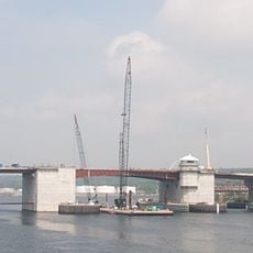
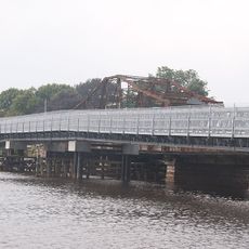
Taunton River, Coastal river in southeastern Massachusetts, United States

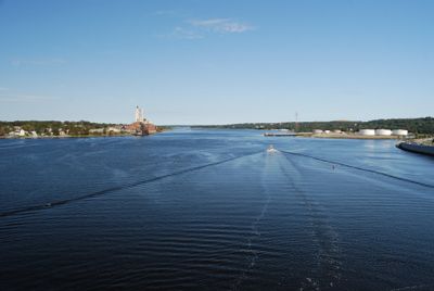
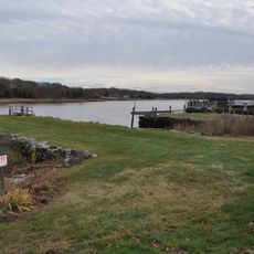
The Taunton River is a coastal river in southeastern Massachusetts that flows roughly 37 miles from Bridgewater to Mount Hope Bay. Its banks remain largely natural and undeveloped, with extensive wetlands creating a network of different habitat types along its course.

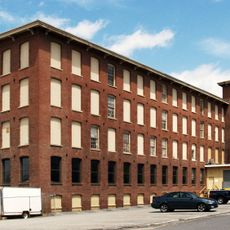
During the 1800s, the river powered important industries including iron mills and shipyards that shaped the region's growth. These enterprises drew workers and investment to nearby towns and left marks on the landscape that you can still trace today.

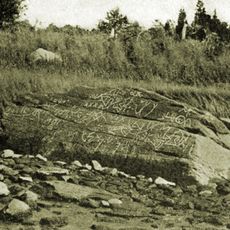
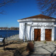
The river held deep importance for Native American communities who depended on its resources for survival and trade. You can still find places along the banks where people left behind pottery and tools that tell their story.

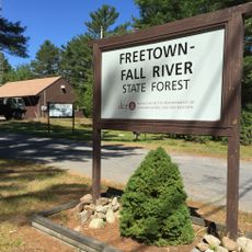
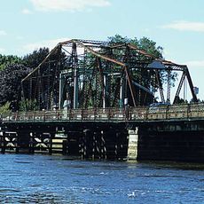
You can reach the river at several points along its course to kayak, fish, or boat through its waters. Parks and walking trails line the banks in many areas, making it easy to explore different sections.

This river remains one of the longest coastal rivers in New England without a dam, allowing its water to flow freely from source to ocean. This unobstructed flow creates an unusually rich range of environments that support wildlife rarely seen elsewhere in the region.

The community of curious travelers

AroundUs brings together thousands of curated places, local tips, and hidden gems, enriched daily by 60,000 contributors worldwide.

Start exploring
Location
GPS coordinates
41.78300,-71.11800
Latest update
December 8, 2025 13:40
Around this place
Dighton Rock
United States of America

Dighton Rock

3.4 km
Freetown Fall River State Forest
United States of America

Freetown Fall River State Forest

6.3 km
Dighton Rock State Park
United States of America

Dighton Rock State Park

3.5 km
Veterans Memorial Bridge
United States of America

Veterans Memorial Bridge

6.9 km
Truesdale Hospital
United States of America

Truesdale Hospital

6.3 km
Berkley State Forest
United States of America

Berkley State Forest

6.1 km
Berkley–Dighton Bridge
United States of America

Berkley–Dighton Bridge

5.8 km
Dighton Community Church
United States of America

Dighton Community Church

3.9 km
Hornbine Baptist Church
United States of America

Hornbine Baptist Church

7.1 km
Border City Mills
United States of America

Border City Mills

6.8 km
Berkley–Dighton Bridge
United States of America

Berkley–Dighton Bridge

5.8 km
Sagamore Mills No. 1 and No. 3
United States of America

Sagamore Mills No. 1 and No. 3

6.8 km
North Christian Congregational Church
United States of America

North Christian Congregational Church

4.4 km
Dighton Wharves Historic District
United States of America

Dighton Wharves Historic District

2.9 km
Ashley House
United States of America

Ashley House

5 km
Baker House
United States of America

Baker House

6.3 km
Borden-Winslow House
United States of America

Borden-Winslow House

6.5 km
Coram Shipyard Historic District
United States of America

Coram Shipyard Historic District

3.3 km
House at 197 Hornbine Road
United States of America

House at 197 Hornbine Road

6.9 km
Sagamore Mill No. 2
United States of America

Sagamore Mill No. 2

6.9 km
Bark Street School
United States of America

Bark Street School

5.3 km
Somerset Village Historic District
United States of America

Somerset Village Historic District

1.3 km
Luther Winslow, Jr., House
United States of America

Luther Winslow, Jr., House

3.5 km
Hathaway Brightman House
United States of America

Hathaway Brightman House

5.7 km
William Collins House
United States of America

William Collins House

6.9 km
Simcock House
United States of America

Simcock House

4.5 km
Walkden Farm
United States of America

Walkden Farm

4.6 km
Valentine-French House
United States of America

Valentine-French House

3.6 km
Show the full map
Reviews
Share your experience

No review yet

Discussions
Start a discussion...

No discussion yet

« Taunton River - Coastal river in southeastern Massachusetts, United States » is provided by Around Us (aroundus.com). Images and texts are derived from Wikimedia project under a Creative Commons license. You are allowed to copy, distribute, and modify copies of this page, under the conditions set by the license, as long as this note is clearly visible.

Discover hidden gems everywhere you go!

From secret cafés to breathtaking viewpoints, skip the crowded tourist spots and find places that match your style. Our app makes it easy with voice search, smart filtering, route optimization, and insider tips from travelers worldwide. Download now for the complete mobile experience.

Around Us App Screenshot

A unique approach to discovering new places

Le Figaro

All the places worth exploring

France Info

A tailor-made excursion in just a few clicks

20 Minutes

Around Us
Travel Guide & Maps
Download

Send to your phone

QR Code
1

Open the camera app on your mobile.

2

Point at the QR code with your camera. A notification will appear.

3

Tap the notification to open the link.