Enable Location

We need your location to show you interesting places around you

Discover nearby places

Find interesting locations and hidden gems around you

Precise directions

Get accurate directions and distances to places

Your location is never shared with other users. It's only used when you tap the location button.

U.S. Grant Bridge

Log in to your account

Start exploring — it's free

Trusted by 61,417 travelers worldwide

Continue with Google
Continue with Apple
or

We will send you a code to connect

By continuing, you accept our Terms and Conditions and our Privacy Policy

Check your inbox

We've sent a pincode in your inbox. Please enter the code below.

U.S. Grant Bridge, Road bridge in Portsmouth, United States.

Description

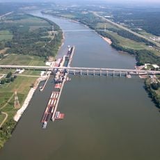
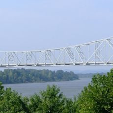
The U.S. Grant Bridge is a cable-stayed bridge that spans the Ohio River, linking Portsmouth, Ohio with South Portsmouth, Kentucky. It carries two traffic lanes and serves as a vital crossing on U.S. Route 23 for the surrounding region.

History

An original suspension bridge was built in 1927 as a toll structure and was the first private crossing of the Ohio River between Wheeling and Cincinnati in that stretch. In 2006, the structure was replaced with the current cable-stayed design after toll operations ended under state management in the 1970s.

Culture

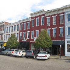
The bridge carries the name of a general who lived in the region and played a key role in American history, connecting two small river communities that have relied on this crossing for generations.

Practical

The bridge is open continuously for traffic and provides a direct connection between Ohio and Kentucky on U.S. Route 23. Pedestrians and cyclists can use the bridge, though walkway space is limited along the crossing.

Did you know?

The current bridge sits slightly downstream from the original 1927 crossing, a decision made during the 2006 reconstruction to accommodate modern engineering standards. This shift in location means travelers crossing today are actually using a slightly different route than generations of drivers before them.

Location
Official opening
October 16, 2006
GPS coordinates
38.72472,-82.99806
Latest update
December 11, 2025 11:03

AroundUs brings together thousands of curated places, local tips, and hidden gems, enriched daily by 60,000 contributors worldwide. Discover all places nearby (Ohio).

Around this place
Southern Ohio Correctional Facility
United States of America

Southern Ohio Correctional Facility

16.9 km
Spartan Municipal Stadium
United States of America

Spartan Municipal Stadium

1.8 km
Lower Shawneetown
United States of America

Lower Shawneetown

2.2 km
Shawnee State Park
United States of America

Shawnee State Park

17.4 km
Shawnee State Forest
United States of America

Shawnee State Forest

11.9 km
Sciotoville Bridge
United States of America

Sciotoville Bridge

10.2 km
Greenup Lock and Dam
United States of America

Greenup Lock and Dam

14.9 km
Greenbo Lake
United States of America

Greenbo Lake

28.5 km
Carl Perkins Bridge
United States of America

Carl Perkins Bridge

1.7 km
Tremper Mound and Works
United States of America

Tremper Mound and Works

8.6 km
Biggs Site
United States of America

Biggs Site

5.6 km
Jesse Stuart Memorial Bridge
United States of America

Jesse Stuart Memorial Bridge

14.9 km
Portsmouth Public Library
United States of America

Portsmouth Public Library

1.4 km
Boneyfiddle Commercial District
United States of America

Boneyfiddle Commercial District

748 m
Philip Moore Stone House
United States of America

Philip Moore Stone House

3.7 km
Bennett's Mill Covered Bridge
United States of America

Bennett's Mill Covered Bridge

12.2 km
Otway Covered Bridge
United States of America

Otway Covered Bridge

22.7 km
Odd Fellows Hall
United States of America

Odd Fellows Hall

1.1 km
Evangelical Church of Christ
United States of America

Evangelical Church of Christ

1.1 km
Bigelow United Methodist Church
United States of America

Bigelow United Methodist Church

1 km
Wurtland Union Church
United States of America

Wurtland Union Church

27 km
Greenup Masonic Lodge
United States of America

Greenup Masonic Lodge

21.6 km
Methodist Episcopal Church South
United States of America

Methodist Episcopal Church South

21.8 km
Columbia Music Arena
United States of America

Columbia Music Arena

1.1 km
Horseshoe Mound
United States of America

Horseshoe Mound

2.7 km
William Newman House
United States of America

William Newman House

743 m
Portsmouth Earthworks, Group A
United States of America

Portsmouth Earthworks, Group A

2.2 km
Boyhood Home of Roy Rogers
United States of America

Boyhood Home of Roy Rogers

18.3 km
Show the full map
« U.S. Grant Bridge - Road bridge in Portsmouth, United States » is provided by Around Us (aroundus.com). Images and texts are derived from Wikimedia project under a Creative Commons license. You are allowed to copy, distribute, and modify copies of this page, under the conditions set by the license, as long as this note is clearly visible.

Discover hidden gems everywhere you go!

From secret cafés to breathtaking viewpoints, skip the crowded tourist spots and find places that match your style. Our app makes it easy with voice search, smart filtering, route optimization, and insider tips from travelers worldwide. Download now for the complete mobile experience.

Around Us App Screenshot

A unique approach to discovering new places

Le Figaro

All the places worth exploring

France Info

A tailor-made excursion in just a few clicks

20 Minutes

Around Us
Travel Guide & Maps
Download

Send to your phone

QR Code
1

Open the camera app on your mobile.

2

Point at the QR code with your camera. A notification will appear.

3

Tap the notification to open the link.