Enable Location

We need your location to show you interesting places around you

Discover nearby places

Find interesting locations and hidden gems around you

Precise directions

Get accurate directions and distances to places

Your location is never shared with other users. It's only used when you tap the location button.

Vander Veer Park Historic District

Log in to your account

Start exploring — it's free

Trusted by 61,888 travelers worldwide

Continue with Google
Continue with Apple
or

We will send you a code to connect

By continuing, you accept our Terms and Conditions and our Privacy Policy

Check your inbox

We've sent a pincode in your inbox. Please enter the code below.

Vander Veer Park Historic District, Historic district in Davenport, United States.

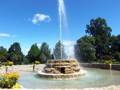
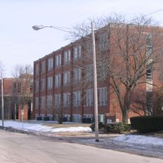
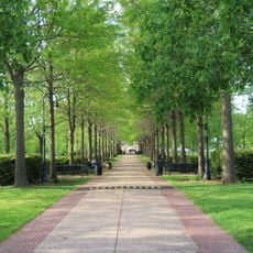
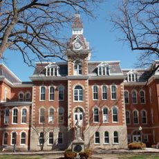
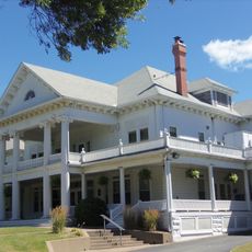
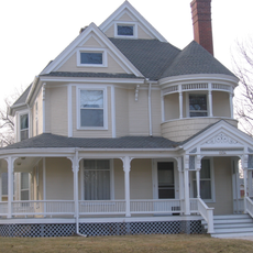
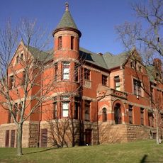
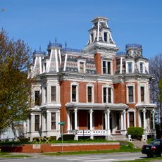
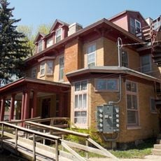
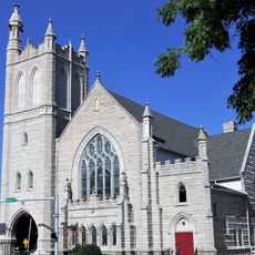
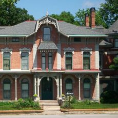
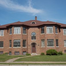
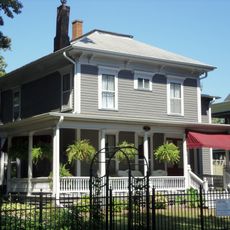
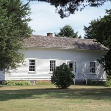
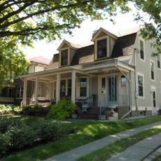
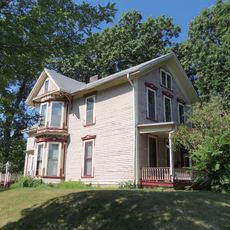
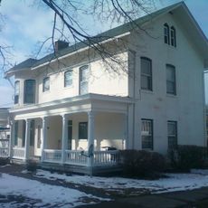
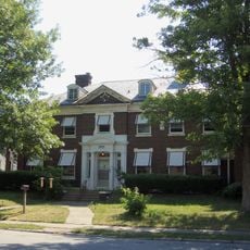
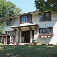
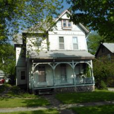
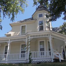
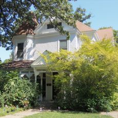
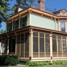
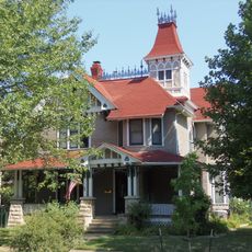
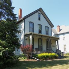
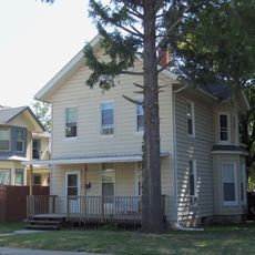
Vander Veer Park Historic District is a 70-acre neighborhood containing 66 historic buildings surrounding a central park with landscaped gardens, ponds, and walking paths. The houses were built primarily in the late 1800s and early 1900s and continue to define the area's character.

The site began as the Scott County Fairgrounds, was transformed into a public park in 1890, and received its current name Vander Veer Park in 1911. This name change marked the completion of its evolution from an amusement venue into an established residential neighborhood.

The residential buildings display architectural styles from 1895 to 1915 featuring Queen Anne and Tudor Revival elements that shape the neighborhood today. These design choices reflected the prosperity of the middle and upper-class families who lived here during that era.

The district sits roughly 22 blocks north of the Mississippi River and connects to downtown Davenport via Harrison, Main, and Brady streets. The flat terrain and grid layout make exploring on foot or by bicycle straightforward.

The park's core still features original late 1800s infrastructure including a glasshouse and designed flower gardens. The original street lighting from that era remains intact and contributes to the authentic character of the space.

The community of curious travelers

AroundUs brings together thousands of curated places, local tips, and hidden gems, enriched daily by 60,000 contributors worldwide.

Start exploring
Location
GPS coordinates
41.54306,-90.57444
Latest update
December 14, 2025 11:25
Around this place
Marycrest College Historic District
United States of America

Marycrest College Historic District

1.2 km
Vander Veer Botanical Park
United States of America

Vander Veer Botanical Park

104 m
Ambrose Hall
United States of America

Ambrose Hall

706 m
Outing Club
United States of America

Outing Club

299 m
Leon Bismark Beiderbecke House
United States of America

Leon Bismark Beiderbecke House

894 m
College Square Historic District
United States of America

College Square Historic District

1.2 km
J. Monroe Parker-Ficke House
United States of America

J. Monroe Parker-Ficke House

1.2 km
Renwick House
United States of America

Renwick House

990 m
St. John's United Methodist Church
United States of America

St. John's United Methodist Church

1.1 km
F.H. Miller House
United States of America

F.H. Miller House

805 m
Columbia Avenue Historic District
United States of America

Columbia Avenue Historic District

514 m
First National Bank of Davenport
United States of America

First National Bank of Davenport

761 m
Oak Lane Historic District
United States of America

Oak Lane Historic District

1 km
Alexander Brownlie House
United States of America

Alexander Brownlie House

1 km
Davenport Water Co. Pumping Station No. 2
United States of America

Davenport Water Co. Pumping Station No. 2

1 km
Charles Grilk House
United States of America

Charles Grilk House

353 m
East 14th Street Historic District
United States of America

East 14th Street Historic District

1.2 km
John W. Ballard House
United States of America

John W. Ballard House

843 m
Charles S. Simpson House
United States of America

Charles S. Simpson House

1.1 km
Edward C. Roberts House
United States of America

Edward C. Roberts House

1.2 km
Finley Guy Building
United States of America

Finley Guy Building

630 m
I. Edward Templeton House
United States of America

I. Edward Templeton House

1.1 km
William T. Goodrich House
United States of America

William T. Goodrich House

353 m
William Holbrook House
United States of America

William Holbrook House

1.2 km
Thomas Murray House
United States of America

Thomas Murray House

1 km
Ball-Waterman House
United States of America

Ball-Waterman House

1 km
W.S. Cameron House
United States of America

W.S. Cameron House

1.1 km
Oscar C. Woods House
United States of America

Oscar C. Woods House

1 km
Show the full map
« Vander Veer Park Historic District - Historic district in Davenport, United States » is provided by Around Us (aroundus.com). Images and texts are derived from Wikimedia project under a Creative Commons license. You are allowed to copy, distribute, and modify copies of this page, under the conditions set by the license, as long as this note is clearly visible.

Discover hidden gems everywhere you go!

From secret cafés to breathtaking viewpoints, skip the crowded tourist spots and find places that match your style. Our app makes it easy with voice search, smart filtering, route optimization, and insider tips from travelers worldwide. Download now for the complete mobile experience.

Around Us App Screenshot

A unique approach to discovering new places

Le Figaro

All the places worth exploring

France Info

A tailor-made excursion in just a few clicks

20 Minutes

Around Us
Travel Guide & Maps
Download

Send to your phone

QR Code
1

Open the camera app on your mobile.

2

Point at the QR code with your camera. A notification will appear.

3

Tap the notification to open the link.