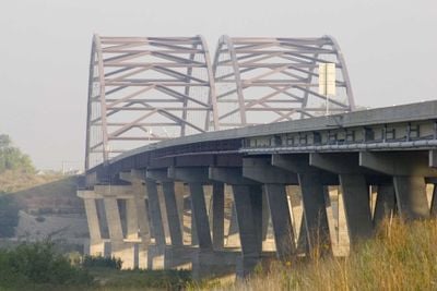
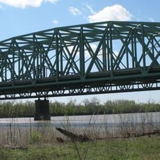
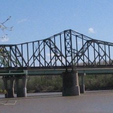
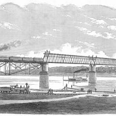
Veterans Memorial Bridge, Twin tied-arch road bridge in St. Louis Metropolitan Area, US
The Veterans Memorial Bridge consists of two parallel tied-arch structures that cross the Missouri River and link St. Louis County with St. Charles County. Each span stretches roughly 988 meters (3,243 feet) and uses separate roadways to handle eastbound and westbound traffic on Route 364.
The structure was completed and opened in December 2003, marking a major infrastructure milestone for the region's transportation network. This development significantly improved connectivity between the two counties and enhanced traffic flow across the Missouri River.
The bridge bears a name honoring military service members, reflecting a regional custom of dedicating major structures to acknowledge veterans' contributions. This naming choice shows how the community values and remembers its past.
The bridge uses separate lanes for eastbound and westbound traffic, making it clear for drivers heading in either direction. A dedicated path on the north side allows pedestrians and cyclists to cross safely without mixing with vehicle traffic.
A dedicated bicycle and pedestrian path on the north side links Creve Coeur Memorial Park directly to the Katy Trail System. This connection lets cyclists and walkers move between two major green spaces without having to focus on car traffic.
The community of curious travelers
AroundUs brings together thousands of curated places, local tips, and hidden gems, enriched daily by 60,000 contributors worldwide.