Enable Location

We need your location to show you interesting places around you

Discover nearby places

Find interesting locations and hidden gems around you

Precise directions

Get accurate directions and distances to places

Your location is never shared with other users. It's only used when you tap the location button.

Wissahickon Memorial Bridge

Log in to your account

Start exploring — it's free

Trusted by 65,821 travelers worldwide

Continue with Google
Continue with Apple
or

We will send you a code to connect

By continuing, you accept our Terms and Conditions and our Privacy Policy

Check your inbox

We've sent a pincode in your inbox. Please enter the code below.

Discussion Reviews 1 Photos
5k Popularity

Wissahickon Memorial Bridge, Concrete arch bridge in Fairmount Park, Philadelphia, United States

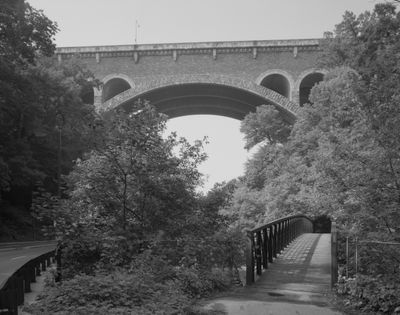
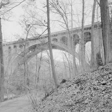
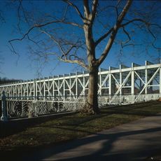
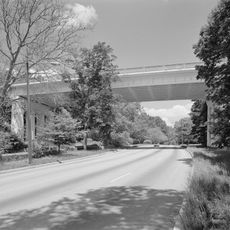
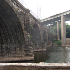
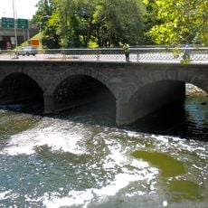
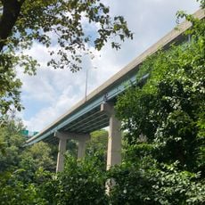
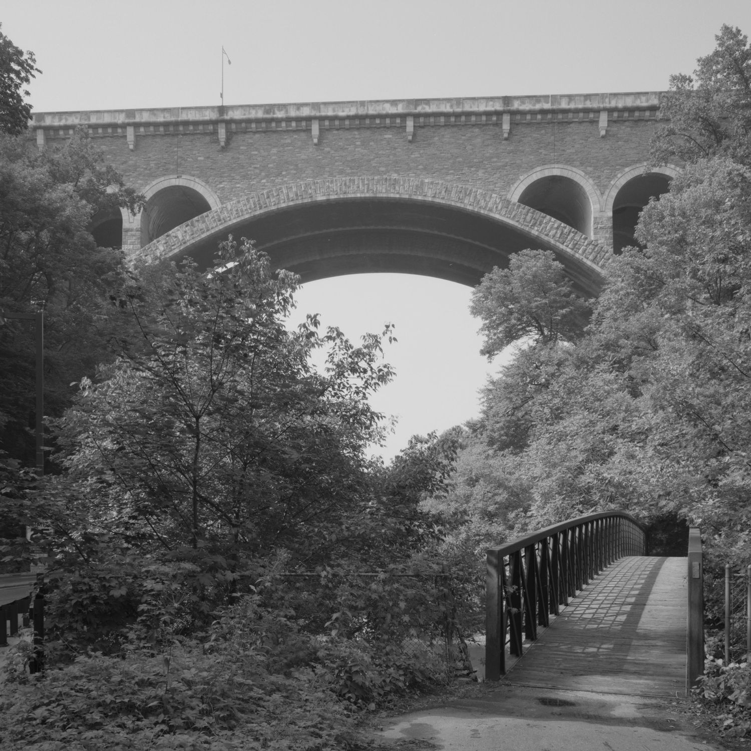
The Wissahickon Memorial Bridge is a concrete arch bridge in Philadelphia, Pennsylvania, spanning Wissahickon Creek and Lincoln Drive to connect the neighborhoods of East Falls and Roxborough. Built from reinforced concrete, it rises well above the valley floor and is clearly visible from the wooded slopes on either side.

The bridge was designed by architect Paul Philippe Cret and completed in 1932, replacing an older crossing that could no longer meet the demands of a growing city. It was added to the National Register of Historic Places in recognition of its architectural and civic value.

The bridge is named after residents of Philadelphia's northwest neighborhoods who served in World War I. Those crossing it today can look down into a deep, wooded valley that feels far removed from the city streets on either side.

The bridge can be crossed on foot or by car and is easy to reach from both East Falls and Roxborough. Pedestrians get an open view down into the Wissahickon Creek valley, so it is worth pausing on the walkway to take it in.

The original design included a lower deck intended for trolleys and a planned subway extension to Roxborough, neither of which was ever built. This unrealized layer beneath the bridge hints at how differently the city's northwest might have developed with rail connections.

The community of curious travelers

AroundUs brings together thousands of curated places, local tips, and hidden gems, enriched daily by 60,000 contributors worldwide.

Start exploring
Location
Inception
1931
Architects
Paul Philippe Cret
Official opening
May 1932
GPS coordinates
40.02417,-75.19611
Latest update
March 3, 2026 08:15
Around this place
Germantown Cricket Club
United States of America

Germantown Cricket Club

1.9 km
Wyck House
United States of America

Wyck House

1.5 km
Historic RittenhouseTown
United States of America

Historic RittenhouseTown

653 m
Alden Park Manor
United States of America

Alden Park Manor

879 m
Walnut Lane Bridge
United States of America

Walnut Lane Bridge

948 m
Ravenhill
United States of America

Ravenhill

968 m
Ebenezer Maxwell House
United States of America

Ebenezer Maxwell House

1.9 km
Falls Bridge
United States of America

Falls Bridge

1.8 km
Chain Bridge at Falls of Schuylkill
United States of America

Chain Bridge at Falls of Schuylkill

2 km
Paper Mill Run
United States of America

Paper Mill Run

983 m
Tulpehocken Station Historic District
United States of America

Tulpehocken Station Historic District

2 km
Walnut Lane Memorial Bridge
United States of America

Walnut Lane Memorial Bridge

1.2 km
United States of America

Paul J. Gutman Library

480 m
Philadelphia and Reading Railroad, Schuylkill River Viaduct
United States of America

Philadelphia and Reading Railroad, Schuylkill River Viaduct

2 km
The Monastery
United States of America

The Monastery

1.5 km
Pencoyd Bridge
United States of America

Pencoyd Bridge

1.7 km
Twin Bridges
United States of America

Twin Bridges

2 km
St. Peter's Episcopal Church of Germantown
United States of America

St. Peter's Episcopal Church of Germantown

1.5 km
Mayfair House
United States of America

Mayfair House

1.5 km
Edward B. Seymour House
United States of America

Edward B. Seymour House

2 km
Ridge Avenue Bridge in Philadelphia
United States of America

Ridge Avenue Bridge in Philadelphia

1.4 km
Philadelphia and Reading Railroad, Bridge at West Falls
United States of America

Philadelphia and Reading Railroad, Bridge at West Falls

2 km
City Avenue Bridges
United States of America

City Avenue Bridges

1.6 km
Delmar Apartments
United States of America

Delmar Apartments

1.4 km
Dobson Mills
United States of America

Dobson Mills

2 km
William C. Sharpless House
United States of America

William C. Sharpless House

1.8 km
Wissahickon
United States of America

Wissahickon

1.6 km
Smyser and English Pharmacy
United States of America

Smyser and English Pharmacy

1.5 km
Show the full map
Reviews
Share your experience

No review yet

Discussions
Start a discussion...

No discussion yet

« Wissahickon Memorial Bridge - Concrete arch bridge in Fairmount Park, Philadelphia, United States » is provided by Around Us (aroundus.com). Images and texts are derived from Wikimedia project under a Creative Commons license. You are allowed to copy, distribute, and modify copies of this page, under the conditions set by the license, as long as this note is clearly visible.

Discover hidden gems everywhere you go!

From secret cafés to breathtaking viewpoints, skip the crowded tourist spots and find places that match your style. Our app makes it easy with voice search, smart filtering, route optimization, and insider tips from travelers worldwide. Download now for the complete mobile experience.

Around Us App Screenshot

A unique approach to discovering new places

Le Figaro

All the places worth exploring

France Info

A tailor-made excursion in just a few clicks

20 Minutes

Around Us
Travel Guide & Maps
Download

Send to your phone

QR Code
1

Open the camera app on your mobile.

2

Point at the QR code with your camera. A notification will appear.

3

Tap the notification to open the link.