Willow Metropark, Metropark in Wayne County, Michigan, United States
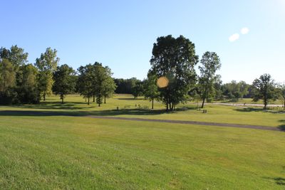
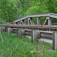
Willow Metropark is a large park in Wayne County stretching along the Huron River, featuring forests, open meadows, and an extensive trail network for walking and cycling. The grounds combine natural woodland areas with maintained recreational spaces throughout.
The park became part of the Huron-Clinton Metroparks system, which created a connected green corridor through southeast Michigan's developed areas. This regional network was established to preserve outdoor recreation space within growing communities.
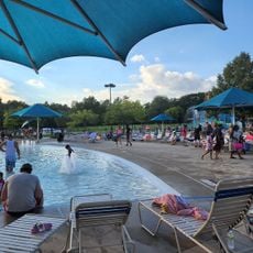
The park serves as a meeting place where families gather for seasonal recreation, swimming in summer and cross-country skiing in winter. People rely on these spaces to spend time together and enjoy outdoor activities throughout the year.
The park has multiple entry points with parking areas and well-maintained facilities including restrooms and picnic zones. Clear paths and signage help visitors navigate the grounds easily throughout their visit.
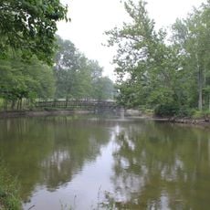
The grounds feature three distinct water features including the Huron River, Washago Pond, and a swimming pool, each offering different water experiences. This combination allows visitors to enjoy multiple ways of recreation in and around water.
Location: Wayne County
GPS coordinates: 42.13800,-83.37530
Latest update: December 12, 2025 14:20
Grosse Ile
17.8 km
Michigan Flight Museum
15.7 kmFlat Rock Speedway
8.4 km
Gateway Bridge
16.6 km
Lake Erie Metropark
15.5 km
Lower Huron Metropark
6 km
Wayne County Bridge
16.6 km
State Wayne Theater
16.2 km
Sheldon Inn
17.3 km
French Landing Dam and Powerhouse
10.1 km
Annapolis Park Historic District
15.2 km
Huron High School
2.7 km
Pia's Ristorante Italiano
17.1 km
Leo's Coney Island
12.1 km
Jefferson Avenue–Huron River and Harbin Drive–Silver Creek Canal Bridges
17 km
Midway Sports & Entertainment
17.6 km
John and Edna Truesdell Fischer Farmstead
16.9 km
Calf Island
16.7 km
Gibraltar Road–Waterway Canal Bridge
16 km
Turtle Cove Family Aquatic Center
6.4 km
Waltz Road–Huron River Bridge
3.4 km
Lilley Road–Lower Rouge River Bridge
17.1 km
South Pointe Drive–Frenchman's Creek Bridge
17.2 km
St. John's Lutheran Church and School
4.6 km
10 Pins of Trenton
15.6 km
Southgate Tower
16.2 km
Old Van Buren Township Hall Historical Marker
12.3 km
Old Rawsonville Village Historical Marker
16.3 kmVisited this place? Tap the stars to rate it and share your experience / photos with the community! Try now! You can cancel it anytime.
Discover hidden gems everywhere you go!
From secret cafés to breathtaking viewpoints, skip the crowded tourist spots and find places that match your style. Our app makes it easy with voice search, smart filtering, route optimization, and insider tips from travelers worldwide. Download now for the complete mobile experience.
A unique approach to discovering new places❞
— Le Figaro
All the places worth exploring❞
— France Info
A tailor-made excursion in just a few clicks❞
— 20 Minutes