Enable Location

We need your location to show you interesting places around you

Discover nearby places

Find interesting locations and hidden gems around you

Precise directions

Get accurate directions and distances to places

Your location is never shared with other users. It's only used when you tap the location button.

French Landing Dam and Powerhouse

Log in to your account

Start exploring — it's free

Trusted by 62,392 travelers worldwide

Continue with Google
Continue with Apple
or

We will send you a code to connect

By continuing, you accept our Terms and Conditions and our Privacy Policy

Check your inbox

We've sent a pincode in your inbox. Please enter the code below.

French Landing Dam and Powerhouse

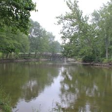
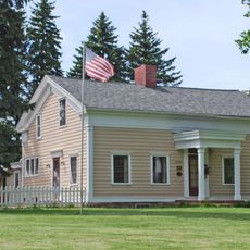
French Landing Dam and Powerhouse, Hydroelectric power station in Wayne County, Michigan.

French Landing Dam is a hydroelectric facility on the Huron River that converts flowing water into electrical power for the surrounding area. The structure operates as a gravity dam, holding water while channeling it through turbines in the powerhouse.

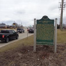
Detroit Edison Company acquired the land in 1910 and completed construction of the dam in 1925 as part of Michigan's early hydroelectric development. The site was later recognized as a Michigan State Historic Site in 1982 due to its role in industrial growth.

The Michigan State Historic Site designation in 1982 recognizes the dam's role in local industrial development and renewable energy production.

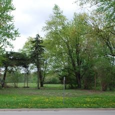
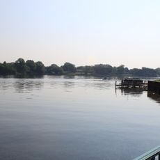
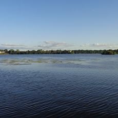
The site is accessible through French Landing Park along Haggerty Road, where visitors can fish and enjoy recreational activities along the water. The location provides good vantage points for observing the dam and the adjacent Belleville Lake.

The facility underwent restoration in 1988 after decades of standing unused, significantly increasing its operational capacity. This modernization showed how aging energy infrastructure can be revived and returned to productive use.

The community of curious travelers

AroundUs brings together thousands of curated places, local tips, and hidden gems, enriched daily by 60,000 contributors worldwide.

Start exploring
Location
Inception
1924
GPS coordinates
42.21440,-83.44080
Latest update
December 12, 2025 17:47
Around this place
Michigan Flight Museum
United States of America

Michigan Flight Museum

6.2 km
Ypsilanti Automotive Heritage Museum
United States of America

Ypsilanti Automotive Heritage Museum

14.2 km
Lower Huron Metropark
United States of America

Lower Huron Metropark

4.5 km
State Wayne Theater
United States of America

State Wayne Theater

8.8 km
Willow Metropark
United States of America

Willow Metropark

10.1 km
Sheldon Inn
United States of America

Sheldon Inn

7.3 km
Annapolis Park Historic District
United States of America

Annapolis Park Historic District

10.9 km
Thomas and Maria Blackman Bartlett House
United States of America

Thomas and Maria Blackman Bartlett House

13 km
Huron High School
United States of America

Huron High School

12.6 km
John and Eliza Barr Patterson House
United States of America

John and Eliza Barr Patterson House

14.4 km
Canton Township MPS
United States of America

Canton Township MPS

11.1 km
David and Elizabeth Bell Boldman House
United States of America

David and Elizabeth Bell Boldman House

8.4 km
Ephraim and Emma Woodworth Truesdell House
United States of America

Ephraim and Emma Woodworth Truesdell House

9.4 km
Thomas and Isabella Moore Clyde House
United States of America

Thomas and Isabella Moore Clyde House

12.8 km
John and Edna Truesdell Fischer Farmstead
United States of America

John and Edna Truesdell Fischer Farmstead

6.8 km
George and Mary Pine Smith House
United States of America

George and Mary Pine Smith House

7.9 km
Phillip and Maria Hasselbach Dingledey House
United States of America

Phillip and Maria Hasselbach Dingledey House

11.6 km
The Canton Historical Society and Museum
United States of America

The Canton Historical Society and Museum

10.2 km
Waltz Road–Huron River Bridge
United States of America

Waltz Road–Huron River Bridge

6.7 km
Lilley Road–Lower Rouge River Bridge
United States of America

Lilley Road–Lower Rouge River Bridge

7.4 km
Abraham Lincoln Monument
United States of America

Abraham Lincoln Monument

12.6 km
St. John's Lutheran Church and School
United States of America

St. John's Lutheran Church and School

13.7 km
Michigan's Interurbans Historical Marker
United States of America

Michigan's Interurbans Historical Marker

14 km
The Village Theater at Cherry Hill
United States of America

The Village Theater at Cherry Hill

12.9 km
Old Rawsonville Village Historical Marker
United States of America

Old Rawsonville Village Historical Marker

8.5 km
Old Van Buren Township Hall Historical Marker
United States of America

Old Van Buren Township Hall Historical Marker

4.2 km
Belleville Lake
United States of America

Belleville Lake

4.6 km
Ford Lake
United States of America

Ford Lake

11.9 km
Show the full map
« French Landing Dam and Powerhouse - Hydroelectric power station in Wayne County, Michigan » is provided by Around Us (aroundus.com). Images and texts are derived from Wikimedia project under a Creative Commons license. You are allowed to copy, distribute, and modify copies of this page, under the conditions set by the license, as long as this note is clearly visible.

Discover hidden gems everywhere you go!

From secret cafés to breathtaking viewpoints, skip the crowded tourist spots and find places that match your style. Our app makes it easy with voice search, smart filtering, route optimization, and insider tips from travelers worldwide. Download now for the complete mobile experience.

Around Us App Screenshot

A unique approach to discovering new places

Le Figaro

All the places worth exploring

France Info

A tailor-made excursion in just a few clicks

20 Minutes

Around Us
Travel Guide & Maps
Download

Send to your phone

QR Code
1

Open the camera app on your mobile.

2

Point at the QR code with your camera. A notification will appear.

3

Tap the notification to open the link.