Wayne County

Log in to your account

AroundUs is a community-driven map of interesting places, built by curious explorers like you. It grows with every review, story, and photo you share.
Connect to save your favorite spots, contribute locations, and create personalized routes.
Continue with Google
Continue with Apple
Continue with X
Continue with Facebook
Continue with email
By continuing, you accept our Terms and Conditions and our Privacy Policy
Create an account
Add to collection
Map
Suggest a change
Share

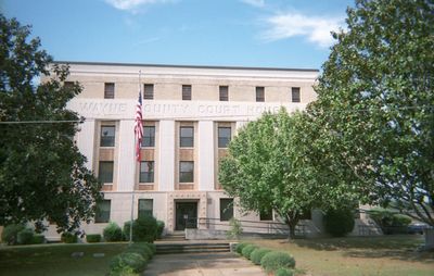
Wayne County, County administration center in Detroit, Michigan.

Wayne County is an administrative division in southeastern Michigan that encompasses Detroit and surrounding suburban communities. The region features a mix of urban neighborhoods, residential areas, and open spaces connected by an extensive road network.

The county was established in 1796 and officially organized in 1815, taking its name from Revolutionary War General Anthony Wayne. It originally included territories that extended across what are now several states.

The Detroit Metropolitan Wayne County Airport connects the region to global destinations while serving as a central transportation hub for southeastern Michigan's diverse population.

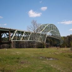
The region can be traversed using several interstate highways that serve as major transportation routes. Visitors should expect moderate to heavy traffic, particularly during rush hours in and around urban areas.

The county was home to a milestone in American road infrastructure: the first mile of concrete-paved rural highway in the nation was built here. This section demonstrated the durability and advantages of concrete over traditional road materials.

GPS coordinates: 31.62125,-88.68589

Latest update: December 7, 2025 20:48

Photos
Around this place
Stuckey's Bridge
United States of America

Stuckey's Bridge

72.4 km
Lauren Rogers Museum of Art
United States of America

Lauren Rogers Museum of Art

43 km
Laurel Central Historic District
United States of America

Laurel Central Historic District

43.1 km
Amos Deason Home
United States of America

Amos Deason Home

48.8 km
Mahned Bridge
United States of America

Mahned Bridge

58.2 km
Bladon Springs State Park
United States of America

Bladon Springs State Park

48.2 km
African American Military History Museum
United States of America

African American Military History Museum

65.9 km
Old Hattiesburg High School
United States of America

Old Hattiesburg High School

66.4 km
Old Augusta Historic Site
United States of America

Old Augusta Historic Site

56.1 km
Coffeeville Lock and Dam
United States of America

Coffeeville Lock and Dam

54.9 km
Eaton Elementary School
United States of America

Eaton Elementary School

65.5 km
Causeyville Historic District
United States of America

Causeyville Historic District

71.9 km
St. Stephens Courthouse
United States of America

St. Stephens Courthouse

60.5 km
Amos Deason House
United States of America

Amos Deason House

48.5 km
Leaf River Bridge
United States of America

Leaf River Bridge

56.4 km
Trotter-Byrd House
United States of America

Trotter-Byrd House

45.9 km
Newell Rogers House
United States of America

Newell Rogers House

43.3 km
Judge John L. Buckley House
United States of America

Judge John L. Buckley House

63.1 km
Capt. C.C. Ferrill House
United States of America

Capt. C.C. Ferrill House

46.3 km
Benjamin H. Carter House
United States of America

Benjamin H. Carter House

46.4 km
Saenger Theatre
United States of America

Saenger Theatre

66.2 km
Shubuta Bridge
United States of America

Shubuta Bridge

26.3 km
Hub City Historic District
United States of America

Hub City Historic District

66.1 km
Jim Folsom Bridge
United States of America

Jim Folsom Bridge

57.3 km
Hattiesburg Historic Neighborhood District
United States of America

Hattiesburg Historic Neighborhood District

66.2 km
The University of Southern Mississippi Historic District
United States of America

The University of Southern Mississippi Historic District

66.4 km
Dunn's Falls
United States of America

Dunn's Falls

68.8 km
North Main Street Historic District
United States of America

North Main Street Historic District

66.4 km
Show the full map
Reviews

Visited this place? Tap the stars to rate it and share your experience / photos with the community! Try now! You can cancel it anytime.

« Wayne County - County administration center in Detroit, Michigan » is provided by Around Us (aroundus.com). Images and texts are derived from Wikimedia project under a Creative Commons license. You are allowed to copy, distribute, and modify copies of this page, under the conditions set by the license, as long as this note is clearly visible.

Discover hidden gems everywhere you go!

From secret cafés to breathtaking viewpoints, skip the crowded tourist spots and find places that match your style. Our app makes it easy with voice search, smart filtering, route optimization, and insider tips from travelers worldwide. Download now for the complete mobile experience.

Around Us App Screenshot

A unique approach to discovering new places

Le Figaro

All the places worth exploring

France Info

A tailor-made excursion in just a few clicks

20 Minutes