Lower Huron Metropark

Log in to your account

AroundUs is a community-driven map of interesting places, built by curious explorers like you. It grows with every review, story, and photo you share.
Connect to save your favorite spots, contribute locations, and create personalized routes.
Continue with Google
Continue with Apple
Continue with X
Continue with Facebook
Continue with email
By continuing, you accept our Terms and Conditions and our Privacy Policy
Create an account

Lower Huron Metropark

Add to collection
Map
Suggest a change
Share

Lower Huron Metropark, Public recreational park in Belleville, Michigan.

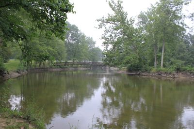
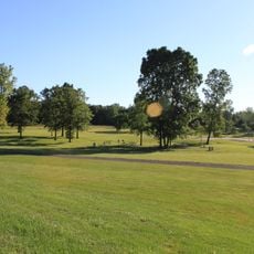
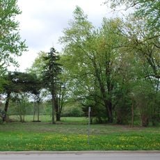
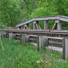
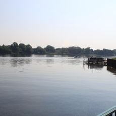
Lower Huron Metropark is a large public recreational park along the Huron River with mature forests, open meadows, and multiple trails through natural areas. The grounds offer camping spots, sports courts, and a long paved path for walking and biking.

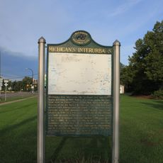
The park was established as part of the Huron-Clinton Metroparks system to protect natural areas in the Detroit region and provide public recreation spaces. This approach helped preserve the river landscape and surrounding forests from development.

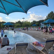
The Turtle Cove Family Aquatic Center serves as a popular gathering spot where visitors and locals enjoy water activities and swimming during the warm season.

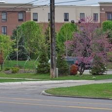
Visitors can enter the grounds from East Huron River Drive, with parking available in several areas. Most paths are easy to walk, though some sections run through forest where the ground can be muddy when wet.

The Woods Creek Trail winds through dense forest and gives visitors chances to spot deer, birds, and other wildlife in their natural setting. The river comes into view from various points along the path, offering quiet moments away from roads.

Location: Michigan

GPS coordinates: 42.17500,-83.42770

Latest update: December 12, 2025 09:05

Photos
Around this place
Michigan Flight Museum
United States of America

Michigan Flight Museum

9.7 km
Ypsilanti Automotive Heritage Museum
United States of America

Ypsilanti Automotive Heritage Museum

16.8 km
United States of America

Flat Rock Speedway

14.4 km
Gateway Bridge
United States of America

Gateway Bridge

16.4 km
State Wayne Theater
United States of America

State Wayne Theater

12.5 km
Willow Metropark
United States of America

Willow Metropark

6 km
Sheldon Inn
United States of America

Sheldon Inn

11.8 km
French Landing Dam and Powerhouse
United States of America

French Landing Dam and Powerhouse

4.5 km
Annapolis Park Historic District
United States of America

Annapolis Park Historic District

13.2 km
Huron High School
United States of America

Huron High School

8.7 km
Canton Township MPS
United States of America

Canton Township MPS

15.6 km
Ypsilanti District Library
United States of America

Ypsilanti District Library

15.9 km
David and Elizabeth Bell Boldman House
United States of America

David and Elizabeth Bell Boldman House

12.8 km
Ephraim and Emma Woodworth Truesdell House
United States of America

Ephraim and Emma Woodworth Truesdell House

13.9 km
John and Edna Truesdell Fischer Farmstead
United States of America

John and Edna Truesdell Fischer Farmstead

11.3 km
George and Mary Pine Smith House
United States of America

George and Mary Pine Smith House

12.3 km
Phillip and Maria Hasselbach Dingledey House
United States of America

Phillip and Maria Hasselbach Dingledey House

16 km
Turtle Cove Family Aquatic Center
United States of America

Turtle Cove Family Aquatic Center

470 m
The Canton Historical Society and Museum
United States of America

The Canton Historical Society and Museum

14.7 km
Waltz Road–Huron River Bridge
United States of America

Waltz Road–Huron River Bridge

2.6 km
Lilley Road–Lower Rouge River Bridge
United States of America

Lilley Road–Lower Rouge River Bridge

11.9 km
Abraham Lincoln Monument
United States of America

Abraham Lincoln Monument

14.8 km
St. John's Lutheran Church and School
United States of America

St. John's Lutheran Church and School

9.2 km
Vision Lanes
United States of America

Vision Lanes

16.7 km
Michigan's Interurbans Historical Marker
United States of America

Michigan's Interurbans Historical Marker

16.5 km
Old Van Buren Township Hall Historical Marker
United States of America

Old Van Buren Township Hall Historical Marker

6.4 km
Old Rawsonville Village Historical Marker
United States of America

Old Rawsonville Village Historical Marker

10.5 km
Belleville Lake
United States of America

Belleville Lake

7 km
Show the full map
Reviews

Visited this place? Tap the stars to rate it and share your experience / photos with the community! Try now! You can cancel it anytime.

« Lower Huron Metropark - Public recreational park in Belleville, Michigan » is provided by Around Us (aroundus.com). Images and texts are derived from Wikimedia project under a Creative Commons license. You are allowed to copy, distribute, and modify copies of this page, under the conditions set by the license, as long as this note is clearly visible.

Discover hidden gems everywhere you go!

From secret cafés to breathtaking viewpoints, skip the crowded tourist spots and find places that match your style. Our app makes it easy with voice search, smart filtering, route optimization, and insider tips from travelers worldwide. Download now for the complete mobile experience.

Around Us App Screenshot

A unique approach to discovering new places

Le Figaro

All the places worth exploring

France Info

A tailor-made excursion in just a few clicks

20 Minutes