Chest opened
+${chestReward.xp} XP
Explorer
NOUVEAU ×${chestReward.collectible.quantity}
tapez pour fermer
Chest locked

Open chests in the app

Around Us is built for your phone — chests unlock when you walk, explore and capture nearby places.

Enable Location

We need your location to show you interesting places around you

Discover nearby places

Find interesting locations and hidden gems around you

Precise directions

Get accurate directions and distances to places

Your location is never shared with other users. It's only used when you tap the location button.

Log in to your account

Start exploring — it's free

Trusted by 72,890 travelers worldwide

Continue with Google
Continue with Apple
or

We will send you a code to connect

By continuing, you accept our Terms and Conditions and our Privacy Policy

Check your inbox

We've sent a pincode in your inbox. Please enter the code below.

Jimtown
Discussion Reviews Photo
1.3k Popularity

Jimtown, Rural community in Baugo Township, Indiana

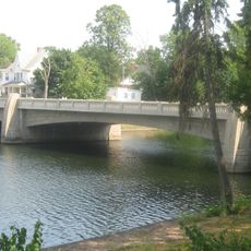
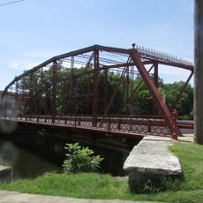
Jimtown is a small rural settlement in Baugo Township located near Baugo Creek and composed mainly of residential areas and surrounding farmland. The community spreads across flat terrain at an elevation of about 778 feet above sea level.

The settlement was established in 1835 by eight families who settled near a Potawatomi community, with James Davis playing a leading role in early development. This founding shaped the long-term structure and growth of the settlement.

The name Jimtown came from early settlement days and shapes community life through schools and rural traditions that have connected families across generations.

Municipal services are accessed through the 46517 postal code, and the Saint Joseph River north of the settlement offers recreational options. Visitors should expect the rural character of the area and allow time to explore the surroundings.

The area is known by two names - Jamestown and Jimtown - a remnant of local naming evolution in Elkhart County records. This name variation reflects the history and local conventions that have shaped the community.

The community of curious travelers

AroundUs brings together thousands of curated places, local tips, and hidden gems, enriched daily by 60,000 contributors worldwide.

Start exploring
Location
GPS coordinates
41.63560,-86.02280
Latest update
December 14, 2025 17:40
Around this place
RV/MH Hall of Fame
United States of America

RV/MH Hall of Fame

15.9 km
Ruthmere Mansion
United States of America

Ruthmere Mansion

7.6 km
Beiger Mansion
United States of America

Beiger Mansion

13.2 km
The Lerner Theatre
United States of America

The Lerner Theatre

6.9 km
United States of America

Potawatomi Conservatories

16.5 km
Charles Gerard Conn Mansion
United States of America

Charles Gerard Conn Mansion

6.3 km
Old Mishawaka Carnegie Library
United States of America

Old Mishawaka Carnegie Library

13.7 km
Dr. Havilah Beardsley House
United States of America

Dr. Havilah Beardsley House

7.5 km
Mark L. and Harriet E. Monteith House
United States of America

Mark L. and Harriet E. Monteith House

8.2 km
Ellis-Schindler House
United States of America

Ellis-Schindler House

14.3 km
Elkhart County Courthouse
United States of America

Elkhart County Courthouse

16.5 km
Dodge House
United States of America

Dodge House

13.1 km
Midwest Museum of American Art
United States of America

Midwest Museum of American Art

6.8 km
Elkhart Downtown Commercial Historic District
United States of America

Elkhart Downtown Commercial Historic District

6.9 km
Battell Park Historic District
United States of America

Battell Park Historic District

14.1 km
Bridge Street Bridge
United States of America

Bridge Street Bridge

5.3 km
Beardsley Avenue Historic District
United States of America

Beardsley Avenue Historic District

7.4 km
Fort Wayne Street Bridge
United States of America

Fort Wayne Street Bridge

15.2 km
Mishawaka Reservoir Caretaker's Residence
United States of America

Mishawaka Reservoir Caretaker's Residence

13.5 km
Emmanuel C. Bickel House
United States of America

Emmanuel C. Bickel House

6.7 km
Normain Heights Historic District
United States of America

Normain Heights Historic District

14.1 km
William and Helen Koerting House
United States of America

William and Helen Koerting House

9.9 km
Eller-Hosford House
United States of America

Eller-Hosford House

12.6 km
Garth Stroup Home
United States of America

Garth Stroup Home

12.9 km
Historic YWCA building
United States of America

Historic YWCA building

7 km
Morehous Residential Historic District
United States of America

Morehous Residential Historic District

6.4 km
Colonial Gardens Commercial Historic District
United States of America

Colonial Gardens Commercial Historic District

15.5 km
Joseph and Sarah Puterbaugh Farm
United States of America

Joseph and Sarah Puterbaugh Farm

4.7 km
Show the full map
Reviews
Share your experience

No review yet

Discussions
Start a discussion...

No discussion yet

« Jimtown - Rural community in Baugo Township, Indiana » is provided by Around Us (aroundus.com). Images and texts are derived from Wikimedia project under a Creative Commons license. You are allowed to copy, distribute, and modify copies of this page, under the conditions set by the license, as long as this note is clearly visible.

Discover hidden gems everywhere you go!

From secret cafés to breathtaking viewpoints, skip the crowded tourist spots and find places that match your style. Our app makes it easy with voice search, smart filtering, route optimization, and insider tips from travelers worldwide. Download now for the complete mobile experience.

Around Us App Screenshot

A unique approach to discovering new places

Le Figaro

All the places worth exploring

France Info

A tailor-made excursion in just a few clicks

20 Minutes

Around Us
Travel Guide & Maps
Download

Send to your phone

QR Code
1

Open the camera app on your mobile.

2

Point at the QR code with your camera. A notification will appear.

3

Tap the notification to open the link.