Chest opened
+${chestReward.xp} XP
Explorer
NOUVEAU ×${chestReward.collectible.quantity}
tapez pour fermer
Chest locked

Open chests in the app

Around Us is built for your phone — chests unlock when you walk, explore and capture nearby places.

Enable Location

We need your location to show you interesting places around you

Discover nearby places

Find interesting locations and hidden gems around you

Precise directions

Get accurate directions and distances to places

Your location is never shared with other users. It's only used when you tap the location button.

Log in to your account

Start exploring — it's free

Trusted by 72,893 travelers worldwide

Continue with Google
Continue with Apple
or

We will send you a code to connect

By continuing, you accept our Terms and Conditions and our Privacy Policy

Check your inbox

We've sent a pincode in your inbox. Please enter the code below.

Discussion Reviews Photo
10.3k Popularity

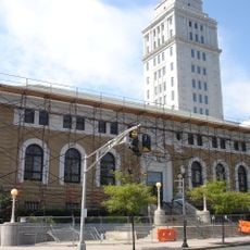
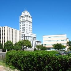
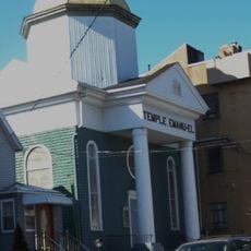
North Shore, Residential district in Staten Island, United States

North Shore is a waterfront district on the northern edge of Staten Island, facing Manhattan and New Jersey across the harbor. It covers several adjoining neighborhoods, including St. George where the ferry terminal stands, as well as Stapleton and Tompkinsville.

The Lenape people lived along this shore before European settlers arrived in the 1600s. The area grew into an industrial and port zone during the 1800s, then gradually shifted toward residential use over the following century.

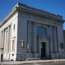
The St. George Theatre is an old cinema building now used as a concert and events hall. Attending a show there gives visitors a chance to see the original 1920s interior and meet a loyal local crowd.

The St. George ferry terminal is the best starting point for a visit, as it connects to bus lines and the Staten Island Railway. The waterfront areas are within walking distance from the terminal, while farther neighborhoods are easier to reach by bus.

Richmond Terrace, the oldest street on the island, follows a path that the Lenape used long before European settlement. During the American Revolution, British forces widened the route, and the road still traces much of its original course today.

The community of curious travelers

AroundUs brings together thousands of curated places, local tips, and hidden gems, enriched daily by 60,000 contributors worldwide.

Start exploring
Location
GPS coordinates
40.63100,-74.17000
Latest update
March 3, 2026 08:21
Around this place
Bayonne Bridge
United States of America

Bayonne Bridge

2.7 km
Goethals Bridge
United States of America

Goethals Bridge

2.4 km
Arthur Kill Vertical Lift Bridge
United States of America

Arthur Kill Vertical Lift Bridge

2.3 km
Staten Island Zoo
United States of America

Staten Island Zoo

4.6 km
CRRNJ Newark Bay Bridge
United States of America

CRRNJ Newark Bay Bridge

3.1 km
Red Hook Container Terminal
United States of America

Red Hook Container Terminal

1.8 km
United States of America

New Springville, Staten Island

4.2 km
Clove Lake Park
United States of America

Clove Lake Park

4.9 km
Baron Hirsch Cemetery
United States of America

Baron Hirsch Cemetery

1.6 km
United States of America

William T. Davis Wildlife Refuge

4 km
Willowbrook Park
United States of America

Willowbrook Park

3.3 km
Old Goethals Bridge
United States of America

Old Goethals Bridge

2.3 km
Boxwood Hall
United States of America

Boxwood Hall

5 km
Church of Our Lady of Pity
United States of America

Church of Our Lady of Pity

2.6 km
Gardiner-Tyler House
United States of America

Gardiner-Tyler House

4.9 km
Church of the Holy Family
United States of America

Church of the Holy Family

2.9 km
United States of America

Old Place, Staten Island

512 m
Elizabeth Public Library
United States of America

Elizabeth Public Library

5.1 km
Bayonne Community Museum
United States of America

Bayonne Community Museum

4.5 km
United States of America

Reformed Church on Staten Island

3.3 km
Hale-Whitney Mansion
United States of America

Hale-Whitney Mansion

4 km
Union County Courthouse
United States of America

Union County Courthouse

5.2 km
Temple Emanu-El
United States of America

Temple Emanu-El

3.1 km
South Front Street Bridge
United States of America

South Front Street Bridge

2.3 km
St. John's Parsonage
United States of America

St. John's Parsonage

4.9 km
Belcher–Ogden Mansion; Benjamin Price House; and Price–Brittan House Historic District
United States of America

Belcher–Ogden Mansion; Benjamin Price House; and Price–Brittan House Historic District

4.9 km
Kreuzer-Pelton House
United States of America

Kreuzer-Pelton House

5.1 km
Peter Houseman House
United States of America

Peter Houseman House

3.3 km
Show the full map
Reviews
Share your experience

No review yet

Discussions
Start a discussion...

No discussion yet

« North Shore - Residential district in Staten Island, United States » is provided by Around Us (aroundus.com). Images and texts are derived from Wikimedia project under a Creative Commons license. You are allowed to copy, distribute, and modify copies of this page, under the conditions set by the license, as long as this note is clearly visible.

Discover hidden gems everywhere you go!

From secret cafés to breathtaking viewpoints, skip the crowded tourist spots and find places that match your style. Our app makes it easy with voice search, smart filtering, route optimization, and insider tips from travelers worldwide. Download now for the complete mobile experience.

Around Us App Screenshot

A unique approach to discovering new places

Le Figaro

All the places worth exploring

France Info

A tailor-made excursion in just a few clicks

20 Minutes

Around Us
Travel Guide & Maps
Download

Send to your phone

QR Code
1

Open the camera app on your mobile.

2

Point at the QR code with your camera. A notification will appear.

3

Tap the notification to open the link.