Chest opened
+${chestReward.xp} XP
Explorer
NOUVEAU ×${chestReward.collectible.quantity}
tapez pour fermer
Chest locked

Open chests in the app

Around Us is built for your phone — chests unlock when you walk, explore and capture nearby places.

Enable Location

We need your location to show you interesting places around you

Discover nearby places

Find interesting locations and hidden gems around you

Precise directions

Get accurate directions and distances to places

Your location is never shared with other users. It's only used when you tap the location button.

Log in to your account

Start exploring — it's free

Trusted by 72,882 travelers worldwide

Continue with Google
Continue with Apple
or

We will send you a code to connect

By continuing, you accept our Terms and Conditions and our Privacy Policy

Check your inbox

We've sent a pincode in your inbox. Please enter the code below.

Hockomock Swamp
Discussion Reviews Photo
24.4k Popularity

Hockomock Swamp, Protected wetland system in southeastern Massachusetts, United States.

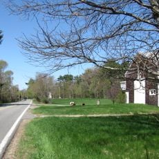
Hockomock Swamp is a sprawling wetland in southeastern Massachusetts composed of freshwater marshes, woodlands, waterways, and flood plains. The swamp functions as an interconnected ecological system fed by underground water sources that support the entire landscape.

During the 17th century, the Wampanoag people used this swamp as a protected refuge during their conflicts with English settlers. The terrain offered them cover and strategic advantages during their struggles.

The name comes from Algonquin words meaning 'place where spirits dwell', showing how Native Americans saw this land as sacred. Today, walking through the wetlands helps visitors understand the spiritual importance this place once held.

Visitors can access large portions of the swamp for fishing, hunting, and wildlife viewing, managed by the state fish and wildlife division. Visiting during seasons when activities are permitted and wildlife is most active provides the best experience.

Archaeological finds show that people have been using this area for roughly 9,000 years, making it one of the region's oldest inhabited sites. This long history reveals how essential the swamps were for survival across many generations.

The community of curious travelers

AroundUs brings together thousands of curated places, local tips, and hidden gems, enriched daily by 60,000 contributors worldwide.

Start exploring
Location
GPS coordinates
41.99170,-71.07860
Latest update
December 20, 2025 12:45
Around this place
Taunton State Hospital
United States of America

Taunton State Hospital

9.1 km
Ames Shovel Shop
United States of America

Ames Shovel Shop

8.8 km
United States of America

King Phillip's Cave

4.5 km
Ames Free Library
United States of America

Ames Free Library

8.7 km
Whittenton Mills Complex
United States of America

Whittenton Mills Complex

7.8 km
United States of America

The Rockery

8.6 km
H.H. Richardson Historic District of North Easton
United States of America

H.H. Richardson Historic District of North Easton

8.9 km
United States of America

Taunton Iron Works

8.8 km
Reverend James Keith Parsonage
United States of America

Reverend James Keith Parsonage

5.8 km
Bristol County Courthouse Complex
United States of America

Bristol County Courthouse Complex

8.7 km
Union Congregational Church
United States of America

Union Congregational Church

8.3 km
Bay Road
United States of America

Bay Road

4.1 km
Children's Museum in Easton
United States of America

Children's Museum in Easton

8.6 km
Watson Pond State Park
United States of America

Watson Pond State Park

5.5 km
North Easton Historic District
United States of America

North Easton Historic District

8.9 km
North Taunton Baptist Church
United States of America

North Taunton Baptist Church

8.7 km
Hopewell School
United States of America

Hopewell School

8.1 km
Furnace Village Historic District
United States of America

Furnace Village Historic District

5.7 km
W.C. Beattie House
United States of America

W.C. Beattie House

8.5 km
William H. McElwain School
United States of America

William H. McElwain School

8.1 km
James Leonard House
United States of America

James Leonard House

9 km
Hopewell Mills District
United States of America

Hopewell Mills District

8.6 km
Ambrose Lincoln, Jr., House
United States of America

Ambrose Lincoln, Jr., House

8.8 km
Gen. Thomas Lincoln House
United States of America

Gen. Thomas Lincoln House

4.2 km
Howard Home for Aged Men
United States of America

Howard Home for Aged Men

8.5 km
Buildings at 80 and 88 W. Brittania St.
United States of America

Buildings at 80 and 88 W. Brittania St.

8.9 km
Calvin T. Macomber House
United States of America

Calvin T. Macomber House

8.5 km
Bay Road
United States of America

Bay Road

4.1 km
Show the full map
Reviews
Share your experience

No review yet

Discussions
Start a discussion...

No discussion yet

« Hockomock Swamp - Protected wetland system in southeastern Massachusetts, United States » is provided by Around Us (aroundus.com). Images and texts are derived from Wikimedia project under a Creative Commons license. You are allowed to copy, distribute, and modify copies of this page, under the conditions set by the license, as long as this note is clearly visible.

Discover hidden gems everywhere you go!

From secret cafés to breathtaking viewpoints, skip the crowded tourist spots and find places that match your style. Our app makes it easy with voice search, smart filtering, route optimization, and insider tips from travelers worldwide. Download now for the complete mobile experience.

Around Us App Screenshot

A unique approach to discovering new places

Le Figaro

All the places worth exploring

France Info

A tailor-made excursion in just a few clicks

20 Minutes

Around Us
Travel Guide & Maps
Download

Send to your phone

QR Code
1

Open the camera app on your mobile.

2

Point at the QR code with your camera. A notification will appear.

3

Tap the notification to open the link.