Enable Location

We need your location to show you interesting places around you

Discover nearby places

Find interesting locations and hidden gems around you

Precise directions

Get accurate directions and distances to places

Your location is never shared with other users. It's only used when you tap the location button.

Log in to your account

Start exploring — it's free

Trusted by 62,900 travelers worldwide

Continue with Google
Continue with Apple
or

We will send you a code to connect

By continuing, you accept our Terms and Conditions and our Privacy Policy

Check your inbox

We've sent a pincode in your inbox. Please enter the code below.

King Phillip's Cave
Discussion Reviews Photo
4.3k Popularity

King Phillip's Cave, Show cave in Norton, Massachusetts, United States.

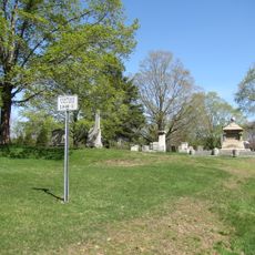
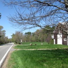
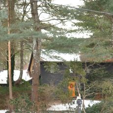
King Phillip's Cave is a natural cavern in Massachusetts with stone formations created by glacial deposits from the last ice age. The structure displays distinctive conglomerate rock patterns and sits within a 7-acre protected landscape accessible by marked trails from Stone Run Drive.

The cave was named after Metacomet, a Wampanoag leader who used it for shelter during conflicts in the 1670s. This period marked profound changes in the region as European settlement and warfare fundamentally altered the landscape.

The cave's name recalls a Wampanoag leader and marks the indigenous presence that shaped this region, something visitors sense while walking through the protected landscape. The surroundings convey how important this location was to people who lived here long before European settlement.

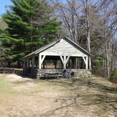
Access to the cave comes through marked trails starting from Stone Run Drive and winding through the protected area. The paths are straightforward to follow, and visitors should wear sturdy footwear and check conditions before visiting.

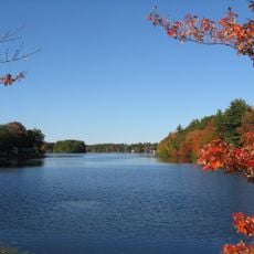
The cave sits near Lake Winnecunnett, an area once surrounded by numerous indigenous settlements. From this vantage point, visitors look out over land that held deep connections to pre-colonial history.

The community of curious travelers

AroundUs brings together thousands of curated places, local tips, and hidden gems, enriched daily by 60,000 contributors worldwide.

Start exploring
Location
GPS coordinates
41.98070,-71.13090
Latest update
December 11, 2025 11:04
Around this place
Xfinity Center
United States of America

Xfinity Center

7.5 km
Whittenton Mills Complex
United States of America

Whittenton Mills Complex

6.6 km
Norton Reservoir
United States of America

Norton Reservoir

4.9 km
Bristol County Courthouse Complex
United States of America

Bristol County Courthouse Complex

8 km
Union Congregational Church
United States of America

Union Congregational Church

7.1 km
Bay Road
United States of America

Bay Road

3.4 km
Watson Pond State Park
United States of America

Watson Pond State Park

3.7 km
North Taunton Baptist Church
United States of America

North Taunton Baptist Church

8 km
Hopewell School
United States of America

Hopewell School

7.4 km
Taunton Alms House
United States of America

Taunton Alms House

6.9 km
N. S. Mason House
United States of America

N. S. Mason House

8.7 km
Furnace Village Historic District
United States of America

Furnace Village Historic District

4.7 km
W.C. Beattie House
United States of America

W.C. Beattie House

7.2 km
James Leonard House
United States of America

James Leonard House

7.7 km
Hopewell Mills District
United States of America

Hopewell Mills District

7.8 km
Hodges House
United States of America

Hodges House

7 km
Ambrose Lincoln, Jr., House
United States of America

Ambrose Lincoln, Jr., House

8.1 km
Gen. Thomas Lincoln House
United States of America

Gen. Thomas Lincoln House

3.8 km
George Capron House
United States of America

George Capron House

8.7 km
Pitt Clarke House
United States of America

Pitt Clarke House

5.4 km
Brow's Tavern
United States of America

Brow's Tavern

7.7 km
Soldiers' Memorial Library
United States of America

Soldiers' Memorial Library

8.6 km
Buildings at 80 and 88 W. Brittania St.
United States of America

Buildings at 80 and 88 W. Brittania St.

7.9 km
Norton Center Historic District
United States of America

Norton Center Historic District

4.8 km
Calvin T. Macomber House
United States of America

Calvin T. Macomber House

7.2 km
Fuller-Dauphin Estate
United States of America

Fuller-Dauphin Estate

8.7 km
Bay Road
United States of America

Bay Road

3.4 km
Joseph Willis House
United States of America

Joseph Willis House

7.3 km
Show the full map
« King Phillip's Cave - Show cave in Norton, Massachusetts, United States » is provided by Around Us (aroundus.com). Images and texts are derived from Wikimedia project under a Creative Commons license. You are allowed to copy, distribute, and modify copies of this page, under the conditions set by the license, as long as this note is clearly visible.

Discover hidden gems everywhere you go!

From secret cafés to breathtaking viewpoints, skip the crowded tourist spots and find places that match your style. Our app makes it easy with voice search, smart filtering, route optimization, and insider tips from travelers worldwide. Download now for the complete mobile experience.

Around Us App Screenshot

A unique approach to discovering new places

Le Figaro

All the places worth exploring

France Info

A tailor-made excursion in just a few clicks

20 Minutes

Around Us
Travel Guide & Maps
Download

Send to your phone

QR Code
1

Open the camera app on your mobile.

2

Point at the QR code with your camera. A notification will appear.

3

Tap the notification to open the link.