Chest opened
+${chestReward.xp} XP
Explorer
NOUVEAU ×${chestReward.collectible.quantity}
tapez pour fermer
Chest locked

Open chests in the app

Around Us is built for your phone — chests unlock when you walk, explore and capture nearby places.

Enable Location

We need your location to show you interesting places around you

Discover nearby places

Find interesting locations and hidden gems around you

Precise directions

Get accurate directions and distances to places

Your location is never shared with other users. It's only used when you tap the location button.

Verville

Log in to your account

Start exploring — it's free

Trusted by 72,878 travelers worldwide

Continue with Google
Continue with Apple
or

We will send you a code to connect

By continuing, you accept our Terms and Conditions and our Privacy Policy

Check your inbox

We've sent a pincode in your inbox. Please enter the code below.

Discussion Reviews 1 Photos
1.3k Popularity

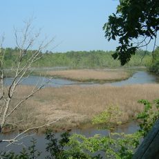
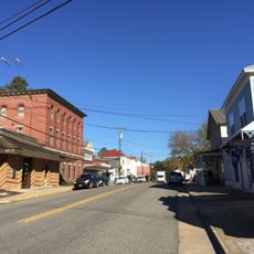
Verville, human settlement in Virginia, United States of America

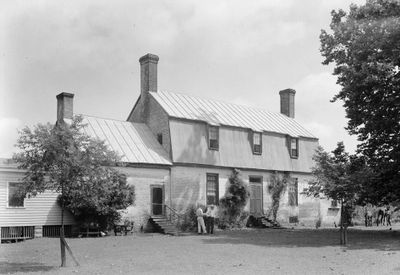
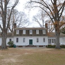
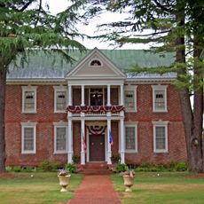
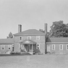
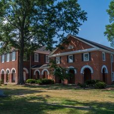
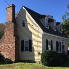
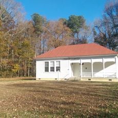
Verville is a brick house built in the 1740s located near Merry Point in Lancaster County, Virginia. The structure displays typical Chesapeake region architecture with a rectangular form, balanced window and door arrangement, and a distinctive gambrel roof, while the interior woodwork was later restyled in the late 1700s or early 1800s.

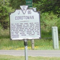
The property was acquired in 1668 by Major Edward Dale and later passed to his daughter Katherine and her husband Captain Thomas Carter as a wedding gift before coming into the possession of Scottish-Irish immigrant James Gordon in the 1700s. The Gordon family retained the estate for several generations until it was purchased by the Currie family in the early 1800s, who renamed it Verville and added wings and renovations.

The house served as a gathering place for wealthy families and a center for celebrations and social meetings. The Gordon family used it as a hub for their business activities and their role in the local community.

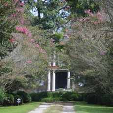
The house sits on private property near Merry Point and can be viewed from outside, but is not open to the public for interior access. Respect for the owners' privacy is important when visiting or viewing the property from nearby roads or paths.

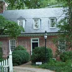
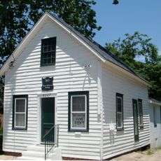
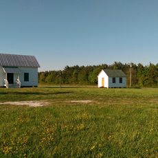
James Gordon kept a diary that was later published, offering insights into daily operations and work on the estate during the 1700s and 1800s. His daughter married a Reverend, and the couple lived in a smaller nearby house called the Honeymoon Cottage, while the main house was reserved for major family events.

The community of curious travelers

AroundUs brings together thousands of curated places, local tips, and hidden gems, enriched daily by 60,000 contributors worldwide.

Start exploring
Location
Inception
1749
GPS coordinates
37.71970,-76.47780
Latest update
February 9, 2026 07:46
Around this place
Corotoman
United States of America

Corotoman

7.8 km
Belle Isle State Park
United States of America

Belle Isle State Park

12.3 km
Cobbs Hall
United States of America

Cobbs Hall

12.5 km
Bush Mill Stream Natural Area Preserve
United States of America

Bush Mill Stream Natural Area Preserve

17.2 km
USS Aquamarine
United States of America

USS Aquamarine

7.4 km
Lancaster Court House Historic District
United States of America

Lancaster Court House Historic District

5.7 km
Lansdowne
United States of America

Lansdowne

12.7 km
Mary Ball Washington Museum and Library
United States of America

Mary Ball Washington Museum and Library

5.7 km
Rosegill
United States of America

Rosegill

12.9 km
Belle Isle
United States of America

Belle Isle

12.6 km
Sandwich
United States of America

Sandwich

12.3 km
Middlesex County Courthouse
United States of America

Middlesex County Courthouse

16.3 km
Village of Morattico Historic District
United States of America

Village of Morattico Historic District

15.4 km
Urbanna Historic District
United States of America

Urbanna Historic District

12.6 km
Wormeley Cottage
United States of America

Wormeley Cottage

12.9 km
Middlesex County Courthouse
United States of America

Middlesex County Courthouse

12.7 km
Howland Chapel School
United States of America

Howland Chapel School

17 km
Bluff Point Graded School No. 3
United States of America

Bluff Point Graded School No. 3

12.4 km
Steuart Blakemore Building
United States of America

Steuart Blakemore Building

5.7 km
Clifton
United States of America

Clifton

9.5 km
White Stone Beach
United States of America

White Stone Beach

12.6 km
Shiloh School
United States of America

Shiloh School

14 km
United States of America

Urbanna Harbor Gallery & Art Services

12.6 km
United States of America

Bird Viewing Blind

12 km
United States of America

Scenic viewpoint

14.7 km
United States of America

Scenic viewpoint

13.1 km
United States of America

Scenic viewpoint

15 km
United States of America

Scenic viewpoint

16.8 km
Show the full map
Reviews
Share your experience

No review yet

Discussions
Start a discussion...

No discussion yet

« Verville - human settlement in Virginia, United States of America » is provided by Around Us (aroundus.com). Images and texts are derived from Wikimedia project under a Creative Commons license. You are allowed to copy, distribute, and modify copies of this page, under the conditions set by the license, as long as this note is clearly visible.

Discover hidden gems everywhere you go!

From secret cafés to breathtaking viewpoints, skip the crowded tourist spots and find places that match your style. Our app makes it easy with voice search, smart filtering, route optimization, and insider tips from travelers worldwide. Download now for the complete mobile experience.

Around Us App Screenshot

A unique approach to discovering new places

Le Figaro

All the places worth exploring

France Info

A tailor-made excursion in just a few clicks

20 Minutes

Around Us
Travel Guide & Maps
Download

Send to your phone

QR Code
1

Open the camera app on your mobile.

2

Point at the QR code with your camera. A notification will appear.

3

Tap the notification to open the link.