Enable Location

We need your location to show you interesting places around you

Discover nearby places

Find interesting locations and hidden gems around you

Precise directions

Get accurate directions and distances to places

Your location is never shared with other users. It's only used when you tap the location button.

Fort Santa Agueda

Log in to your account

Start exploring — it's free

Trusted by 62,615 travelers worldwide

Continue with Google
Continue with Apple
or

We will send you a code to connect

By continuing, you accept our Terms and Conditions and our Privacy Policy

Check your inbox

We've sent a pincode in your inbox. Please enter the code below.

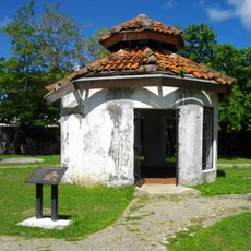
Fort Santa Agueda, Spanish colonial fort in Hagåtña, US.

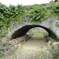
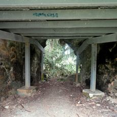
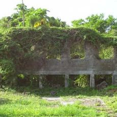
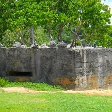
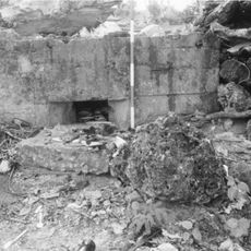
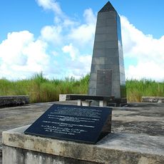
Fort Santa Agueda is a Spanish colonial fortification on a hillside in Hagåtña with visible stone remains and portions of the parapet still standing. The site preserves sections of the original coral stone construction that once formed the defensive walls.

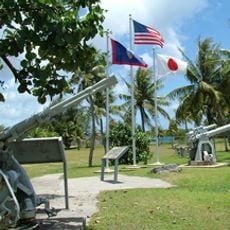
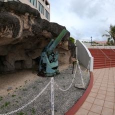
This site was built in the late 1700s during Spanish rule to defend the region from attack. It later served as an American signal station and then as a Japanese gun position during World War II.

The fort represents a significant example of Spanish colonial military architecture and demonstrates the historical defense strategies employed in the Pacific region.

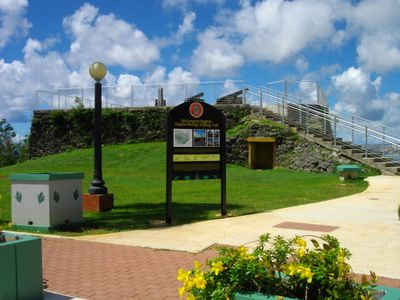
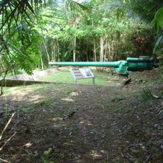
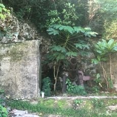
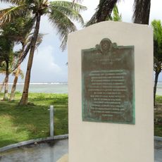
The site sits along Guam Highway 7 with a walking path leading up from the road to the remains. Interpretive signs at the location explain what you are seeing and provide context about its different uses over time.

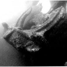
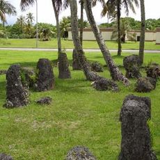
Artifacts found at the site reveal traces of its different roles, including materials from the Japanese occupation period. These layers of objects tell the story of how this place was repurposed by different powers over many decades.

The community of curious travelers

AroundUs brings together thousands of curated places, local tips, and hidden gems, enriched daily by 60,000 contributors worldwide.

Start exploring
Location
GPS coordinates
13.47351,144.74763
Latest update
December 13, 2025 12:40
Around this place
Plaza de España
United States of America

Plaza de España

424 m
United States of America

Blue Hole

14.4 km
Japanese midget submarine Ha. 62-76
United States of America

Japanese midget submarine Ha. 62-76

12.1 km
Guam Congress Building
United States of America

Guam Congress Building

524 m
United States of America

UnderWater World Guam

7.8 km
United States of America

Piti Bomb Holes Marine Preserve

5 km
Orote Field
United States of America

Orote Field

12.2 km
Piti Guns
United States of America

Piti Guns

5.9 km
Aratama Maru
United States of America

Aratama Maru

15.6 km
Guam Museum
United States of America

Guam Museum

479 m
An-Noor Mosque
United States of America

An-Noor Mosque

7.3 km
Asan Invasion Beach
United States of America

Asan Invasion Beach

4.2 km
Agana Spanish Bridge
United States of America

Agana Spanish Bridge

172 m
United States of America

Talofofo Bay

15.3 km
Agat Invasion Beach
United States of America

Agat Invasion Beach

14 km
South Finegayan Latte Stone Park
United States of America

South Finegayan Latte Stone Park

12.3 km
Guam Cable Station
United States of America

Guam Cable Station

11.4 km
Sumay Cemetery
United States of America

Sumay Cemetery

10.9 km
Dungcas Beach Defense Guns
United States of America

Dungcas Beach Defense Guns

3.3 km
Agana Historic District
United States of America

Agana Historic District

1.8 km
Agana-Hagatna Pillbox
United States of America

Agana-Hagatna Pillbox

618 m
Gongna Beach defenses
United States of America

Gongna Beach defenses

8.1 km
As Sombreru Pillboxes
United States of America

As Sombreru Pillboxes

6.4 km
Ipao Pillbox I
United States of America

Ipao Pillbox I

5.4 km
Korean Air Flight KE801 1997-Crash Memorial
United States of America

Korean Air Flight KE801 1997-Crash Memorial

2.6 km
Trinchera Beach
United States of America

Trinchera Beach

2.1 km
Nieves M. Flores Memorial Library
United States of America

Nieves M. Flores Memorial Library

661 m
Apolinario Mabini historical marker
United States of America

Apolinario Mabini historical marker

4.2 km
Show the full map
« Fort Santa Agueda - Spanish colonial fort in Hagåtña, US » is provided by Around Us (aroundus.com). Images and texts are derived from Wikimedia project under a Creative Commons license. You are allowed to copy, distribute, and modify copies of this page, under the conditions set by the license, as long as this note is clearly visible.

Discover hidden gems everywhere you go!

From secret cafés to breathtaking viewpoints, skip the crowded tourist spots and find places that match your style. Our app makes it easy with voice search, smart filtering, route optimization, and insider tips from travelers worldwide. Download now for the complete mobile experience.

Around Us App Screenshot

A unique approach to discovering new places

Le Figaro

All the places worth exploring

France Info

A tailor-made excursion in just a few clicks

20 Minutes

Around Us
Travel Guide & Maps
Download

Send to your phone

QR Code
1

Open the camera app on your mobile.

2

Point at the QR code with your camera. A notification will appear.

3

Tap the notification to open the link.