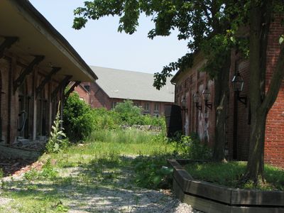
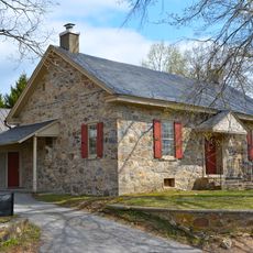
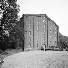
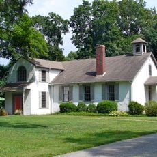
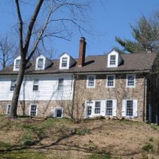
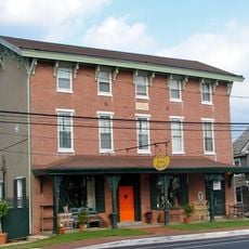
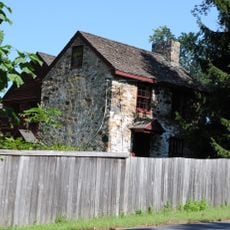
Enable Location

We need your location to show you interesting places around you

Discover nearby places

Find interesting locations and hidden gems around you

Precise directions

Get accurate directions and distances to places

Your location is never shared with other users. It's only used when you tap the location button.

Garrett Snuff Mill

Log in to your account

Start exploring — it's free

Trusted by 62,787 travelers worldwide

Continue with Google
Continue with Apple
or

We will send you a code to connect

By continuing, you accept our Terms and Conditions and our Privacy Policy

Check your inbox

We've sent a pincode in your inbox. Please enter the code below.

Garrett Snuff Mill

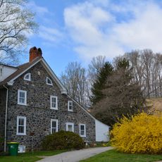
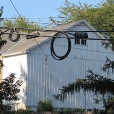
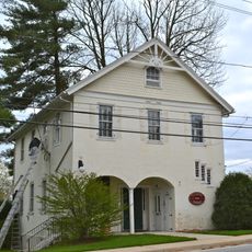
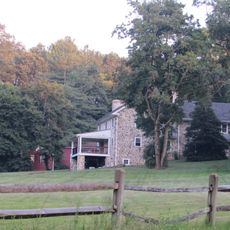
The Garrett Snuff Mill is a factory in New Castle County founded in the early 1800s and run by the Garrett family to transform tobacco into snuff powder. The complex includes multiple stone and brick buildings with large windows constructed between the late 1800s and early 1900s that supported different stages of snuff production.

The Garrett family began as millers on Red Clay Creek in the early 1700s and built the first major stone mill in 1846, which was rebuilt after a fire in 1858. The business grew under various owners including the American Tobacco Company and later George W. Helme Company until closing in 1954 due to outdated machinery and declining demand.

The Garrett name reflects the family enterprise that built and sustained this tobacco business across multiple generations in the region. The mill served as a daily workplace where the community gathered, making it a social and economic hub that shaped the identity of Yorklyn itself.

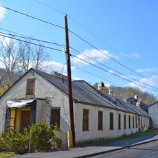
Visitors can explore the exterior and certain accessible sections of the complex to view the architecture and layout of the historic factory. The grounds are quite quiet and work best for those interested in industrial history and early manufacturing practices.

The site displays original iron and wood machinery dating back to the 1880s still standing in the buildings. These remnants offer visitors a rare look at the actual manufacturing techniques and work tools that are more than a century old.

The community of curious travelers

AroundUs brings together thousands of curated places, local tips, and hidden gems, enriched daily by 60,000 contributors worldwide.

Start exploring
GPS coordinates
39.80861,-75.67389
Latest update
February 9, 2026 08:21
Around this place
Ashland Covered Bridge
United States of America

Ashland Covered Bridge

1.8 km
Hindu Temple of Delaware
United States of America

Hindu Temple of Delaware

2.3 km
Auburn Valley State Park
United States of America

Auburn Valley State Park

501 m
Owl's Nest Country Place
United States of America

Owl's Nest Country Place

4.3 km
Jacob Broom House
United States of America

Jacob Broom House

2.7 km
Mount Cuba Astronomical Observatory
United States of America

Mount Cuba Astronomical Observatory

4.4 km
Hockessin Friends Meetinghouse
United States of America

Hockessin Friends Meetinghouse

2.3 km
Harlan Log House
United States of America

Harlan Log House

4.7 km
Coffee Run Mission Site
United States of America

Coffee Run Mission Site

4.7 km
Auburn Mills Historic District
United States of America

Auburn Mills Historic District

556 m
Cloud-Reese House
United States of America

Cloud-Reese House

2.2 km
Chandler Mill Bridge
United States of America

Chandler Mill Bridge

3.4 km
Garrett Snuff Mills Historic District
United States of America

Garrett Snuff Mills Historic District

265 m
Stockton-Montmorency
United States of America

Stockton-Montmorency

4.3 km
Joseph Gregg House
United States of America

Joseph Gregg House

4 km
Carpenter-Lippincott House
United States of America

Carpenter-Lippincott House

5 km
T. Pierson Farm
United States of America

T. Pierson Farm

4.3 km
A. Armstrong Farm
United States of America

A. Armstrong Farm

2.5 km
Walnut Green School
United States of America

Walnut Green School

4.5 km
Mount Cuba Historic District
United States of America

Mount Cuba Historic District

3.6 km
Springer Farm
United States of America

Springer Farm

4.9 km
Public School No. 29
United States of America

Public School No. 29

3.2 km
S. P. Dixon Farm
United States of America

S. P. Dixon Farm

2 km
Mt. Airy School No. 27
United States of America

Mt. Airy School No. 27

5 km
J. Mason Farm
United States of America

J. Mason Farm

2.2 km
Centreville Historic District
United States of America

Centreville Historic District

5.1 km
Graves Mill Historic District
United States of America

Graves Mill Historic District

2.6 km
Mt. Cuba Center
United States of America

Mt. Cuba Center

3 km
Show the full map
« Garrett Snuff Mill » is provided by Around Us (aroundus.com). Images and texts are derived from Wikimedia project under a Creative Commons license. You are allowed to copy, distribute, and modify copies of this page, under the conditions set by the license, as long as this note is clearly visible.

Discover hidden gems everywhere you go!

From secret cafés to breathtaking viewpoints, skip the crowded tourist spots and find places that match your style. Our app makes it easy with voice search, smart filtering, route optimization, and insider tips from travelers worldwide. Download now for the complete mobile experience.

Around Us App Screenshot

A unique approach to discovering new places

Le Figaro

All the places worth exploring

France Info

A tailor-made excursion in just a few clicks

20 Minutes

Around Us
Travel Guide & Maps
Download

Send to your phone

QR Code
1

Open the camera app on your mobile.

2

Point at the QR code with your camera. A notification will appear.

3

Tap the notification to open the link.