Saline County Poor Farm

Log in to your account

AroundUs is a community-driven map of interesting places, built by curious explorers like you. It grows with every review, story, and photo you share.
Connect to save your favorite spots, contribute locations, and create personalized routes.
Continue with Google
Continue with Apple
Continue with X
Continue with Facebook
Continue with email
By continuing, you accept our Terms and Conditions and our Privacy Policy
Create an account
Add to collection
Map
Suggest a change
Share

Saline County Poor Farm, Historic district in Harrisburg, United States

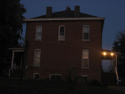
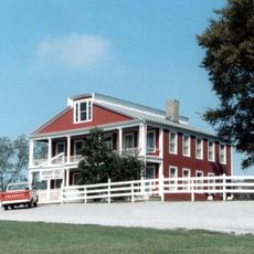
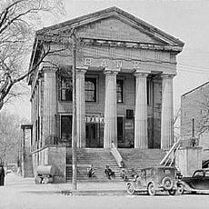
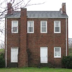
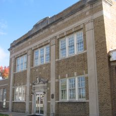
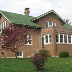
Saline County Poor Farm is a historic district in Harrisburg featuring Renaissance Revival architecture with red brick walls, tall windows, and symmetrical wings extending from the main building. The 3.5-acre property includes a cemetery and museum sections that document the original purpose and layout of the facility.

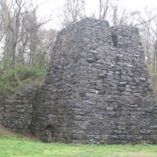
The county established this facility in 1863 following state law requirements, replacing the original log building with a permanent brick structure in 1877. Operations continued independently here until the 1950s, while many other similar county institutions merged or closed after legislative changes in 1917.

The farm demonstrates how communities once addressed poverty by offering residents work in exchange for food and shelter on the grounds. Visitors can observe how this system operated and understand the daily routines of those who lived and worked here.

The property is accessible for museum tours and cemetery visits that provide insight into historical operations at the site. Visitors should expect uneven terrain and changing weather, so comfortable walking shoes and appropriate clothing are advisable.

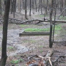
The grounds preserve a cemetery with graves of former residents, offering a rare direct connection to the personal stories of those who lived here. This resting place provides a moving reminder of individual lives and family histories at the site.

Location: Harrisburg

Architectural style: Renaissance Revival architecture

GPS coordinates: 37.71972,-88.55417

Latest update: December 14, 2025 18:01

Photos
Around this place
Crenshaw House
United States of America

Crenshaw House

23.1 km
Garden of the Gods Wilderness
United States of America

Garden of the Gods Wilderness

18.8 km
Tunnel Hill State Trail
United States of America

Tunnel Hill State Trail

12.6 km
Dixon Springs State Park
United States of America

Dixon Springs State Park

38.8 km
Illinois Salines
United States of America

Illinois Salines

22.9 km
Shawneetown Bank State Historic Site
United States of America

Shawneetown Bank State Historic Site

37 km
Illinois Iron Furnace
United States of America

Illinois Iron Furnace

31.6 km
Shawneetown Bridge
United States of America

Shawneetown Bridge

37.4 km
Orr-Herl Mound and Village Site
United States of America

Orr-Herl Mound and Village Site

37.5 km
Carrier Mills Archaeological District
United States of America

Carrier Mills Archaeological District

8.9 km
United States of America

Gallatin County Courthouse

32.4 km
John Marshall House Museum
United States of America

John Marshall House Museum

36.9 km
Bell Smith Springs
United States of America

Bell Smith Springs

24.1 km
Willis Allen House
United States of America

Willis Allen House

32.9 km
Lusk Creek Canyon
United States of America

Lusk Creek Canyon

22.4 km
West Frankfort City Hall
United States of America

West Frankfort City Hall

38.1 km
Goddard Chapel
United States of America

Goddard Chapel

33.3 km
Saline County Courthouse
United States of America

Saline County Courthouse

2.5 km
Hardin County Courthouse
United States of America

Hardin County Courthouse

37.5 km
Williamson County Courthouse
United States of America

Williamson County Courthouse

33 km
Eldorado City Hall
United States of America

Eldorado City Hall

14.3 km
Harrisburg City Hall
United States of America

Harrisburg City Hall

2.6 km
Ed M. Stotlar House
United States of America

Ed M. Stotlar House

34 km
Robert and John McKee Peeples Houses
United States of America

Robert and John McKee Peeples Houses

37.1 km
AMC Classic Illinois Centre 8
United States of America

AMC Classic Illinois Centre 8

37.3 km
Grand Theater
United States of America

Grand Theater

14.6 km
Raum Lookout Tower
United States of America

Raum Lookout Tower

31.5 km
Peters Creek Lookout Tower
United States of America

Peters Creek Lookout Tower

36.2 km
Show the full map
Reviews

Visited this place? Tap the stars to rate it and share your experience / photos with the community! Try now! You can cancel it anytime.

« Saline County Poor Farm - Historic district in Harrisburg, United States » is provided by Around Us (aroundus.com). Images and texts are derived from Wikimedia project under a Creative Commons license. You are allowed to copy, distribute, and modify copies of this page, under the conditions set by the license, as long as this note is clearly visible.

Discover hidden gems everywhere you go!

From secret cafés to breathtaking viewpoints, skip the crowded tourist spots and find places that match your style. Our app makes it easy with voice search, smart filtering, route optimization, and insider tips from travelers worldwide. Download now for the complete mobile experience.

Around Us App Screenshot

A unique approach to discovering new places

Le Figaro

All the places worth exploring

France Info

A tailor-made excursion in just a few clicks

20 Minutes