Enable Location

We need your location to show you interesting places around you

Discover nearby places

Find interesting locations and hidden gems around you

Precise directions

Get accurate directions and distances to places

Your location is never shared with other users. It's only used when you tap the location button.

Fort Belle Fontaine County Park

Log in to your account

Start exploring — it's free

Trusted by 63,423 travelers worldwide

Continue with Google
Continue with Apple
or

We will send you a code to connect

By continuing, you accept our Terms and Conditions and our Privacy Policy

Check your inbox

We've sent a pincode in your inbox. Please enter the code below.

Fort Belle Fontaine County Park
Discussion Reviews 1 Photos
2.2k Popularity

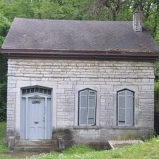
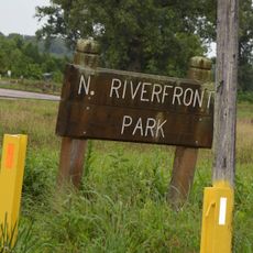
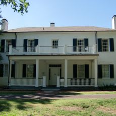
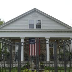
Fort Belle Fontaine County Park, Historic fort and county park in St. Louis County, United States.

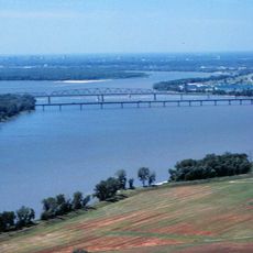
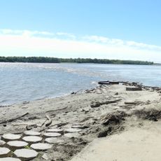
Fort Belle Fontaine County Park is a 305-acre property along the Missouri River featuring limestone staircases and natural trails throughout its grounds. A three-mile network of paths connects historical landmarks and open prairie areas.

The fort was established in 1805 as the first United States military installation west of the Mississippi River. It operated for about two decades before closure in 1826.

The park bears witness to the meetings and exchanges between Native Americans, European traders, and American soldiers during the early 1800s. Signs throughout the grounds tell these stories, helping visitors understand the complex interactions that took place here.

All visitors must stop at a security checkpoint before accessing the park trails and grounds. Wear comfortable walking shoes since the limestone staircases are steep in places and paths cross uneven terrain.

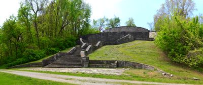
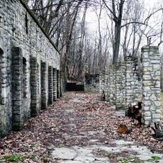
Grand limestone staircases built in 1936 through the Works Progress Administration remain standing on the grounds today. These structures showcase the craftsmanship of a Depression-era public works project.

The community of curious travelers

AroundUs brings together thousands of curated places, local tips, and hidden gems, enriched daily by 60,000 contributors worldwide.

Start exploring
Location
Inception
1986
GPS coordinates
38.82500,-90.21900
Latest update
December 13, 2025 17:10
Around this place
Piasa
United States of America

Piasa

8.3 km
Chain of Rocks Bridge
United States of America

Chain of Rocks Bridge

8.1 km
Clark Bridge
United States of America

Clark Bridge

7.3 km
New Chain of Rocks Bridge
United States of America

New Chain of Rocks Bridge

7.8 km
Alton Military Prison
United States of America

Alton Military Prison

7.8 km
Melvin Price Locks and Dam
United States of America

Melvin Price Locks and Dam

7.5 km
Jones-Confluence Point State Park
United States of America

Jones-Confluence Point State Park

8.7 km
Fort Belle Fontaine
United States of America

Fort Belle Fontaine

404 m
Old Clark Bridge
United States of America

Old Clark Bridge

7.3 km
Elijah P. Lovejoy Monument
United States of America

Elijah P. Lovejoy Monument

8.6 km
Lock and Dam No. 26
United States of America

Lock and Dam No. 26

7.5 km
Alton Bridge
United States of America

Alton Bridge

7.2 km
Lewis Bridge
United States of America

Lewis Bridge

2.5 km
Lyman Trumbull House
United States of America

Lyman Trumbull House

8.9 km
Bellefontaine Bridge
United States of America

Bellefontaine Bridge

2.5 km
Haskell Playhouse
United States of America

Haskell Playhouse

9 km
Christian Hill Historic District
United States of America

Christian Hill Historic District

8.1 km
Guertler House
United States of America

Guertler House

9 km
Middletown Historic District (Alton, Illinois)
United States of America

Middletown Historic District (Alton, Illinois)

8.7 km
Colonel George H. Blasé Park
United States of America

Colonel George H. Blasé Park

9.4 km
Gen. Daniel Bissell House
United States of America

Gen. Daniel Bissell House

7.7 km
Post House
United States of America

Post House

9.2 km
Alton Chapter House
United States of America

Alton Chapter House

8.2 km
Yakel House and Union Brewery
United States of America

Yakel House and Union Brewery

8.9 km
Chain of Rocks Water Purification Plant
United States of America

Chain of Rocks Water Purification Plant

8.3 km
General Daniel Bissell house
United States of America

General Daniel Bissell house

7.7 km
McPike Mansion
United States of America

McPike Mansion

9.5 km
Jamestown 14
United States of America

Jamestown 14

2.7 km
Show the full map
Reviews
Share your experience

No review yet

Discussions
Start a discussion...

No discussion yet

« Fort Belle Fontaine County Park - Historic fort and county park in St. Louis County, United States » is provided by Around Us (aroundus.com). Images and texts are derived from Wikimedia project under a Creative Commons license. You are allowed to copy, distribute, and modify copies of this page, under the conditions set by the license, as long as this note is clearly visible.

Discover hidden gems everywhere you go!

From secret cafés to breathtaking viewpoints, skip the crowded tourist spots and find places that match your style. Our app makes it easy with voice search, smart filtering, route optimization, and insider tips from travelers worldwide. Download now for the complete mobile experience.

Around Us App Screenshot

A unique approach to discovering new places

Le Figaro

All the places worth exploring

France Info

A tailor-made excursion in just a few clicks

20 Minutes

Around Us
Travel Guide & Maps
Download

Send to your phone

QR Code
1

Open the camera app on your mobile.

2

Point at the QR code with your camera. A notification will appear.

3

Tap the notification to open the link.