Enable Location

We need your location to show you interesting places around you

Discover nearby places

Find interesting locations and hidden gems around you

Precise directions

Get accurate directions and distances to places

Your location is never shared with other users. It's only used when you tap the location button.

Highland Rim

Log in to your account

Start exploring — it's free

Trusted by 63,009 travelers worldwide

Continue with Google
Continue with Apple
or

We will send you a code to connect

By continuing, you accept our Terms and Conditions and our Privacy Policy

Check your inbox

We've sent a pincode in your inbox. Please enter the code below.

Highland Rim
Discussion Reviews 1 Photos
19.5k Popularity

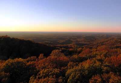
Highland Rim, Elevation zone in Tennessee, United States.

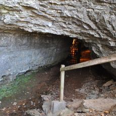
Highland Rim is a circular plateau in Tennessee that surrounds the Nashville Basin, featuring rolling hills, valleys, and numerous streams throughout the region. The elevation reaches around 1,400 feet and displays varied topography with many rock formations visible across the landscape.

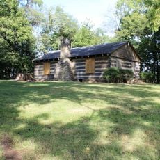
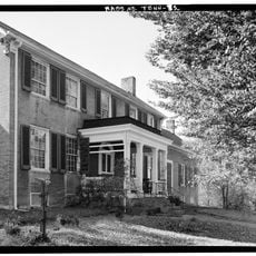
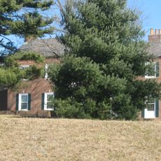
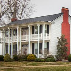
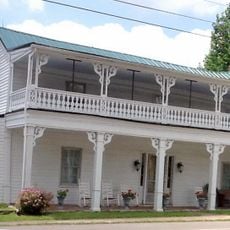
The region formed millions of years ago through geological processes that left limestone and minerals, creating this distinctive landform. In the 1800s, the mineral-rich soil attracted settlers who built farms and established agricultural communities across the area.

The terrain shapes how people have farmed and lived in the region for generations, with different crops thriving in different parts based on the land. Locals have adapted their way of life to the rolling landscape and its challenges.

Visitors can explore the area by visiting various viewing points that reveal waterfalls and rock formations from higher elevations. Spring and fall are ideal times to visit when weather is mild and the terrain is easiest to walk through.

The area divides into four main sections, each with different geological features and landforms that visitors can observe. This division means each section has its own appearance and rock types, making the region interesting to explore across all parts.

The community of curious travelers

AroundUs brings together thousands of curated places, local tips, and hidden gems, enriched daily by 60,000 contributors worldwide.

Start exploring
Location
GPS coordinates
36.50000,-87.00000
Latest update
December 7, 2025 10:07
Around this place
Bell Witch Cave
United States of America

Bell Witch Cave

11.3 km
Dunbar Cave State Park
United States of America

Dunbar Cave State Park

27.9 km
Red River Meeting House
United States of America

Red River Meeting House

29.7 km
Port Royal State Park
United States of America

Port Royal State Park

14.3 km
Wessyngton
United States of America

Wessyngton

381 m
Glen Raven
United States of America

Glen Raven

7.2 km
United States of America

Guthrie Historic District

22.2 km
Robertson County Courthouse
United States of America

Robertson County Courthouse

10.2 km
Madison Street Methodist Church
United States of America

Madison Street Methodist Church

14.2 km
Cheatham County Courthouse
United States of America

Cheatham County Courthouse

25.7 km
Highland Chapel Union Church
United States of America

Highland Chapel Union Church

23.3 km
Tip Top
United States of America

Tip Top

30.3 km
The Beeches
United States of America

The Beeches

13.2 km
Bethlehem Methodist Church and Cemetery
United States of America

Bethlehem Methodist Church and Cemetery

25.2 km
Whites Creek Historic District
United States of America

Whites Creek Historic District

30.9 km
Mansfield Cheatham House
United States of America

Mansfield Cheatham House

9.8 km
Dr. Martin Walton House
United States of America

Dr. Martin Walton House

20.1 km
Madison Street Historic District
United States of America

Madison Street Historic District

30.7 km
Sudley Place
United States of America

Sudley Place

23 km
Wilkinson House
United States of America

Wilkinson House

21.5 km
Russell House
United States of America

Russell House

12.2 km
Longview Farm House
United States of America

Longview Farm House

29.6 km
Johnson-Hach House
United States of America

Johnson-Hach House

31.2 km
Sanford Wilson House
United States of America

Sanford Wilson House

20.7 km
Oak Top
United States of America

Oak Top

30.3 km
William Randolph House
United States of America

William Randolph House

27.6 km
Allensville Historic District
United States of America

Allensville Historic District

24.8 km
Dunbar Cave
United States of America

Dunbar Cave

27.9 km
Show the full map
Reviews
Share your experience

No review yet

Discussions
Start a discussion...

No discussion yet

« Highland Rim - Elevation zone in Tennessee, United States » is provided by Around Us (aroundus.com). Images and texts are derived from Wikimedia project under a Creative Commons license. You are allowed to copy, distribute, and modify copies of this page, under the conditions set by the license, as long as this note is clearly visible.

Discover hidden gems everywhere you go!

From secret cafés to breathtaking viewpoints, skip the crowded tourist spots and find places that match your style. Our app makes it easy with voice search, smart filtering, route optimization, and insider tips from travelers worldwide. Download now for the complete mobile experience.

Around Us App Screenshot

A unique approach to discovering new places

Le Figaro

All the places worth exploring

France Info

A tailor-made excursion in just a few clicks

20 Minutes

Around Us
Travel Guide & Maps
Download

Send to your phone

QR Code
1

Open the camera app on your mobile.

2

Point at the QR code with your camera. A notification will appear.

3

Tap the notification to open the link.