Chest opened
+${chestReward.xp} XP
Explorer
NOUVEAU ×${chestReward.collectible.quantity}
tapez pour fermer
Chest locked

Open chests in the app

Around Us is built for your phone — chests unlock when you walk, explore and capture nearby places.

Enable Location

We need your location to show you interesting places around you

Discover nearby places

Find interesting locations and hidden gems around you

Precise directions

Get accurate directions and distances to places

Your location is never shared with other users. It's only used when you tap the location button.

Log in to your account

Start exploring — it's free

Trusted by 72,991 travelers worldwide

Continue with Google
Continue with Apple
or

We will send you a code to connect

By continuing, you accept our Terms and Conditions and our Privacy Policy

Check your inbox

We've sent a pincode in your inbox. Please enter the code below.

Keokuk's Reserve
Discussion Reviews Photo
2.1k Popularity

Keokuk's Reserve, Native American reserve in Iowa, United States

Keokuk's Reserve is a Sauk and Fox territory that stretches along both sides of the Iowa River, running from the Mississippi River inland. The land was established following a peace agreement and provided a home for the remaining populations of both tribes.

Following the Black Hawk War of 1832, the Sauk and Fox tribes retained this section of land while ceding larger territories to the United States. The reserve emerged from negotiations designed to preserve at least a portion of ancestral lands for the tribes.

The reserve is named after Chief Keokuk, a Sauk leader who served as a negotiator between his people and the United States government. His name remains tied to this land as a reminder of the diplomatic efforts made during a transformative period.

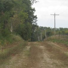
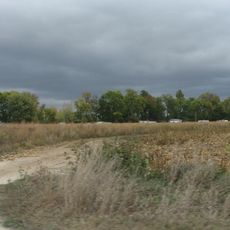
The landscape consists mainly of flatland with woodlands and streams, with the Iowa River forming a natural boundary. Visitors should note that the terrain changes seasonally, and accessibility can vary depending on weather conditions.

Between 1833 and 1845, the population in the reserve fell from around 6,000 to roughly 1,200 people due to resource scarcity and difficult living conditions. This period marked a turning point in the reserve's history and the beginning of a new chapter for its inhabitants.

The community of curious travelers

AroundUs brings together thousands of curated places, local tips, and hidden gems, enriched daily by 60,000 contributors worldwide.

Start exploring
GPS coordinates
41.28333,-91.28333
Latest update
December 14, 2025 09:46
Around this place
Toolesboro Mound Group
United States of America

Toolesboro Mound Group

24.5 km
United States of America

Port Louisa National Wildlife Refuge

22.9 km
Lock and Dam No. 17
United States of America

Lock and Dam No. 17

21.3 km
Alexander Clark House
United States of America

Alexander Clark House

25 km
Pliny and Adelia Fay House
United States of America

Pliny and Adelia Fay House

24.5 km
Louisa County Courthouse
United States of America

Louisa County Courthouse

14.2 km
Gipple's Quarry Bridge
United States of America

Gipple's Quarry Bridge

13.7 km
United States of America

Muscatine Arboretum

23.6 km
Clark-Blackwell House
United States of America

Clark-Blackwell House

24.3 km
Hotel Wapello
United States of America

Hotel Wapello

14 km
Big Slough Creek Bridge
United States of America

Big Slough Creek Bridge

22.3 km
Bethel Church
United States of America

Bethel Church

20.9 km
Community Building
United States of America

Community Building

6.5 km
West Hill Historic District
United States of America

West Hill Historic District

24.6 km
Greenwood Cemetery Chapel
United States of America

Greenwood Cemetery Chapel

23.8 km
County Line Bridge
United States of America

County Line Bridge

17 km
J. C. B. Warde House
United States of America

J. C. B. Warde House

24.4 km
Samuel Nichols House
United States of America

Samuel Nichols House

21.7 km
Florence-Council On The Iowa Site
United States of America

Florence-Council On The Iowa Site

24 km
St. Mary's Catholic Church
United States of America

St. Mary's Catholic Church

21.8 km
Muscatine County Home Dairy Barn
United States of America

Muscatine County Home Dairy Barn

23.6 km
Ijem Avenue Commercial Historic District
United States of America

Ijem Avenue Commercial Historic District

22.1 km
Pearl Bottom Museum
United States of America

Pearl Bottom Museum

25 km
United States of America

Sand Run Park

20.9 km
United States of America

Cone Marsh State Wildlife Management Area

15.2 km
United States of America

Mark Twain National Wildlife Refuge

15 km
United States of America

Metal Flower

6.8 km
United States of America

Scenic viewpoint

24.5 km
Show the full map
Reviews
Share your experience

No review yet

Discussions
Start a discussion...

No discussion yet

« Keokuk's Reserve - Native American reserve in Iowa, United States » is provided by Around Us (aroundus.com). Images and texts are derived from Wikimedia project under a Creative Commons license. You are allowed to copy, distribute, and modify copies of this page, under the conditions set by the license, as long as this note is clearly visible.

Discover hidden gems everywhere you go!

From secret cafés to breathtaking viewpoints, skip the crowded tourist spots and find places that match your style. Our app makes it easy with voice search, smart filtering, route optimization, and insider tips from travelers worldwide. Download now for the complete mobile experience.

Around Us App Screenshot

A unique approach to discovering new places

Le Figaro

All the places worth exploring

France Info

A tailor-made excursion in just a few clicks

20 Minutes

Around Us
Travel Guide & Maps
Download

Send to your phone

QR Code
1

Open the camera app on your mobile.

2

Point at the QR code with your camera. A notification will appear.

3

Tap the notification to open the link.