Chest opened
+${chestReward.xp} XP
Explorer
NOUVEAU ×${chestReward.collectible.quantity}
tapez pour fermer
Chest locked

Open chests in the app

Around Us is built for your phone — chests unlock when you walk, explore and capture nearby places.

Enable Location

We need your location to show you interesting places around you

Discover nearby places

Find interesting locations and hidden gems around you

Precise directions

Get accurate directions and distances to places

Your location is never shared with other users. It's only used when you tap the location button.

Log in to your account

Start exploring — it's free

Trusted by 73,097 travelers worldwide

Continue with Google
Continue with Apple
or

We will send you a code to connect

By continuing, you accept our Terms and Conditions and our Privacy Policy

Check your inbox

We've sent a pincode in your inbox. Please enter the code below.

Port Louisa National Wildlife Refuge
Discussion Reviews Photo
2.6k Popularity

Port Louisa National Wildlife Refuge, National wildlife refuge along Mississippi River, Illinois.

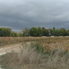
Port Louisa National Wildlife Refuge is a protected area along the Mississippi River that spans wetlands, grasslands, and forests throughout its divisions. The landscape supports a wide range of animal populations across different terrain types, from river floodplains to upland habitats.

The refuge was established in 1958 to protect migratory birds traveling along the Mississippi River migration route. Since then it has grown into an important conservation area for species that depend on this river landscape.

The refuge serves as a key gathering place for watching migratory birds, particularly during spring and fall movements along the river corridor. Local communities and visitors use it as a space to observe wildlife in its natural seasonal patterns and rhythms.

The refuge has marked trails, observation platforms, and a visitor station where you can get maps and information. Come prepared for changing weather and wear comfortable shoes, as the terrain varies between easy paths and uneven ground.

The refuge supports an unusually large diversity of amphibians and reptiles that thrive in the river floodplains and surrounding habitats. This variety of species makes it a rare example of the complexity of wetland ecosystems in this region.

The community of curious travelers

AroundUs brings together thousands of curated places, local tips, and hidden gems, enriched daily by 60,000 contributors worldwide.

Start exploring
Location
Location
Inception
1958
GPS coordinates
41.20000,-91.03330
Latest update
December 12, 2025 17:46
Around this place
Toolesboro Mound Group
United States of America

Toolesboro Mound Group

5.7 km
Norbert F. Beckey Bridge
United States of America

Norbert F. Beckey Bridge

24.8 km
Lock and Dam No. 16
United States of America

Lock and Dam No. 16

25.3 km
Lock and Dam No. 17
United States of America

Lock and Dam No. 17

2.5 km
Keithsburg Rail Bridge
United States of America

Keithsburg Rail Bridge

12.5 km
Mercer County Jail
United States of America

Mercer County Jail

23.8 km
Alexander Clark House
United States of America

Alexander Clark House

24.7 km
Mercer County Courthouse
United States of America

Mercer County Courthouse

23.8 km
Muscatine County Courthouse
United States of America

Muscatine County Courthouse

25 km
Trinity Episcopal Church
United States of America

Trinity Episcopal Church

24.9 km
Pliny and Adelia Fay House
United States of America

Pliny and Adelia Fay House

24.3 km
Louisa County Courthouse
United States of America

Louisa County Courthouse

13 km
Clark-Blackwell House
United States of America

Clark-Blackwell House

24.2 km
Hawkeye Creek Bridge
United States of America

Hawkeye Creek Bridge

17.6 km
First Presbyterian Church
United States of America

First Presbyterian Church

24.8 km
Hotel Wapello
United States of America

Hotel Wapello

13 km
Levi Willits House
United States of America

Levi Willits House

4.5 km
Bethel Church
United States of America

Bethel Church

16.3 km
West Hill Historic District
United States of America

West Hill Historic District

24.5 km
Old Jail
United States of America

Old Jail

25.6 km
Downtown Commercial Historic District
United States of America

Downtown Commercial Historic District

24.9 km
Greenwood Cemetery Chapel
United States of America

Greenwood Cemetery Chapel

24.6 km
Welch Apartments
United States of America

Welch Apartments

24.7 km
James S. Thompson House
United States of America

James S. Thompson House

4.2 km
J. C. B. Warde House
United States of America

J. C. B. Warde House

24.2 km
Florence-Council On The Iowa Site
United States of America

Florence-Council On The Iowa Site

12.4 km
S. M. McKibben House
United States of America

S. M. McKibben House

24.8 km
Commercial House
United States of America

Commercial House

13.4 km
Show the full map
Reviews
Share your experience

No review yet

Discussions
Start a discussion...

No discussion yet

« Port Louisa National Wildlife Refuge - National wildlife refuge along Mississippi River, Illinois » is provided by Around Us (aroundus.com). Images and texts are derived from Wikimedia project under a Creative Commons license. You are allowed to copy, distribute, and modify copies of this page, under the conditions set by the license, as long as this note is clearly visible.

Discover hidden gems everywhere you go!

From secret cafés to breathtaking viewpoints, skip the crowded tourist spots and find places that match your style. Our app makes it easy with voice search, smart filtering, route optimization, and insider tips from travelers worldwide. Download now for the complete mobile experience.

Around Us App Screenshot

A unique approach to discovering new places

Le Figaro

All the places worth exploring

France Info

A tailor-made excursion in just a few clicks

20 Minutes

Around Us
Travel Guide & Maps
Download

Send to your phone

QR Code
1

Open the camera app on your mobile.

2

Point at the QR code with your camera. A notification will appear.

3

Tap the notification to open the link.