Enable Location

We need your location to show you interesting places around you

Discover nearby places

Find interesting locations and hidden gems around you

Precise directions

Get accurate directions and distances to places

Your location is never shared with other users. It's only used when you tap the location button.

Magee Marsh Wildlife Area

Log in to your account

Start exploring — it's free

Trusted by 62,410 travelers worldwide

Continue with Google
Continue with Apple
or

We will send you a code to connect

By continuing, you accept our Terms and Conditions and our Privacy Policy

Check your inbox

We've sent a pincode in your inbox. Please enter the code below.

Magee Marsh Wildlife Area

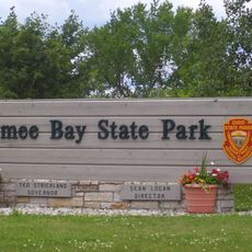
Magee Marsh Wildlife Area, Protected marsh in Carroll Township, Ohio.

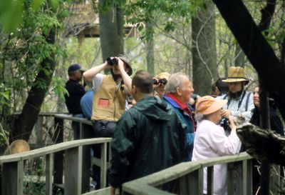
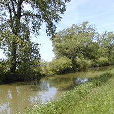
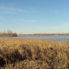
Magee Marsh Wildlife Area is a protected wetland along Lake Erie's shore, bordered by thick woods and marshy vegetation. A wooden boardwalk about a mile long takes visitors through different habitats where water and forest meet.

The marsh was an important waterfowl area in the early 1800s and later became private hunting grounds. Today it functions as a protected refuge focused on habitat restoration and conservation.

The marsh draws birders and nature enthusiasts who come to watch migratory songbirds and waterfowl throughout the year. People visit for a chance to spot species that pass through or nest in the region.

Access is available from clearly marked parking areas near the boardwalk, which connects to observation platforms. Comfortable walking shoes and insect repellent are recommended, especially during warmer months.

The marsh played a key role in reintroducing Canada geese to Ohio during the 1960s, serving as a breeding site for thousands of young geese. This success makes it a notable example of wildlife restoration in the region.

The community of curious travelers

AroundUs brings together thousands of curated places, local tips, and hidden gems, enriched daily by 60,000 contributors worldwide.

Start exploring
Location
GPS coordinates
41.61417,-83.16389
Latest update
December 14, 2025 13:08
Around this place
Crystal Cave
United States of America

Crystal Cave

28.2 km
Maumee Bay State Park
United States of America

Maumee Bay State Park

19.8 km
Veterans' Glass City Skyway
United States of America

Veterans' Glass City Skyway

29.5 km
West Sister Island
United States of America

West Sister Island

14.8 km
African Safari Wildlife Park
United States of America

African Safari Wildlife Park

28.1 km
National Museum of the Great Lakes
United States of America

National Museum of the Great Lakes

29.6 km
Ottawa National Wildlife Refuge
United States of America

Ottawa National Wildlife Refuge

4.3 km
Toledo Harbor Light
United States of America

Toledo Harbor Light

21.4 km
Green Island
United States of America

Green Island

25.1 km
South Bass Island Light
United States of America

South Bass Island Light

26.9 km
Jay Cooke House
United States of America

Jay Cooke House

28.9 km
Cedar Point National Wildlife Refuge
United States of America

Cedar Point National Wildlife Refuge

15.4 km
Robert Craig Memorial Bridge
United States of America

Robert Craig Memorial Bridge

29.4 km
Liberty Aviation Museum
United States of America

Liberty Aviation Museum

27.5 km
Catawba Island State Park
United States of America

Catawba Island State Park

25.9 km
Turtle Island Light
United States of America

Turtle Island Light

24.4 km
Erie Proving Ground
United States of America

Erie Proving Ground

13.6 km
Port Clinton Light
United States of America

Port Clinton Light

22.1 km
Green Island Light
United States of America

Green Island Light

24.9 km
Old School Privy
United States of America

Old School Privy

19.7 km
Overmyer–Waggoner–Roush Farm
United States of America

Overmyer–Waggoner–Roush Farm

23.2 km
Georg Cronenwett House
United States of America

Georg Cronenwett House

24.7 km
West Sister Island Light
United States of America

West Sister Island Light

14.4 km
Col. James M. Schoonmaker Museum Ship
United States of America

Col. James M. Schoonmaker Museum Ship

29.6 km
North Maumee Bay Archeological District
United States of America

North Maumee Bay Archeological District

28.2 km
Walbridge Branch Library
United States of America

Walbridge Branch Library

27.6 km
Oak Point State Park
United States of America

Oak Point State Park

28.9 km
First Ship-To-Shore Radio Broadcast
United States of America

First Ship-To-Shore Radio Broadcast

29.3 km
Show the full map
« Magee Marsh Wildlife Area - Protected marsh in Carroll Township, Ohio » is provided by Around Us (aroundus.com). Images and texts are derived from Wikimedia project under a Creative Commons license. You are allowed to copy, distribute, and modify copies of this page, under the conditions set by the license, as long as this note is clearly visible.

Discover hidden gems everywhere you go!

From secret cafés to breathtaking viewpoints, skip the crowded tourist spots and find places that match your style. Our app makes it easy with voice search, smart filtering, route optimization, and insider tips from travelers worldwide. Download now for the complete mobile experience.

Around Us App Screenshot

A unique approach to discovering new places

Le Figaro

All the places worth exploring

France Info

A tailor-made excursion in just a few clicks

20 Minutes

Around Us
Travel Guide & Maps
Download

Send to your phone

QR Code
1

Open the camera app on your mobile.

2

Point at the QR code with your camera. A notification will appear.

3

Tap the notification to open the link.