Upper Falls, waterfall in British Columbia, Canada
Location: British Columbia
GPS coordinates: 49.12389,-124.99167
Latest update: November 22, 2025 14:47
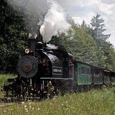
Alberni Pacific Railway
18 km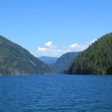
Alberni Inlet
13.5 km
Taylor Arm Provincial Park
17.4 km
Fossli Provincial Park
14.4 km
Numahta
13.7 km
Saach'akwat'a
13 km
T'iitskakis
9.6 km
Hiina'is
11.4 km
Yaashitquo-a
16.7 km
Thunderbird's Nest (T'iitsk'in Paawats) Protected Area
7 km
Scout Camp Beach
15.4 km
Mount Hankin Bluffs
15.6 km
Bamfield Lifeboat
17.9 km
Taylor Arm beach
17.1 km
Viewing Tower
17.8 km
China Creek Beach
14.7 km
The Johan Friis Eagle
17.7 km
Mural, Work of art
18 km
Scenic viewpoint
17.5 km
Port Alberni Train Station
18 km
Valley View
17.3 km
Alberni Inlet
15.7 km
Alberni Inlet Trail HOL 131 M
15.6 km
Alberni Inlet HOL 182 M
15.4 km
Alberni Inlet
15.4 km
Scenic viewpoint
17.7 km
Natural Beaver Den Habitat
18 km
Scenic viewpoint
17.8 kmReviews
Visited this place? Tap the stars to rate it and share your experience / photos with the community! Try now! You can cancel it anytime.
Discover hidden gems everywhere you go!
From secret cafés to breathtaking viewpoints, skip the crowded tourist spots and find places that match your style. Our app makes it easy with voice search, smart filtering, route optimization, and insider tips from travelers worldwide. Download now for the complete mobile experience.

A unique approach to discovering new places❞
— Le Figaro
All the places worth exploring❞
— France Info
A tailor-made excursion in just a few clicks❞
— 20 Minutes