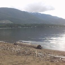
Burnie River Protected Area, protected area in British Columbia, Canada
Location: Regional District of Kitimat-Stikine
GPS coordinates: 54.18806,-127.81111
Latest update: November 22, 2025 05:52
Lakelse Lake Provincial Park
50.8 km
Atna River Provincial Park
24.6 km
Howson Peak
26 km
Lakelse Hot Springs
50.3 km
Nalbeelah Creek Wetlands Provincial Park
50.1 km
Neneikëkh/Nanika-Kidprice Provincial Park
37.2 km
Swan Creek Protected Area
34.7 km
Morice Lake Provincial Park
26.8 km
Fubar Glacier
37.9 km
Davies Glacier
20.7 km
Shadow Glacier
30.2 km
New Moon Glacier
29.7 km
Utem Glacier
31.2 km
Lunar Glacier
28.6 km
Full Moon Glacier
30.3 km
Williams Creek Ecological Reserve
34.2 km
Burnie-Shea Provincial Park
19.2 km
Slide Tower
51.1 km
Fire Mountain Hiking Trail
48.8 km
Mount Layton Hot Springs
51.1 km
Cannonball
51.1 km
Cannonball
51.1 km
Cannonball
51.1 km
Onion Lake Lookout
49.7 km
Waterfall
21.7 km
Waterfall
24.8 km
Waterfall
50.3 km
Waterfall
46.4 kmReviews
Visited this place? Tap the stars to rate it and share your experience / photos with the community! Try now! You can cancel it anytime.
Discover hidden gems everywhere you go!
From secret cafés to breathtaking viewpoints, skip the crowded tourist spots and find places that match your style. Our app makes it easy with voice search, smart filtering, route optimization, and insider tips from travelers worldwide. Download now for the complete mobile experience.

A unique approach to discovering new places❞
— Le Figaro
All the places worth exploring❞
— France Info
A tailor-made excursion in just a few clicks❞
— 20 Minutes