Mercator-Kaserne Euskirchen, Military barracks in Euskirchen, Germany
Mercator-Kaserne is a military facility in Euskirchen occupying a large area along Frauenberger Straße with structures and operational installations for the German Armed Forces. Today it functions as the Zentrum für Geoinformationswesen der Bundeswehr, managing geographical information systems that support defense activities.
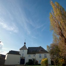
The barracks were built between 1936 and 1938 as part of Wehrmacht military expansion during Nazi Germany. After World War II, it initially housed displaced persons before being taken over by Belgian forces.
The barracks honors Gerhard Mercator, a Flemish cartographer, through its name given in 1985, reflecting the site's connection to geographical knowledge and mapping.
Access to the site is restricted as it remains an active military facility under operational status. Visitors should inquire beforehand about access conditions and follow security protocols standard at guarded military installations.
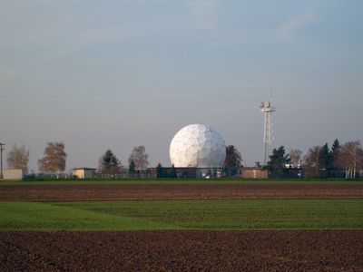
Until September 2023, a NATO satellite ground station called the Geo-Kugel stood on the site as a distinctive landmark visible across the area. Its removal significantly altered the visual character of the facility.
The community of curious travelers
AroundUs brings together thousands of curated places, local tips, and hidden gems, enriched daily by 60,000 contributors worldwide.