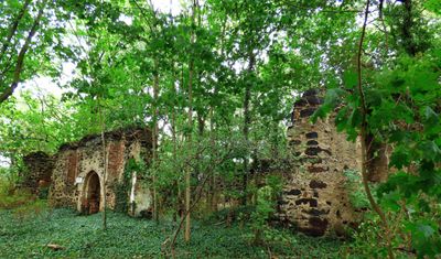
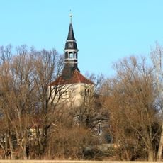
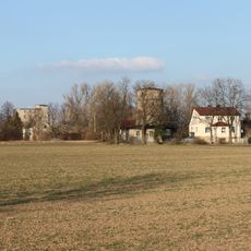
Dorfkirche Alt Lönnewitz, Medieval church ruins in Mühlberg/Elbe, Germany
Description
Dorfkirche Alt Lönnewitz is a church ruin built from red brick with bog iron ore, featuring pointed arch windows throughout the remaining walls. The structure sits within a dense forest setting near Federal Road 183, surrounded by the Lönnewitzer Heide nature reserve that frames the site today.
History
The church was built in the 13th century and heavily damaged during the Thirty Years War. It was rebuilt in 1682 under the direction of Dam von Weltewitz, creating the structure visible today.
Culture
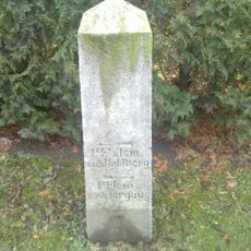
A memorial stone inside the ruins documents the village's existence from 1251 until 1948, when military restrictions forced its disappearance. Visitors can sense the story of a community that once gathered here for worship and then vanished from the landscape.
Practical
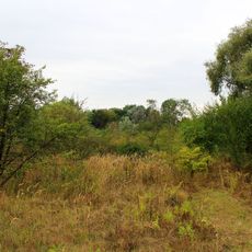
The site is easily accessible from Federal Road 183 and sits within a nature reserve with good walking paths in the surrounding area. Bring appropriate clothing for forest environments, as the ruins can be visited throughout the year regardless of season.
Did you know?
A brass baptismal font from the church's founding era remains inside the ruins, while most other liturgical equipment was looted during wartime. This vessel is one of few surviving objects that speaks to the original religious function of the place.
AroundUs brings together thousands of curated places, local tips, and hidden gems, enriched daily by 60,000 contributors worldwide. Discover all places nearby (Mühlberg/Elbe).
Falkenberg station
4.6 km
Pfarrgarten Saxdorf
5.9 km
Brandenburgisches Eisenbahnmuseum Falkenberg (Elster)
5.2 km
Jesus-Christus-Kirche (Falkenberg an der Elster)
4.7 km
Dorfkirche
5.9 km
Koßdorf Winmill
5.4 km
Wasserturm (Falkenberg/Elster)
4.2 km
Village church Rehfeld
6.1 km
Dorfkirche Kölsa
4.6 km
Dorfkirche Koßdorf
5 km
Lönnewitzer Heide
0 m
Solarpark Lönnewitz
553 m
Wohnhaus Lindenstraße 28 (Rehfeld)
6 km
Allerheiligen-Kirche
4.4 km
Wohnstallhaus
4.6 km
Eisenbahnmuseum Falkenberg/Elster
5.2 km
Dorfkirche Stehla
6.3 km
Kiebitzer Baggerteich
6.6 km
Transformatorenstation
6.3 km
Wegestein Nichtewitz
6.6 km
Wegestein
4.2 km
Nördliches Gutsverwalterhaus (Geb. 9), westliches Pförtnerhaus mit Toranlage und Resten der Einfriedung (Geb. 8, 8a), Wirtschaftsgebäude parallel zur Straße (Geb. 1), südwestliche Scheune (Geb. 3) sowie südöstliches und östliches Wirtschaftsg
6.1 km
Naturdenkmal Feldulme
2.9 km
Wegestein Stehla
6.3 km
Naturdenkmal Friedenseiche Stieleiche Kölsa, Hauptstraße; Flur 2, Flurstück 174 in Kölsa
4.8 km
Naturdenkmal Sommerlinde Schmerkendorf, Hauptstraße 26; Flur 5, Flurstück 74/1 in Schmerkendorf
3.1 km
Holländermühle Stehla
6.1 km
Wegestein Packisch
6.1 kmDiscover hidden gems everywhere you go!
From secret cafés to breathtaking viewpoints, skip the crowded tourist spots and find places that match your style. Our app makes it easy with voice search, smart filtering, route optimization, and insider tips from travelers worldwide. Download now for the complete mobile experience.
A unique approach to discovering new places❞
— Le Figaro
All the places worth exploring❞
— France Info
A tailor-made excursion in just a few clicks❞
— 20 Minutes