Stollberg, Administrative town in Erzgebirgskreis district, Saxony, Germany.
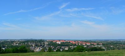
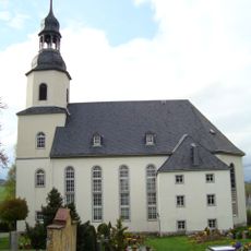
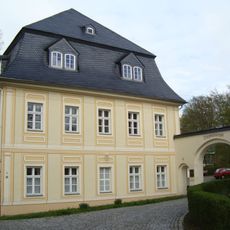
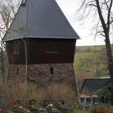
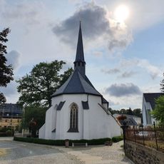
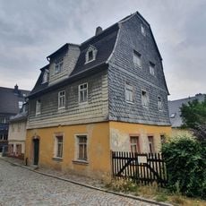
Stollberg is a town in the Erzgebirgskreis region of Saxony, situated at approximately 464 meters elevation in hilly terrain. The town spreads across several districts and features typical central Saxon architecture throughout its layout.
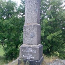
The town developed as a mining settlement in the Erzgebirge region, with mining shaping its economy for centuries. During the 20th century, Stollberg underwent several administrative changes, including the creation of Landkreis Stollberg, which later merged into other district structures.
Stollberg maintains strong connections with neighboring municipalities through regular regional festivals and events that showcase Saxon traditions.
The town is well connected by roads linking it to the larger centers of Zwickau and Chemnitz nearby. Visitors navigate easily by following the main roads that pass through the different districts.
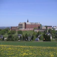
The former Hoheneck prison, which operated until 2001, remains a powerful landmark linked to the complex recent past. This facility reflects the region's significant and troubled 20th-century history in a way that shaped local memory.
Location: Erzgebirgskreis
Elevation above the sea: 464 m
Website: https://stollberg-erzgebirge.de
GPS coordinates: 50.70833,12.77833
Latest update: December 7, 2025 10:01
Castle Hoheneck
575 m
Schloss Hoheneck
634 m
Talsperre Stollberg
2.1 km
Waldbad Neuwürschnitz
4.4 km
Katzenstein
6.2 km
St. Johannis (Niederzwönitz)
7.9 km
Steinhübel Neuwürschnitz
4.4 km
Manoir de Niederzwönitz
7.9 km
Höhlteich
3.4 km
Protestant Church
3.7 km
Marienkirche
327 m
Kirche, frei stehender Glockenturm und Denkmal für die Gefallenen des Ersten Weltkrieges Hauptstraße 50
7.1 km
Hauwald-Querenbach
3.3 km
Sachgesamtheit Bad Guter Brunnen mit folgenden Einzeldenkmalen: Freiluftgebäude und Brunnen (siehe auch Einzeldenkmalliste - Obj. 09238419) sowie Gelände des ehemaligen Kurbades und Teich als Sachgesamtheitsteile Hartensteiner Straße -
6.8 km
Wohnhaus in halboffener Bebauung, mit Garten Untere Mühlenstraße 6
228 m
Lutherlinde
6.8 km
Rosental - Heiliger Wald
3.5 km
Stadthalle Oelsnitz im Erzgebirge
5.7 km
Amtsgericht Stollberg/Erzgeb.
45 m
Rathaus Stollberg/Erzgeb.
53 m
Herrenstraße 15
152 m
St. Jakobi
81 m
Luther-Buche (Rotbuche)
2.2 km
Carl-von-Bach Gymnasium
293 m
Geburtshaus Hochschullehrer Carl von Bach (1847-1931)
92 m
Postmeilenstein in Brünlos
2.4 km
Bad Guter Brunnen
6.7 km
Einzeldenkmale der Sachgesamtheit Bad Guter Brunnen: Freiluftgebäude und Brunnen (siehe auch Sachgesamtheitsdokument - Obj. 09306215) Hartensteiner Straße -
6.8 kmVisited this place? Tap the stars to rate it and share your experience / photos with the community! Try now! You can cancel it anytime.
Discover hidden gems everywhere you go!
From secret cafés to breathtaking viewpoints, skip the crowded tourist spots and find places that match your style. Our app makes it easy with voice search, smart filtering, route optimization, and insider tips from travelers worldwide. Download now for the complete mobile experience.
A unique approach to discovering new places❞
— Le Figaro
All the places worth exploring❞
— France Info
A tailor-made excursion in just a few clicks❞
— 20 Minutes