Chest opened
+${chestReward.xp} XP
Explorer
NOUVEAU ×${chestReward.collectible.quantity}
tapez pour fermer
Chest locked

Open chests in the app

Around Us is built for your phone — chests unlock when you walk, explore and capture nearby places.

Enable Location

We need your location to show you interesting places around you

Discover nearby places

Find interesting locations and hidden gems around you

Precise directions

Get accurate directions and distances to places

Your location is never shared with other users. It's only used when you tap the location button.

Log in to your account

Start exploring — it's free

Trusted by 72,880 travelers worldwide

Continue with Google
Continue with Apple
or

We will send you a code to connect

By continuing, you accept our Terms and Conditions and our Privacy Policy

Check your inbox

We've sent a pincode in your inbox. Please enter the code below.

Hollerkolonisation
Discussion Reviews Photo
4.2k Popularity

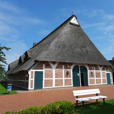
Hollerkolonisation, Medieval land reclamation area in Stade and Hamburg, Germany

The Hollerkolonisation is a medieval land reclamation landscape in the region between Stade, Harburg, and Hamburg, where marshland was turned into farmland through drainage canals and dyke construction. Parallel waterways and dykes still divide the flat land into long, narrow plots today.

In the 12th century, the Archbishop of Bremen invited Dutch settlers to develop the marshy lowlands between Hamburg and Stade. This was part of a broader colonization movement that changed the coastal landscape of northern Germany.

The long, narrow fields and straight canals still follow a pattern that the settlers themselves designed. Communities managed the dykes and waterways together, and this shared responsibility shaped daily life in these villages for generations.

The area is best explored on foot or by bike, as dyke paths and field tracks give access to most of the canals and plots. Paths can get wet and muddy outside of summer, so sturdy footwear is a good idea.

The original land plots were measured using an old unit of length that settlers brought from the Netherlands, and many property boundaries still follow this pattern today. Walking along a dyke, you can read this geometric layout directly in the landscape below.

The community of curious travelers

AroundUs brings together thousands of curated places, local tips, and hidden gems, enriched daily by 60,000 contributors worldwide.

Start exploring
Location
Location
Location
GPS coordinates
53.52580,9.62000
Latest update
March 3, 2026 08:11
Reviews
Share your experience

No review yet

Discussions
Start a discussion...

No discussion yet

« Hollerkolonisation - Medieval land reclamation area in Stade and Hamburg, Germany » is provided by Around Us (aroundus.com). Images and texts are derived from Wikimedia project under a Creative Commons license. You are allowed to copy, distribute, and modify copies of this page, under the conditions set by the license, as long as this note is clearly visible.

Discover hidden gems everywhere you go!

From secret cafés to breathtaking viewpoints, skip the crowded tourist spots and find places that match your style. Our app makes it easy with voice search, smart filtering, route optimization, and insider tips from travelers worldwide. Download now for the complete mobile experience.

Around Us App Screenshot

A unique approach to discovering new places

Le Figaro

All the places worth exploring

France Info

A tailor-made excursion in just a few clicks

20 Minutes

Around Us
Travel Guide & Maps
Download

Send to your phone

QR Code
1

Open the camera app on your mobile.

2

Point at the QR code with your camera. A notification will appear.

3

Tap the notification to open the link.