Puigferrós, mountain in Spain
Location: L'Argentera
Location: Riudecanyes
Elevation above the sea: 466.3 m
GPS coordinates: 41.12918,0.91733
Latest update: June 14, 2024 18:35

Castell d'Escornalbou
214 m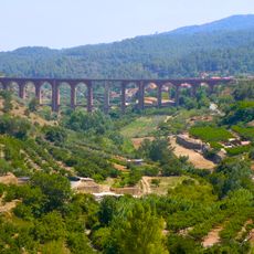
Viaductes del tren
2.3 km
Puigpedregós
737 m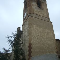
Santa Maria de Duesaigües
2.2 km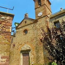
Sant Bartomeu de l'Argentera
1.1 km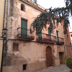
Casa davant de l'església
2.2 km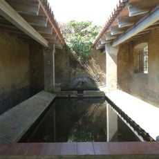
Rentador de Duesaigües
1.8 km
Mas d'en Brocà
1.4 km
Les Forques
1.4 km
Molí del Molinet
1.1 km
Porpallers
2.2 km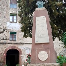
Monument a Eduard Toda a l'Argentera
1.1 km
Casa de la vila de l'Argentera
1.2 km
El Carrilet de Vilamanya
1.6 km
Primera Capella
589 m
Memorial
1.3 km
Mas de Pandot
1.5 km
Monument
1.2 km
Scenic viewpoint
1.7 km
Scenic viewpoint
1.7 km
Masia de Mió
1.4 km
Scenic viewpoint
1.9 km
Ruins
2.1 km
Scenic viewpoint
2.1 km
Scenic viewpoint
2.1 km
Segona Capella
377 m
Santa Bàrbara
326 m
Scenic viewpoint
611 mReviews
Visited this place? Tap the stars to rate it and share your experience / photos with the community! Try now! You can cancel it anytime.
Discover hidden gems everywhere you go!
From secret cafés to breathtaking viewpoints, skip the crowded tourist spots and find places that match your style. Our app makes it easy with voice search, smart filtering, route optimization, and insider tips from travelers worldwide. Download now for the complete mobile experience.

A unique approach to discovering new places❞
— Le Figaro
All the places worth exploring❞
— France Info
A tailor-made excursion in just a few clicks❞
— 20 Minutes