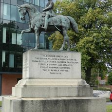
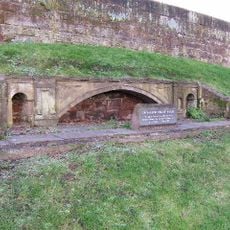
Grosvenor Bridge, Grade I listed stone arch bridge in Chester, England
Grosvenor Bridge is a stone arch bridge crossing the River Dee in Chester with a single large vault spanning the waterway. It connects both sides of the valley and carries road traffic along a direct route through the town.
Construction began in 1827 under architect Thomas Harrison and was completed in 1832. The bridge represented a major engineering achievement for the period and demonstrated Chester's growing importance as a transport hub.
The bridge stands as a representation of British engineering excellence, marking Chester's transformation from a medieval town into an industrial transportation center.
The bridge carries vehicles on the A483 road and is accessible to traffic throughout the day. Pedestrians can walk across it or view it from nearby riverside areas.
When it opened, it was considered one of the most impressive engineering feats of its time with a boldly designed single arch. The structure's construction methods and stone masonry techniques were studied by engineers across Europe.
Location: Cheshire West and Chester
Inception: 1834
Made from material: stone
GPS coordinates: 53.18360,-2.89606
Latest update: December 10, 2025 20:02
Chester Castle
314 m
Minerva's Shrine, Chester
458 m
Grosvenor Museum
479 m
Chester Crown Court
382 m
Overleigh Cemetery
210 m
Cheshire Military Museum
421 m
St. Mary's Centre, Chester
447 m
County Hall, Chester
400 m
Statue of Queen Victoria
369 m
Equestrian statue of Viscount Combermere
349 m
Bridge over drive, in north part of Overleigh Cemetery
122 m
2, Curzon Park North
262 m
West Chapel in south part of Overleigh Cemetery
439 m
Model of the Grosvenor Bridge
229 m
Cenotaph in south part of Overleigh Cemetery
430 m
Gates and gate piers to old (north) part of Overleigh Cemetery
116 m
Base and part shaft of Roodeye Cross at SJ 4016 6584
305 m
Former Premises Of Trustee Savings Bank
453 m
Curtain wall to south of inner bailey
284 m
Curtain wall to west and south west of inner bailey, Chester Castle
291 m
The Georgian House
479 m
Propylaea
351 m
The Lodge
405 m
22, Castle Street
469 m
Part of City Wall from Grosvenor Road to the Watergate
304 m
B Block
317 m
Agricola Tower
330 m
Part Of Roman Quay Wall South Of Lateral Steps From Nuns Road
367 mVisited this place? Tap the stars to rate it and share your experience / photos with the community! Try now! You can cancel it anytime.
Discover hidden gems everywhere you go!
From secret cafés to breathtaking viewpoints, skip the crowded tourist spots and find places that match your style. Our app makes it easy with voice search, smart filtering, route optimization, and insider tips from travelers worldwide. Download now for the complete mobile experience.
A unique approach to discovering new places❞
— Le Figaro
All the places worth exploring❞
— France Info
A tailor-made excursion in just a few clicks❞
— 20 Minutes