Chew Green

Log in to your account

AroundUs is a community-driven map of interesting places, built by curious explorers like you. It grows with every review, story, and photo you share.
Connect to save your favorite spots, contribute locations, and create personalized routes.
Continue with Google
Continue with Apple
Continue with X
Continue with Facebook
Continue with email
By continuing, you accept our Terms and Conditions and our Privacy Policy
Create an account
Add to collection
Map
Suggest a change
Share

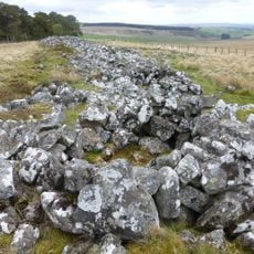
Chew Green, Roman archaeological site in Northumberland, England.

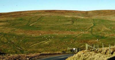
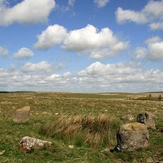
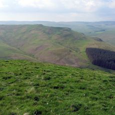
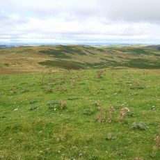
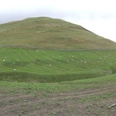
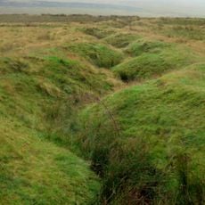
Chew Green is a Roman site that contains a main fort, two smaller fortlets, and two camps spread across about 17 acres of land. The remains lie near the Scottish border and show the military infrastructure the Romans built to control this region.

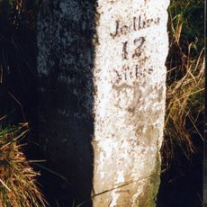
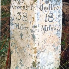
The site was founded along Dere Street, the Roman road that connected York to territories further north, to secure control of the northern frontier. Archaeological digs in the 1930s uncovered these military structures and revealed their layout and purpose.

The site shows how Romans strategically positioned military posts to control movement between England and Scotland. Visitors can see today how these structures shaped the landscape of the borderlands.

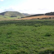
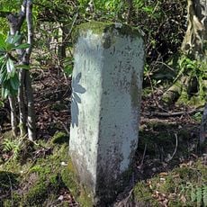
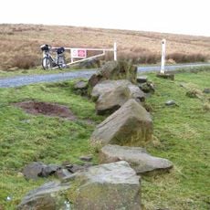
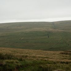
The site is located within the Otterburn Military Training Area in Northumberland National Park and requires special permission to visit. It is best to check conditions ahead of time, as the land is actively used for military training.

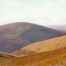
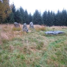
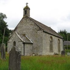
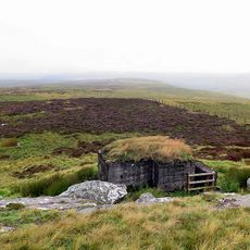
Overlaying the Roman structures are remains of a medieval settlement called Kemylpethe, complete with a small chapel. This layering shows how the site was reused by different peoples across many centuries.

Location: Northumberland

GPS coordinates: 55.37100,-2.33700

Latest update: December 12, 2025 17:44

Photos
Around this place
Catcleugh Reservoir
United Kingdom

Catcleugh Reservoir

7.3 km
Pennymuir Roman camps
United Kingdom

Pennymuir Roman camps

6.3 km
Shillhope Law
United Kingdom

Shillhope Law

8.6 km
Five Stanes
United Kingdom

Five Stanes

9 km
Three Kings
United Kingdom

Three Kings

7.8 km
Church of St Francis of Assisi
United Kingdom

Church of St Francis of Assisi

6.5 km
Outer Golden Pot
United Kingdom

Outer Golden Pot

2.2 km
Hindhope Hill
United Kingdom

Hindhope Hill

3.3 km
Milestone Circa 40 Yards South-East Of Ramshope Cottage
United Kingdom

Milestone Circa 40 Yards South-East Of Ramshope Cottage

7.2 km
Loddan Hill
United Kingdom

Loddan Hill

4 km
Hedley And Robson Tombs Circa 20 Yards South-East Of Church Of St Francis
United Kingdom

Hedley And Robson Tombs Circa 20 Yards South-East Of Church Of St Francis

6.5 km
Heugh Law
United Kingdom

Heugh Law

5.3 km
Milestone Circa 40 Yards South-East Of Catcleugh House
United Kingdom

Milestone Circa 40 Yards South-East Of Catcleugh House

6.6 km
Milestone North West Of Bellshiel Bridge At Ngr 802997
United Kingdom

Milestone North West Of Bellshiel Bridge At Ngr 802997

8.9 km
Observation post 240m west of Ridlees Cairn
United Kingdom

Observation post 240m west of Ridlees Cairn

6.8 km
The Rectory
United Kingdom

The Rectory

6.3 km
Milestone At Byrness
United Kingdom

Milestone At Byrness

6.2 km
Compensation Arch And Basin At Catcleugh Reservoir
United Kingdom

Compensation Arch And Basin At Catcleugh Reservoir

6.8 km
Milestone Circa 100 Yards South-East Of Ramshope Lodge
United Kingdom

Milestone Circa 100 Yards South-East Of Ramshope Lodge

7.8 km
Milestone Circa 1/4 Mile West Of Whitelee
United Kingdom

Milestone Circa 1/4 Mile West Of Whitelee

8.7 km
Middle Golden Pot medieval wayside cross
United Kingdom

Middle Golden Pot medieval wayside cross

3.4 km
Milestone Circa 1/4 Mile North-East Of Blakehopeburnhaugh
United Kingdom

Milestone Circa 1/4 Mile North-East Of Blakehopeburnhaugh

8.2 km
Roman camp, 900m NNE of Featherwood
United Kingdom

Roman camp, 900m NNE of Featherwood

4.4 km
Milestone Circa 100 Yards North-West Of Low Byrness
United Kingdom

Milestone Circa 100 Yards North-West Of Low Byrness

7 km
Woden Law
United Kingdom

Woden Law

4.4 km
Bellshiel Law long cairn
United Kingdom

Bellshiel Law long cairn

7.9 km
Chew Green Roman fort et al
United Kingdom

Chew Green Roman fort et al

148 m
World War I practice trenches 740m north west of Short Fell
United Kingdom

World War I practice trenches 740m north west of Short Fell

7.7 km
Show the full map
Reviews

Visited this place? Tap the stars to rate it and share your experience / photos with the community! Try now! You can cancel it anytime.

« Chew Green - Roman archaeological site in Northumberland, England » is provided by Around Us (aroundus.com). Images and texts are derived from Wikimedia project under a Creative Commons license. You are allowed to copy, distribute, and modify copies of this page, under the conditions set by the license, as long as this note is clearly visible.

Discover hidden gems everywhere you go!

From secret cafés to breathtaking viewpoints, skip the crowded tourist spots and find places that match your style. Our app makes it easy with voice search, smart filtering, route optimization, and insider tips from travelers worldwide. Download now for the complete mobile experience.

Around Us App Screenshot

A unique approach to discovering new places

Le Figaro

All the places worth exploring

France Info

A tailor-made excursion in just a few clicks

20 Minutes