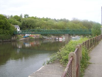
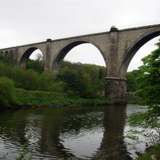
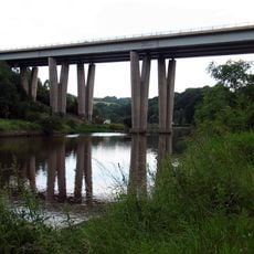
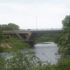
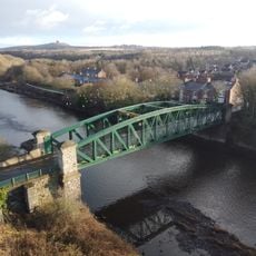
Cox Green footbridge, Steel footbridge in Cox Green, United Kingdom.
Cox Green Footbridge is a pedestrian crossing over the River Wear near Sunderland with a concrete deck and steel support structure. The structure features a central pier and tubular steel beams that support the crossing.
The bridge opened in 1958 to replace a ferry service that had previously provided crossing. This new link fundamentally changed how local people moved between communities and supported economic activity in the area.
The bridge links Cox Green village with Washington, allowing local people to cross easily between the two communities for work and daily activities. Pedestrians use this crossing regularly to maintain connections with neighbors and access services on either side of the river.
The crossing is available to pedestrians and cyclists at any time of day for crossing the river freely. The structure is open to all users and does not require reservations or special arrangements to use it.
The structure showcases an uncommon blend of tubular steel and concrete techniques from the 1950s that were innovative at the time. These construction methods reflect the engineering approach of the post-war period and remain visible in how the bridge was built.
Location: Sunderland
Inception: 1958
Official opening: 1958
GPS coordinates: 54.89080,-1.49410
Latest update: December 14, 2025 17:04
Penshaw Monument
1.2 km
Washington Old Hall
1.9 km
Hylton Castle
4.8 km
Lambton Castle
3.8 km
Northern Spire Bridge
5.3 km
Bowes Railway
5.4 km
Victoria Viaduct
875 m
Biddick Hall
2.7 km
Hylton Viaduct
2.8 km
Mercure Newcastle George Washington Hotel Golf and Spa
4.4 km
Chartershaugh Bridge
2.3 km
Chester New Bridge
5.1 km
Penshaw Bridge
1.8 km
Church of St John the Evangelist
5.1 km
Church of St Matthew
3.9 km
Church of Holy Trinity
4.4 km
Church of St Mary
3.3 km
Hylton Chapel
4.9 km
Church of Holy Trinity
2 km
Church of St Barnabas
4.1 km
Statue of EM Perkins at North End of Monument Terrace
5.2 km
The Shipwrights Public House
3 km
Washington and Barmston War Memorial
2.1 km
Fatfield War Memorial
1.9 km
F Pit Winding House
3.2 km
Stone At Junction With Woodhouse Lane
645 m
Hylton Castle: a medieval fortified house, chapel, 17th and 18th century country houses and associated gardens
4.8 km
Durham Road, opp. Fire station
5.4 kmVisited this place? Tap the stars to rate it and share your experience / photos with the community! Try now! You can cancel it anytime.
Discover hidden gems everywhere you go!
From secret cafés to breathtaking viewpoints, skip the crowded tourist spots and find places that match your style. Our app makes it easy with voice search, smart filtering, route optimization, and insider tips from travelers worldwide. Download now for the complete mobile experience.
A unique approach to discovering new places❞
— Le Figaro
All the places worth exploring❞
— France Info
A tailor-made excursion in just a few clicks❞
— 20 Minutes