Crownhill Fort, Military fort and museum in Plymouth, England
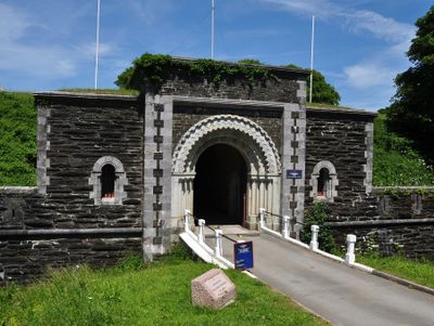
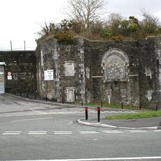
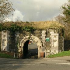
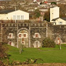
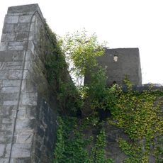
Crownhill Fort is a military fortification featuring extensive defensive structures, deep ditches, ramparts and underground passages that connect different sections. The layout includes multiple gun positions arranged to cover approaches from various directions.
The fort was built in 1863 as part of Lord Palmerston's defensive strategy against potential French attacks during a tense period in European relations. It formed part of a ring of fortifications around Plymouth to protect the coastal city and its harbor.
The fort displays Victorian military engineering with cannons, rifles, and defense systems that shaped 19th-century British military design. The exhibits show how engineers of that era planned and built fortifications to protect ports and cities.
The fort opens on specific days each month for visitors and offers group tours if you want guided information. Overnight accommodations are available on-site if you want to spend more time exploring the grounds and structures.
The fort's walls contain around 350 rifle loopholes that were designed to protect gunners during combat. This extensive number of firing positions reveals the elaborate defensive preparation against large-scale attacks.
Location: City of Plymouth
Address: Plymouth, PL6 5BX
Website: https://landmarktrust.org.uk/crownhill-fort
GPS coordinates: 50.41400,-4.13042
Latest update: December 8, 2025 19:50
Central Park, Plymouth
3.5 km
Plymbridge Woods
3.6 km
Fort Austin
2.5 km
Woodlands Fort
1.7 km
Church of the Ascension, Crownhill
1.1 km
Mutley Baptist Church
3.7 km
'The Ship', Derriford
828 m
Bowden Battery
1.3 km
Knowles Battery
2.4 km
Church of St Mary
2.2 km
Church of St Budeaux
3.3 km
Church of St Mary
3.7 km
Church of St Edward King of the West Saxons
1.8 km
Church of St Pancras
2.1 km
Church of Emmanuel
2.9 km
Southway Library
1.8 km
Efford Library
3.2 km
North Prospect Library
3.5 km
Estover Library
2.1 km
Agaton Fort
3.2 km
Peverell Library
2.5 km
Plym Bridge
3.7 km
Crownhill Library
824 m
Milestone Near Garden Wall West Of Cressy
2.5 km
Weston Mill Cemetery, Cross of Sacrifice, Plymouth
3.4 km
Royal Eye Infirmary
3.8 km
Milestone, Wolseley Road, Ford, SW of roundabout, opp. Esso garage, nr Milehouse
3.7 km
Milepost, Tamerton Foliot, Tavistock Road, by No. 332, Hareston (in cul de sac beside main road by end of old runway)
1.5 kmVisited this place? Tap the stars to rate it and share your experience / photos with the community! Try now! You can cancel it anytime.
Discover hidden gems everywhere you go!
From secret cafés to breathtaking viewpoints, skip the crowded tourist spots and find places that match your style. Our app makes it easy with voice search, smart filtering, route optimization, and insider tips from travelers worldwide. Download now for the complete mobile experience.
A unique approach to discovering new places❞
— Le Figaro
All the places worth exploring❞
— France Info
A tailor-made excursion in just a few clicks❞
— 20 Minutes