Fort Austin, Victorian military fort in Eggbuckland, Plymouth, England
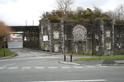
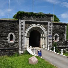
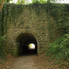
Fort Austin is a Victorian military fort in Eggbuckland with deep rock-cut ditches on three sides. The gun casemates are positioned to allow defenders to protect against attacks from several directions.
Construction began in 1863 as part of Plymouth's northeast defenses, following recommendations from the Royal Commission to protect against French invasion threats. The fort was one of several built along the coast to secure the region.
The fort reflects Victorian military design and shows how 19th-century British coastal defenses were built. Visitors can see the strategic features that were typical of that era's defensive thinking.
Access to the fort is possible, and visitors can explore the preserved sections of the original military road system. It is helpful to wear sturdy shoes as the ground is uneven and the ditches require climbing.
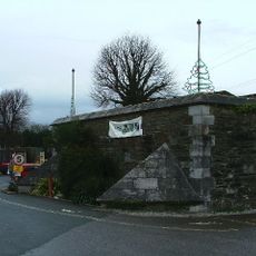
The guardhouse was originally designed for 60 personnel and had two tiers of guns. In 1984 it was converted into Plymouth City Emergency Centre and has served a different purpose since then.
Location: City of Plymouth
Inception: 1863
GPS coordinates: 50.39940,-4.10383
Latest update: December 14, 2025 12:26
Saltram House
2.5 km
Plym Valley Railway
1.6 km
Crownhill Fort
2.5 km
Laira Traction Maintenance Depot
2 km
Plymbridge Woods
1.9 km
Church of the Ascension, Crownhill
2.3 km
Efford Fort
1.3 km
'The Ship', Derriford
1.9 km
Freedom Fields
2.9 km
Bowden Battery
1.2 km
Church of St Simon
2.6 km
Church of St Mary
1.6 km
Church of St Edward King of the West Saxons
797 m
Church of Emmanuel
2.2 km
Chapel At Saltram House
2.4 km
Efford Library
1.3 km
Plym Bridge
2.1 km
Estover Library
1.4 km
Amphitheatre In Grounds Of Saltram House
2.1 km
Crownhill Library
2.2 km
Lodges At Lipson Terrace
2.8 km
Lee Moor Tramway Bridge
1.6 km
Stable Block At Saltram House
2.6 km
Orangery at Saltram House
2.3 km
Garden Temple (known As Fannys Bower) In Grounds Of Saltram House
2.3 km
Gardenhouse At Saltram House
2.2 km
Milestone, top of Lipson Road, opp. Queens Road
2.7 km
Milepost, Tamerton Foliot, Tavistock Road, by No. 332, Hareston (in cul de sac beside main road by end of old runway)
2.8 kmVisited this place? Tap the stars to rate it and share your experience / photos with the community! Try now! You can cancel it anytime.
Discover hidden gems everywhere you go!
From secret cafés to breathtaking viewpoints, skip the crowded tourist spots and find places that match your style. Our app makes it easy with voice search, smart filtering, route optimization, and insider tips from travelers worldwide. Download now for the complete mobile experience.
A unique approach to discovering new places❞
— Le Figaro
All the places worth exploring❞
— France Info
A tailor-made excursion in just a few clicks❞
— 20 Minutes