Godrevy Head to St Agnes

Log in to your account

AroundUs is a community-driven map of interesting places, built by curious explorers like you. It grows with every review, story, and photo you share.
Connect to save your favorite spots, contribute locations, and create personalized routes.
Continue with Google
Continue with Apple
Continue with X
Continue with Facebook
Continue with email
By continuing, you accept our Terms and Conditions and our Privacy Policy
Create an account
Add to collection
Map
Suggest a change
Share

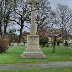
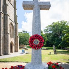
Godrevy Head to St Agnes, Natural conservation area in Cornwall, England.

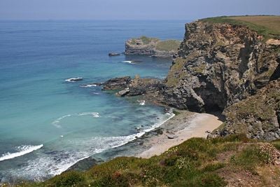
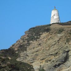
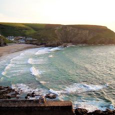
Godrevy Head to St Agnes is a protected coastal site stretching across the north Cornwall coast covering around 627 hectares. The area contains maritime heathland, grassland, and sand dune environments that support different plant and animal communities.

The area gained protected status in 1951 to preserve its scientific importance. The coastal landscape displays geological layers that record natural changes unfolding over thousands of years.

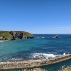
The South West Coast Path traverses through this conservation area, allowing visitors to explore the diverse landscapes and observe native wildlife species.

Parts of the coastline are managed by the National Trust and the Ministry of Defence, so some areas may be restricted at times. Before exploring, check locally what access rules apply, as these can change with the seasons.

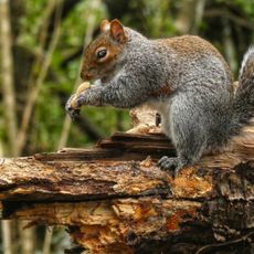
The area hosts one of the largest breeding colonies of black-legged kittiwakes in Cornwall, with populations between 1,000 and 5,000 birds. These seabirds nest on the cliffs and are a common sight for visitors walking the coastal path.

GPS coordinates: 50.24860,-5.31870

Latest update: December 14, 2025 14:45

Photos
Around this place
Portreath Beach
United Kingdom

Portreath Beach

2.2 km
Tehidy
United Kingdom

Tehidy

1.2 km
The Berkeley Centre
United Kingdom

The Berkeley Centre

4.1 km
All Saints' Church, Tuckingmill
United Kingdom

All Saints' Church, Tuckingmill

3.9 km
Church of St Martin and St Meriadocus
United Kingdom

Church of St Martin and St Meriadocus

4.1 km
West Cornwall Bryophytes Site of Special Scientific Interest
United Kingdom

West Cornwall Bryophytes Site of Special Scientific Interest

4.2 km
Tehidy Woods
United Kingdom

Tehidy Woods

1 km
Church of St Illogan
United Kingdom

Church of St Illogan

3.6 km
St Illogan's Church
United Kingdom

St Illogan's Church

3.8 km
Centenary Wesleyan Church
United Kingdom

Centenary Wesleyan Church

4.2 km
Milepost Opposite Methodist Church
United Kingdom

Milepost Opposite Methodist Church

2.8 km
Huer's Hut, Portreath
United Kingdom

Huer's Hut, Portreath

2.6 km
Bridge Inn
United Kingdom

Bridge Inn

3.9 km
Tower of Former Church of St Illogan
United Kingdom

Tower of Former Church of St Illogan

3.6 km
Cross in forecourt of Methodist Chapel, Chapel Street
United Kingdom

Cross in forecourt of Methodist Chapel, Chapel Street

4.2 km
Milepost Approximately 50 Metres South Of Acorn Cottage, At Sw 665 429
United Kingdom

Milepost Approximately 50 Metres South Of Acorn Cottage, At Sw 665 429

3.3 km
Head Of Cornish Cross In Forecourt Of The Donald Thomas Centre
United Kingdom

Head Of Cornish Cross In Forecourt Of The Donald Thomas Centre

4.1 km
Milepost At Sw 663 402
United Kingdom

Milepost At Sw 663 402

4 km
Milestone At Bridge, On South Side Of The B3300
United Kingdom

Milestone At Bridge, On South Side Of The B3300

4.1 km
Tuckingmill War Memorial
United Kingdom

Tuckingmill War Memorial

3.9 km
Milepost On West Side Of Drive To Rosewarne Home Farm
United Kingdom

Milepost On West Side Of Drive To Rosewarne Home Farm

3.9 km
Portreath Harbour Including Slipway To South South West
United Kingdom

Portreath Harbour Including Slipway To South South West

2.5 km
Camborne War Memorial
United Kingdom

Camborne War Memorial

4.1 km
Cornish Cross Approx. 6 Metres South-West Of South Porch Of Church Of St Martin And St Meriadocus
United Kingdom

Cornish Cross Approx. 6 Metres South-West Of South Porch Of Church Of St Martin And St Meriadocus

4.1 km
Milepost At Sw 637 404
United Kingdom

Milepost At Sw 637 404

3.6 km
Milepost Beside Woodland Cottage (Shown As Penpraze On Os Map)
United Kingdom

Milepost Beside Woodland Cottage (Shown As Penpraze On Os Map)

2.2 km
Milestone, Weeth Road, Camborne
United Kingdom

Milestone, Weeth Road, Camborne

3.4 km
Cornish Cross Approx. 8 Metres West Of Tower Of Church Of St Martin And St Meriadocus
United Kingdom

Cornish Cross Approx. 8 Metres West Of Tower Of Church Of St Martin And St Meriadocus

4.1 km
Show the full map
Reviews

Visited this place? Tap the stars to rate it and share your experience / photos with the community! Try now! You can cancel it anytime.

« Godrevy Head to St Agnes - Natural conservation area in Cornwall, England » is provided by Around Us (aroundus.com). Images and texts are derived from Wikimedia project under a Creative Commons license. You are allowed to copy, distribute, and modify copies of this page, under the conditions set by the license, as long as this note is clearly visible.

Discover hidden gems everywhere you go!

From secret cafés to breathtaking viewpoints, skip the crowded tourist spots and find places that match your style. Our app makes it easy with voice search, smart filtering, route optimization, and insider tips from travelers worldwide. Download now for the complete mobile experience.

Around Us App Screenshot

A unique approach to discovering new places

Le Figaro

All the places worth exploring

France Info

A tailor-made excursion in just a few clicks

20 Minutes