Tehidy, Country park in Cornwall, England
Tehidy is a country park covering a large area in Cornwall with ancient woodlands, open spaces, lakes, and numerous walking trails. The grounds offer varied landscapes and habitats to explore, with multiple access points located at different spots around the site.
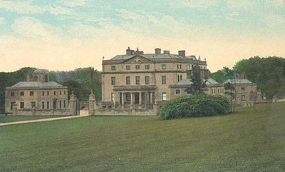
The Basset family owned this estate from the Middle Ages until 1916, when the mansion was sold off. The building was later converted into a tuberculosis hospital and still stands today as a focal point of the park.
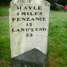
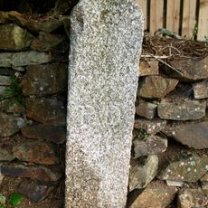
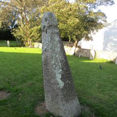
The grounds preserve archaeological traces of human activity, including ancient earthworks and field boundaries that show how people managed the land long ago. You can spot these old structures while walking through different parts of the park.
The park can be entered from several access points, with free parking available at multiple locations. The best way to explore the area is on foot using the marked trails that connect different sections throughout the grounds.
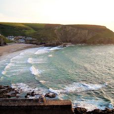
In the northern section of the park, trees shaped by strong coastal winds create unusual forms that catch visitors' attention. These naturally sculpted shapes develop over time as wind patterns repeatedly influence how the trees grow.
Location: Cornwall
GPS coordinates: 50.24200,-5.30500
Latest update: December 14, 2025 13:02
Portreath Beach
2.3 km
Heartlands
3 km
Godrevy Head to St Agnes
1.2 km
The Berkeley Centre
3.2 km
All Saints' Church, Tuckingmill
2.8 km
Church of St Martin and St Meriadocus
3.2 km
West Cornwall Bryophytes Site of Special Scientific Interest
3 km
Tehidy Woods
304 m
Church of St Illogan
2.8 km
St Illogan's Church
2.6 km
Milestone Outside Pool Methodist Chapel
3.2 km
Centenary Wesleyan Church
3.2 km
Huer's Hut, Portreath
2.6 km
Milepost Opposite Methodist Church
2.5 km
Tower of Former Church of St Illogan
2.8 km
Carpenters Shop, Workshops And Forge At Robinsons Shaft, South Crofty Mine
3 km
Head Of Cornish Cross In Forecourt Of The Donald Thomas Centre
3.2 km
Milepost Approximately 50 Metres South Of Acorn Cottage, At Sw 665 429
2.2 km
Tuckingmill War Memorial
2.8 km
Milepost At Sw 663 402
2.7 km
Pump Engine House To Robinsons Shaft At South Crofty Mine
3.1 km
Portreath Harbour Including Slipway To South South West
2.5 km
Milepost On West Side Of Drive To Rosewarne Home Farm
2.9 km
Camborne War Memorial
3.2 km
Milepost Beside Woodland Cottage (Shown As Penpraze On Os Map)
1.6 km
Milepost At Sw 637 404
2.9 km
Milestone, Weeth Road, Camborne
2.7 km
Cornish Cross Approx. 8 Metres West Of Tower Of Church Of St Martin And St Meriadocus
3.2 kmVisited this place? Tap the stars to rate it and share your experience / photos with the community! Try now! You can cancel it anytime.
Discover hidden gems everywhere you go!
From secret cafés to breathtaking viewpoints, skip the crowded tourist spots and find places that match your style. Our app makes it easy with voice search, smart filtering, route optimization, and insider tips from travelers worldwide. Download now for the complete mobile experience.
A unique approach to discovering new places❞
— Le Figaro
All the places worth exploring❞
— France Info
A tailor-made excursion in just a few clicks❞
— 20 Minutes