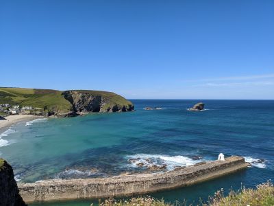
Portreath Beach, Sandy beach in Cornwall, England
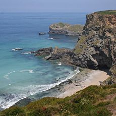
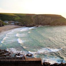
Portreath Beach is a sandy shore on Cornwall's Atlantic coast with golden sand and rock formations surrounding the water on three sides. The beach stretches roughly half a mile and offers shallow water for swimming with good visibility of the seabed.
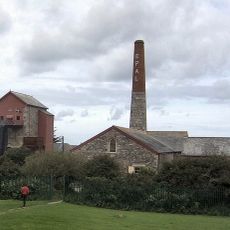
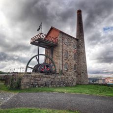
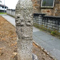
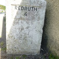
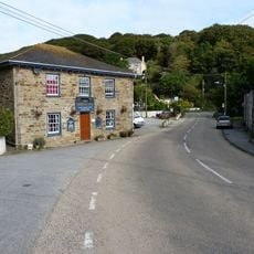
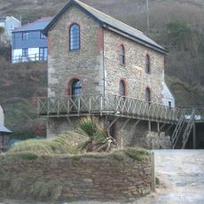
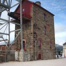
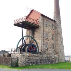
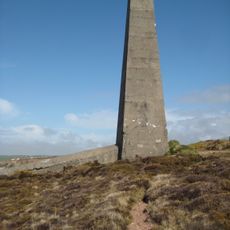
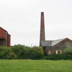
The location developed into an important port during the 18th and 19th centuries for copper exports and coal imports from Wales. This trading history shaped the infrastructure and development of the nearby village that continues today.
The beach forms part of the South West Coast Path network, connecting multiple coastal settlements through a system of maintained walking trails.
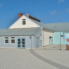
The beach has lifeguards during the season and public restrooms on site. Parking is located nearby, and the adjoining village offers several cafes and restaurants for meals and refreshments.
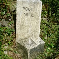
A natural tidal pool formed by the harbor wall on the north side offers sheltered swimming conditions separate from the open sea. This calmer water is especially favored by beginners and families with children.
Location: Cornwall
Address: Portreath Beach, 1 Battery Hill, Portreath, Redruth TR16 4NR, UK
GPS coordinates: 50.26198,-5.29533
Latest update: December 13, 2025 11:46
East Pool mine
4.2 km
Heartlands
4.4 km
Tehidy
2.3 km
Godrevy Head to St Agnes
2.2 km
National Trust - East Pool Mine
4.2 km
Tehidy Woods
2.1 km
Church of St Illogan
2.4 km
St Illogan's Church
3.9 km
Milestone Outside Pool Methodist Chapel
4.3 km
Huer's Hut, Portreath
354 m
Milepost Opposite Methodist Church
752 m
Bridge Inn
2.2 km
Tower of Former Church of St Illogan
2.3 km
Milepost Approximately 50 Metres South Of Acorn Cottage, At Sw 665 429
2.8 km
Carpenters Shop, Workshops And Forge At Robinsons Shaft, South Crofty Mine
4.5 km
Engine House At Sw691479 (Wheal Lushington)
4.7 km
Milepost At Sw 690 430
4.4 km
Milepost At Sw 663 402
4.3 km
Milestone At Bridge, On South Side Of The B3300
2.3 km
Pump Engine House To Robinsons Shaft At South Crofty Mine
4.5 km
Portreath Harbour Including Slipway To South South West
246 m
East Pool Mine Michell Engine House
4.4 km
Milepost At Sw 688 446
3.7 km
Milestone Immediately North Of Number 49
4.7 km
Milepost Beside Woodland Cottage (Shown As Penpraze On Os Map)
1.3 km
Chimney Stack On Clifftop At Sw 680 472
3.4 km
Chimney Stack Approx. 30 Metres East Of Pump Engine House At Taylor's Shaft Of New East Pool Mine
4.2 km
Laity Farmhouse
2.6 kmVisited this place? Tap the stars to rate it and share your experience / photos with the community! Try now! You can cancel it anytime.
Discover hidden gems everywhere you go!
From secret cafés to breathtaking viewpoints, skip the crowded tourist spots and find places that match your style. Our app makes it easy with voice search, smart filtering, route optimization, and insider tips from travelers worldwide. Download now for the complete mobile experience.
A unique approach to discovering new places❞
— Le Figaro
All the places worth exploring❞
— France Info
A tailor-made excursion in just a few clicks❞
— 20 Minutes