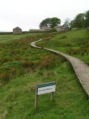
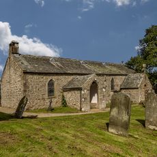
Hannah's Meadows, Protected meadow in Teesdale, England.
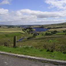
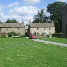
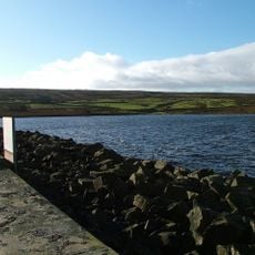
Hannah's Meadows is a protected grassland reserve comprising three fields at Low Birk Hatt Farm, located north of Blackton Reservoir in County Durham. The site encompasses rolling meadowland with diverse plant and invertebrate communities.
The Durham Wildlife Trust acquired the site in 1988 and established it as a nature reserve to protect traditional farming practices and native habitats. Since then, the meadows have been managed using heritage methods rather than modern agricultural approaches.
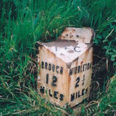
The meadows sit within a landscape shaped by Norse mythology, with the nearby River Balder named after a Norse god and surrounding hills bearing ancient place names. These geographical links reveal the region's deep historical roots.
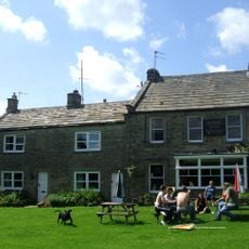
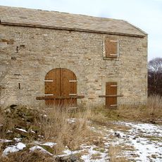
An unstaffed visitor center housed in a converted farm building offers year-round information about the site's ecology and management practices. The location remains open and accessible for self-guided exploration of the meadow trails.
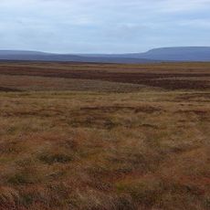
These meadows have remained largely unmodified by artificial fertilizers and grass reseeding, preserving one of the region's most natural grassland communities. Their untouched composition makes them scientifically valuable for studying upland ecology.
GPS coordinates: 54.56220,-2.10139
Latest update: December 10, 2025 20:04
Hury Reservoir
2.7 km
Balderhead Reservoir
1.4 km
God's Bridge
6.3 km
Grassholme Reservoir
3.8 km
Blackton Reservoir
595 m
Cotherstone Moor
1.6 km
Hunder Beck Juniper
768 m
Church of St Romald
7 km
Laithkirk Church
5.8 km
The Kirk Inn
6.9 km
Clove Lodge Farmhouse, Byre/Stables Attached To West And Range Of Sheds Attached To East
782 m
Rose And Crown Hotel
6.9 km
Middleton Bridge
6.8 km
House And Wall Adjacent To Masterman Place Arch
6.9 km
Thringarth Farmhouse And Farm Buildings To Left
4.5 km
Lune Railway Viaduct
6 km
Road Bridge, 400 Metres West Of Town Head Farmhouse, On Road To Mickleton
5.1 km
Balder Viaduct
6.2 km
Archway
6.9 km
1,2 And 3, Masterman Place
6.9 km
3 Headstones To Raine Family About 20 Metres South Of Church Of St Romald
6.9 km
Kirkstile
6.9 km
Field Barn, 700 Metres East Of Hunderthwaite Farmhouse
6.1 km
Milestone, exNR, SW of Hargill Bridge
6 km
Milestone, exNR, north of Selset Resr
4.1 km
Milestone, exNR, east of Greengates
5 km
Bainbridge Memorial Fountain
7 km
Selset Reservoir
3.3 kmVisited this place? Tap the stars to rate it and share your experience / photos with the community! Try now! You can cancel it anytime.
Discover hidden gems everywhere you go!
From secret cafés to breathtaking viewpoints, skip the crowded tourist spots and find places that match your style. Our app makes it easy with voice search, smart filtering, route optimization, and insider tips from travelers worldwide. Download now for the complete mobile experience.
A unique approach to discovering new places❞
— Le Figaro
All the places worth exploring❞
— France Info
A tailor-made excursion in just a few clicks❞
— 20 Minutes