Enable Location

We need your location to show you interesting places around you

Discover nearby places

Find interesting locations and hidden gems around you

Precise directions

Get accurate directions and distances to places

Your location is never shared with other users. It's only used when you tap the location button.

Balderhead Reservoir

Log in to your account

Start exploring — it's free

Trusted by 62,503 travelers worldwide

Continue with Google
Continue with Apple
or

We will send you a code to connect

By continuing, you accept our Terms and Conditions and our Privacy Policy

Check your inbox

We've sent a pincode in your inbox. Please enter the code below.

Balderhead Reservoir

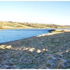
Balderhead Reservoir, lake in the United Kingdom

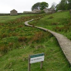
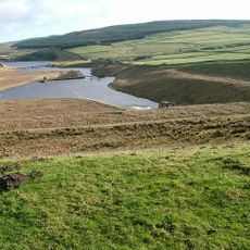
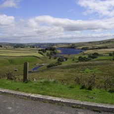
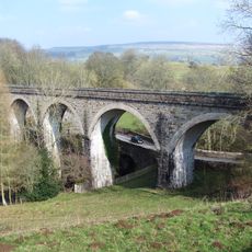
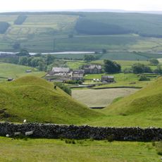
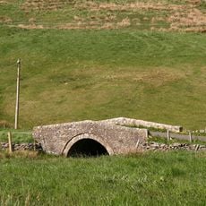
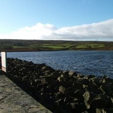
Balderhead Reservoir is a large water body in a quiet valley in Teesdale, County Durham. The water is surrounded by open moorland and fields, with walking paths running along its edges and connecting to nearby Hury and Blackton Reservoirs.

The reservoir was built many years ago to supply water for local industries. Today it serves mainly as a recreational area, as the water needs for industry have decreased over time.

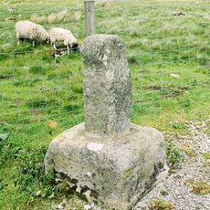
The name Balderhead comes from Old English and refers to the location in a valley. Today, visitors use the reservoir mainly for walking, fishing, and watching birds and stars in the night sky.

Visitors should wear good walking shoes as the paths are unpaved and can become muddy after rain. The area has no shops or cafes, so bring your own supplies if you plan to stay for the day.

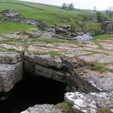
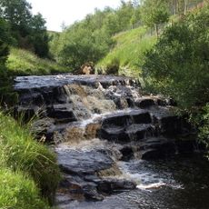
The dam has a large overflow funnel where water falls dramatically, especially during heavy rainfall - a rare sight visible only to visitors during wet seasons. A nearby observatory offers chances to watch planets and learn about astronomy in an area with very dark skies far from city lights.

The community of curious travelers

AroundUs brings together thousands of curated places, local tips, and hidden gems, enriched daily by 60,000 contributors worldwide.

Start exploring
GPS coordinates
54.56111,-2.12361
Latest update
February 9, 2026 08:20
Around this place
Hannah's Meadows
United Kingdom

Hannah's Meadows

1.4 km
Rey Cross
United Kingdom

Rey Cross

6.4 km
Hury Reservoir
United Kingdom

Hury Reservoir

4.1 km
God's Bridge
United Kingdom

God's Bridge

6.8 km
Grassholme Reservoir
United Kingdom

Grassholme Reservoir

4.3 km
Blackton Reservoir
United Kingdom

Blackton Reservoir

2 km
Cotherstone Moor
United Kingdom

Cotherstone Moor

2.4 km
Hunder Beck Juniper
United Kingdom

Hunder Beck Juniper

1.3 km
Laithkirk Church
United Kingdom

Laithkirk Church

6.5 km
Middleton-in-Teesdale War Memorial
United Kingdom

Middleton-in-Teesdale War Memorial

7.5 km
Clove Lodge Farmhouse, Byre/Stables Attached To West And Range Of Sheds Attached To East
United Kingdom

Clove Lodge Farmhouse, Byre/Stables Attached To West And Range Of Sheds Attached To East

1.6 km
Middleton Bridge
United Kingdom

Middleton Bridge

7.3 km
House And Wall Adjacent To Masterman Place Arch
United Kingdom

House And Wall Adjacent To Masterman Place Arch

7.4 km
Milepost, 15 Metres North Of Grains O'Th'Beck Bridge
United Kingdom

Milepost, 15 Metres North Of Grains O'Th'Beck Bridge

5.8 km
Lune Railway Viaduct
United Kingdom

Lune Railway Viaduct

6.8 km
Thringarth Farmhouse And Farm Buildings To Left
United Kingdom

Thringarth Farmhouse And Farm Buildings To Left

4.7 km
Road Bridge, 400 Metres West Of Town Head Farmhouse, On Road To Mickleton
United Kingdom

Road Bridge, 400 Metres West Of Town Head Farmhouse, On Road To Mickleton

6.4 km
Former Chapel With Front Walls And Steps
United Kingdom

Former Chapel With Front Walls And Steps

7.5 km
Archway
United Kingdom

Archway

7.4 km
1,2 And 3, Masterman Place
United Kingdom

1,2 And 3, Masterman Place

7.4 km
Milestone, exNR, SW of Hargill Bridge
United Kingdom

Milestone, exNR, SW of Hargill Bridge

4.9 km
Crosshill Stone
United Kingdom

Crosshill Stone

5.8 km
Milestone, east bound carriageway at Stainmore Summit 100m E of lay-by
United Kingdom

Milestone, east bound carriageway at Stainmore Summit 100m E of lay-by

6.8 km
Milestone, Blackhause Bottom, North Stainmore, Beldon Moss, Old A66 now road top Tan Hill
United Kingdom

Milestone, Blackhause Bottom, North Stainmore, Beldon Moss, Old A66 now road top Tan Hill

7.5 km
Milestone, exNR, north of Selset Resr
United Kingdom

Milestone, exNR, north of Selset Resr

3.6 km
Milestone, exNR, east of Greengates
United Kingdom

Milestone, exNR, east of Greengates

5.4 km
Bainbridge Memorial Fountain
United Kingdom

Bainbridge Memorial Fountain

7.5 km
Selset Reservoir
United Kingdom

Selset Reservoir

2.8 km
Show the full map
« Balderhead Reservoir - lake in the United Kingdom » is provided by Around Us (aroundus.com). Images and texts are derived from Wikimedia project under a Creative Commons license. You are allowed to copy, distribute, and modify copies of this page, under the conditions set by the license, as long as this note is clearly visible.

Discover hidden gems everywhere you go!

From secret cafés to breathtaking viewpoints, skip the crowded tourist spots and find places that match your style. Our app makes it easy with voice search, smart filtering, route optimization, and insider tips from travelers worldwide. Download now for the complete mobile experience.

Around Us App Screenshot

A unique approach to discovering new places

Le Figaro

All the places worth exploring

France Info

A tailor-made excursion in just a few clicks

20 Minutes

Around Us
Travel Guide & Maps
Download

Send to your phone

QR Code
1

Open the camera app on your mobile.

2

Point at the QR code with your camera. A notification will appear.

3

Tap the notification to open the link.