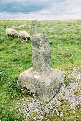
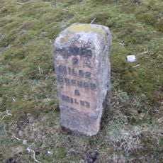
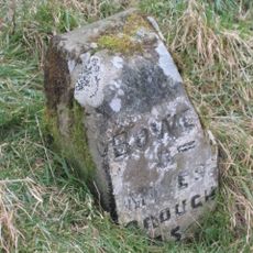
Rey Cross, Stone cross and ancient monument in Bowes, England.
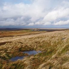
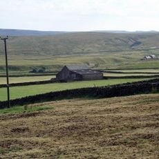
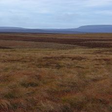
Rey Cross is a stone cross and ancient monument standing on the Pennine moors at roughly 400 meters elevation near the A66 road. The site sits near the Cumbria border and marks a notable position in the moorland landscape.
Rey Cross was ordered built by King Edmund I in the 10th century to mark a boundary between England and Scotland. The stone served for centuries as a significant border marker in this region.
The name comes from the Old Norse word "hreyrr" meaning boundary, showing medieval language influences on British landmarks. This origin shapes how visitors understand and experience the site today.
The monument is easily reached from a dedicated layby on the north side of the A66, especially during drier weather. Visitors should bring suitable clothing for moorland conditions and exposure to wind.
The stone cross has been relocated multiple times, with its most recent move between 1990 and 1992 due to road construction. This relocation shows how modern road development adapted around historical monuments.
Location: Bowes
GPS coordinates: 54.50579,-2.14868
Latest update: December 12, 2025 16:43
Tan Hill
5.6 km
Bowes Castle
8.8 km
Belah Viaduct
6.8 km
Tan Hill Inn
5.6 km
Hannah's Meadows
7 km
Hury Reservoir
9.1 km
Balderhead Reservoir
6.4 km
God's Bridge
5.3 km
Bowes Moor
2.6 km
Blackton Reservoir
7.2 km
Cotherstone Moor
5.9 km
Hunder Beck Juniper
6.2 km
Church of St Giles
8.9 km
The Ancient Unicorn Hotel And Attached Rear Wing (Shown On Os Map As Unicorn House)
9.1 km
St Stephen's Church
6.4 km
Punchbowl Inn
7.9 km
Clove Lodge Farmhouse, Byre/Stables Attached To West And Range Of Sheds Attached To East
6.3 km
Prospect House And Archway To Right
8.8 km
Milestone, 650 Metres West Of Ivy Hall
7.9 km
Boundary Stone On North Side Of Road To North West Of Gate House
4.6 km
Cross House And Church View
8.9 km
Croft House Attached Extension And Sunny Croft
9.1 km
Bowes And District Working Men's Club
9.1 km
The Grove
9 km
Castle Terrace
8.8 km
Milestone, east bound carriageway at Stainmore Summit 100m E of lay-by
1.8 km
Milestone, Blackhause Bottom, North Stainmore, Beldon Moss, Old A66 now road top Tan Hill
3.5 km
Selset Reservoir
8.9 kmVisited this place? Tap the stars to rate it and share your experience / photos with the community! Try now! You can cancel it anytime.
Discover hidden gems everywhere you go!
From secret cafés to breathtaking viewpoints, skip the crowded tourist spots and find places that match your style. Our app makes it easy with voice search, smart filtering, route optimization, and insider tips from travelers worldwide. Download now for the complete mobile experience.
A unique approach to discovering new places❞
— Le Figaro
All the places worth exploring❞
— France Info
A tailor-made excursion in just a few clicks❞
— 20 Minutes