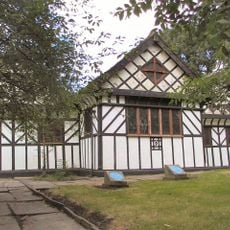
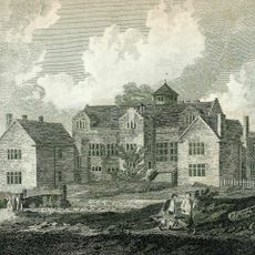
Hyde Hall, Denton, Grade II* listed building in Denton, England.
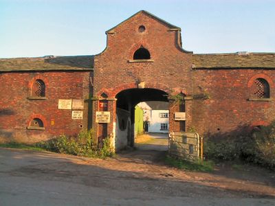
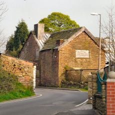
Hyde Hall is a late 16th-century farmhouse on Town Lane in Tameside, built with timber frame and brick exterior. The structure originally formed part of a larger courtyard group that included several outbuildings, which also received Grade II listing protection.
The hall was built in the late 16th century as a working farmhouse. During the English Civil War in 1642, Robert Hyde, who lived there, gathered troops to support the Parliamentarian cause in the Manchester area.
The building carries an inscription beneath the Hyde coat of arms from 1625, reflecting how wealthy families expressed their status through their homes. This carved detail tells you about the values and priorities of the people who lived there during that time.
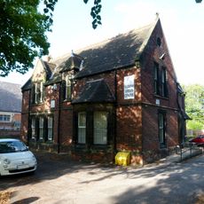
The building is in poor condition with partial roof failure causing interior damage. Because of its state, access may be restricted and visitors should check locally before attempting to view the structure.
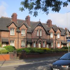
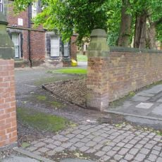
The property was originally part of a larger working farm with multiple outbuildings, some of which still stand today. These additional structures show how extensive agricultural operations were in this part of England during that time.
Location: Tameside
GPS coordinates: 53.44510,-2.12492
Latest update: December 14, 2025 18:07
Debdale Park
2.9 km
St. Elisabeth's Church
2.7 km
St Lawrence's Church, Denton
1.2 km
Gorton Reservoirs
2.8 km
St Anne's Church, Haughton
1.4 km
Houldsworth Working Men's Club
2.3 km
Denton Town Hall
1.3 km
Church of St Mark
2.7 km
Christ Church
1.2 km
Church of St Mary
1.7 km
Number 12 Bridge on Peak Forest Canal
2.6 km
Number 9 Bridge on Peak Forest Canal
2.4 km
Peak Forest Canal, Manchester Road Canal Bridge
2.7 km
Denton War Memorial, Victoria Park, Victoria Street, Denton
1.3 km
Reddish Viaduct
1.3 km
Audenshaw War Memorial
2.5 km
Woodley Tunnel, south portal at SJ 9350 9205 on Peak Forest Canal
2.8 km
Woodley Tunnel, north portal at SJ 9360 9221 on Peak Forest Canal
2.7 km
Clock and Drinking Fountain
2.5 km
Arden Hall
961 m
Rectory to Church of St Elisabeth
2.7 km
Prescott's Almshouses (including associated boundary and garden walls, gateways and gate piers, and outbuildings)
2.5 km
Houldsworth School
2.6 km
Wall to the west and south of Church of St Elizabeth
2.7 km
Apethorn Farmhouse
2.8 km
Wall to west of Church of St Elisabeth
2.7 km
Wall to west of Houldsworth School
2.7 km
Milestone, Hyde Road
1.8 kmVisited this place? Tap the stars to rate it and share your experience / photos with the community! Try now! You can cancel it anytime.
Discover hidden gems everywhere you go!
From secret cafés to breathtaking viewpoints, skip the crowded tourist spots and find places that match your style. Our app makes it easy with voice search, smart filtering, route optimization, and insider tips from travelers worldwide. Download now for the complete mobile experience.
A unique approach to discovering new places❞
— Le Figaro
All the places worth exploring❞
— France Info
A tailor-made excursion in just a few clicks❞
— 20 Minutes