Norsebury Ring, Iron Age hillfort in Micheldever, England.
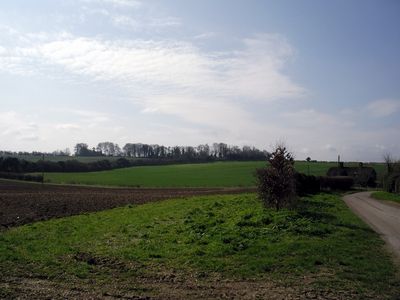
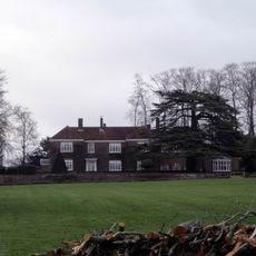
Norsebury Ring is an Iron Age fort in Micheldever situated on a chalk ridge that encompasses about 4 hectares of level ground. The site is defined by inner ramparts and outer counterscarp banks separated by shallow ditches, with the northern and western sections showing better preservation.
Excavations revealed evidence of Bronze Age pottery, Iron Age settlements, and later Roman occupation spanning multiple centuries. The site was used by different groups across several periods due to its strategic position.
The name comes from the old term Naesan Byrg, meaning Fort at the Ness, and shows how place names in Hampshire evolved over centuries. This linguistic change reflects the different peoples and languages that have shaped this area.
The site sits on a chalk ridge overlooking the River Dever with extensive views available from most spots in all directions. Visitors should wear sturdy footwear as the ground is uneven and allow adequate time to explore the full layout properly.
A magnetometer survey in 1997 identified two entrances and a central sub-circular enclosure that may have held a timber shrine like those at other Iron Age sites. This hidden inner structure hints at religious or ceremonial activities that took place here.
Location: Micheldever
GPS coordinates: 51.15790,-1.29909
Latest update: December 14, 2025 18:08
Multi-period site in Micheldever Wood
4.7 km
Tidbury Ring
4 km
Church of St Mary, Micheldever
2.4 km
Church of St Michael
848 m
Church of St Michael
3.8 km
Church of the Holy Trinity
1.5 km
Church of St James
1.1 km
Milestone 50M Sw Of Middle Or Parkhill Lodge
4.6 km
The Dove Inn
3.8 km
Norsebury House
391 m
Old Stores
3.7 km
Thatched Cottages
1.2 km
Sutton Scotney War Memorial
2.8 km
Milestone In Central Reservation Beside Lunways Inn
4.4 km
1-3, Hunton Down Lane
990 m
Milestone 800 Metres West Of Red House, Sutton Scotney
4 km
Milestone Opposite Highway Cottage
4 km
Milestone 1000 Metres North Hunton Grange Farm
1.7 km
Milestone 300 Metres West Of Old Junction With A 303
2.8 km
Cross
5 km
Milestone, 150M N Of Junction With Winchester Road, Micheldever
3.9 km
5 And 6, Hunton Down Lane
991 m
Milestone, Opposite Junction With Wonston Lane
4.4 km
Coach And Horses
2.8 km
Milestone 100 Metres North Of Lower Cranbourne Farm Moated Site
1.5 km
Hunton House
914 m
Milestone, Tidbury Ring
4.1 km
Milestone, Cranbourne Grange
1.5 kmVisited this place? Tap the stars to rate it and share your experience / photos with the community! Try now! You can cancel it anytime.
Discover hidden gems everywhere you go!
From secret cafés to breathtaking viewpoints, skip the crowded tourist spots and find places that match your style. Our app makes it easy with voice search, smart filtering, route optimization, and insider tips from travelers worldwide. Download now for the complete mobile experience.
A unique approach to discovering new places❞
— Le Figaro
All the places worth exploring❞
— France Info
A tailor-made excursion in just a few clicks❞
— 20 Minutes