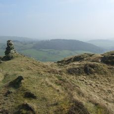
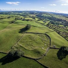
Reston Scar, Mountain summit in Lake District, England
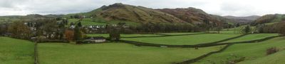
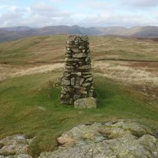
Reston Scar is a mountain summit in the Lake District standing at about 255 meters with a cairn marking its peak. From the top, you can see across to nearby ranges including the Coniston Fells and Langdale Pikes.
Alfred Wainwright documented the fell in 1974 through his book on the Outlying Fells, introducing it to walkers far and wide. Since then it has remained a steady part of the Lake District walking tradition.
The summit forms part of the Wainwright fell-walking collection, a cherished tradition that shapes how hikers experience the Lake District. This classification carries weight among local walking communities who follow these routes generation after generation.
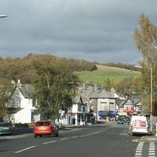
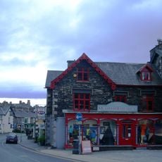
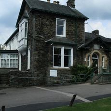
The main route begins in Staveley village and passes Kemp Tarn as it climbs toward the summit. Newly installed gates in the drystone walls help walkers navigate the path and mark the right direction.
The fell has a prominence of only 20 meters, rising modestly above the surrounding landscape. This modest elevation makes it a popular choice for walkers seeking shorter, manageable day walks in the region.
Elevation above the sea: 255 m
GPS coordinates: 54.38176,-2.83273
Latest update: December 14, 2025 18:44
Orrest Head
4.6 km
Holehird Gardens
5.4 km
Potter Fell
4 km
St Mary's Church, Windermere
5 km
Church of St Cuthbert
5.3 km
Hollin Hall
2.8 km
Church of St James
946 m
Hugill Fell
711 m
Church of St Anne
1.4 km
Tower of ruined chapel of St Margaret
1.3 km
Carver Memorial Chapel
5 km
Sun Inn
3.7 km
Baddeley Memorial Clock Tower
5.1 km
St Oswald's Church
5.4 km
Elba Monument
5.2 km
Windermere Hotel (Excluding Modern Additions)
4.6 km
Cheshire Home Holehird
5.4 km
Milestone On Loop Road 50 Yards South Of Junction Of Hollins Lane And Windermere
5.1 km
Church of Our Lady of Windermere and St. Herbert
5.1 km
Ye Olde Bath House
5.3 km
Tower of ruined church of St Catherine
4.3 km
Staveley War Memorial, Cumbria
1 km
Romano-British settlement, 450m east of High Borrans
3.2 km
Milestone 10 Metres East Of Junction Of Crook Road And Ratherheath Lane
4 km
Gateway To South Of Tolson Hall And Attached Walls
5.2 km
2, Victoria Street
4.7 km
Windermere Library
4.8 km
Milestone In Layby To Left Of A591 200 Metres North Of Ratherheath Lane
3.6 kmVisited this place? Tap the stars to rate it and share your experience / photos with the community! Try now! You can cancel it anytime.
Discover hidden gems everywhere you go!
From secret cafés to breathtaking viewpoints, skip the crowded tourist spots and find places that match your style. Our app makes it easy with voice search, smart filtering, route optimization, and insider tips from travelers worldwide. Download now for the complete mobile experience.
A unique approach to discovering new places❞
— Le Figaro
All the places worth exploring❞
— France Info
A tailor-made excursion in just a few clicks❞
— 20 Minutes