St Anne's Church, Woodplumpton, Anglican church in Woodplumpton, England.
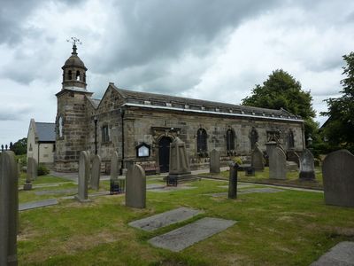
St Anne's Church is an Anglican church in Woodplumpton built with red and yellow sandstone walls, slate roofs, and topped by an octagonal cupola with a stone dome and weathervane. The building's distinctive architectural features make it visually striking and serve as a recognizable landmark in the local area.
The structure was substantially rebuilt in 1630 and later expanded with a south aisle in 1748. Early twentieth-century restoration work by architects Austin and Paley brought further changes and improvements to the building.
The church remains an active place of worship and serves as a focal point for community gatherings in Woodplumpton. It continues to hold its traditional role in the lives of local people through regular services and parish events.
The church is open for regular services including Sunday Eucharist in the morning and Thursday Holy Communion. It is worth checking ahead for current service times and any seasonal changes that might affect visitor access.
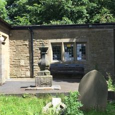
The churchyard contains the grave of Meg Shelton, marked by a large boulder, a figure tied to local legend and folklore. According to old tradition, she was supposedly buried in an unusual manner in the 17th century, making the site of particular historical interest.
The community of curious travelers
AroundUs brings together thousands of curated places, local tips, and hidden gems, enriched daily by 60,000 contributors worldwide.