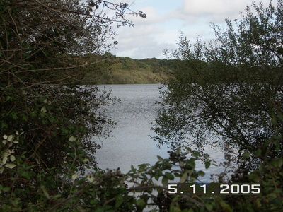
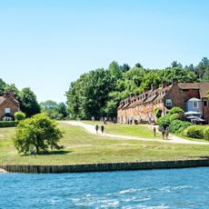
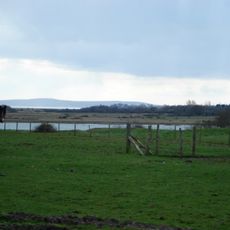
Sowley Pond, Protected wetland site near Beaulieu, England
Sowley Pond is a 49-hectare wetland that forms part of a protected area covering the Solent and Southampton Water region. The water supports many waterfowl species, including surface-feeding ducks and diving ducks that make their home here.
The water was created in the 14th century when monks from nearby Beaulieu Abbey built a dam across a stream to establish a reliable supply of fish for the monastery. This medieval engineering work shaped the landscape that exists today.
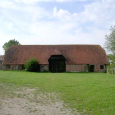
The name reflects the milling heritage of the area, derived from the old water-powered structures that once operated here. Visitors can still sense this industrial past through the shape of the landscape around the water.
The site is closed to public access to protect the wildlife and maintain the ecological balance of the area. Visitors can explore the surrounding landscape and nearby walking routes that offer views from a distance.
The site contains the New Forest's only known breeding population of variable damselflies. It also holds one of Hampshire's largest colonies of nesting herons.
Location: Beaulieu
GPS coordinates: 50.76850,-1.47014
Latest update: December 13, 2025 17:09
Pylewell House
2.3 km
Lymington Open Air Sea Water Baths
4.5 km
South Hampshire Coast
316 m
Buckler's Hard
4.8 km
Hurst Castle And Lymington River Estuary
4.4 km
Church of St Mary
2.3 km
Church of St Paul
3.6 km
St Leonard's Chapel
3.4 km
Standwell House Hotel Stanwell House Hotel
5 km
Walhampton Arms, formerly farm building range at Home Farm
4.4 km
Burrard-Neale Memorial Gas Lamp
4.4 km
Burard-neale Monument
4.3 km
The King's Head Public House
4.9 km
The Angel Hotel
5.1 km
Buckler's Hard Maritime Museum
4.8 km
80, 81 And 82
4.8 km
Drinking Fountain
4.5 km
Walhampton House Walhampton School
4.3 km
No 1, 3 And 5 And Cast Iron Bollard Against No 1 At Junction Of Gosport Street And Quay Hill
4.9 km
No 6 And Band Of Stone Paving On West Sides
4.9 km
Quay Hill Surface
4.9 km
Lower Exbury Farm
4.9 km
16-18, High Street
5 km
Barn And Attached Farm Range 60 Metres South East Of Beufre Farmhouse
4.6 km
St Leonard's Barn
3.5 km
102 And 103, High Street
5.1 km
36 And 37, High Street
5.1 km
29, High Street
5.1 kmVisited this place? Tap the stars to rate it and share your experience / photos with the community! Try now! You can cancel it anytime.
Discover hidden gems everywhere you go!
From secret cafés to breathtaking viewpoints, skip the crowded tourist spots and find places that match your style. Our app makes it easy with voice search, smart filtering, route optimization, and insider tips from travelers worldwide. Download now for the complete mobile experience.
A unique approach to discovering new places❞
— Le Figaro
All the places worth exploring❞
— France Info
A tailor-made excursion in just a few clicks❞
— 20 Minutes