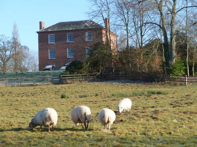
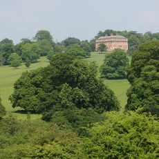
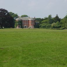
Sodington Hall, Grade II listed country house in Mamble, England.
Sodington Hall is a three-story brick house built in the Georgian style with sash windows and a central entrance. The building features a solid, balanced design that rises prominently from the surrounding countryside.
The present building replaced an older fortified house that was destroyed in 1646 during the English Civil War. The new construction rose in the 18th century on the same site where the earlier house had stood.
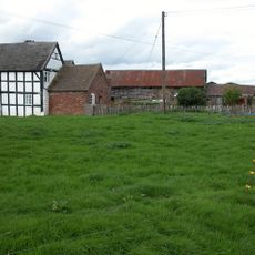
The Blount family shaped this place over many generations, leaving their mark on how it developed. Their long occupation of the land remains connected to the identity of this place.
The house sits in a rural setting roughly 6 miles southwest of Bewdley, reachable by the A456 road. It remains a private residence with restricted access, so visitors can only view it from the road or nearby paths.
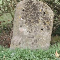
Digging during the building's construction in 1806 revealed traces of Roman settlement beneath the site. Fragments of ancient pavement and water pipes showed that people had lived here centuries before the Georgian house was built.
Location: Mamble
GPS coordinates: 52.33600,-2.45200
Latest update: December 13, 2025 11:42
Mawley Hall
4.3 km
Eastham Bridge
3.9 km
Church of Saint Peter and Saint Paul
3.9 km
Rock Farm moated site, deserted medieval village and ridge and furrow, 100m SE of St Peter and St Paul's Church
4 km
Church of St John the Baptist, Mamble
783 m
Church of St Andrew
4.3 km
Church of St Peter and St Paul
4.2 km
Church of St James, Pensax
3.6 km
Church of All Saints
3.5 km
Church of St Lawrence
2.7 km
Church of St Bartholomew
2.3 km
The Sun And Slipper Public House
725 m
Lower Langley Farmhouse
4.5 km
Rea Aqueduct At Ngr So 6511 7030 (That Part In Neen Sollars Cp)
4.2 km
Shakenhurst
2.8 km
Milestone At Ngr So 6991 7487
3.9 km
Milestone, 150yds W of turn to Stanford Bridge
4.1 km
Milestone, roadside at SO6544569565
4.1 km
Milestone, E of Cutmill Bridge
3 km
Milestone, Linkhill Wood, S of "The Farm"
2.5 km
Milestone, W of Eastham Bridge
4.2 km
Milestone, Lodge Coppice; E of B4201
4.7 km
Milestone, Oak Farm; W of farm
4.8 km
Milestone, between entrance to Carlton Farm and waterworks
3.1 km
Milestone, Cleobury Road, Clows Top
2.2 km
Milestone, opp. drive to Woodston Farm
2.9 km
Milestone, Broombank, on line of old road
2.6 km
Milestone, 30m W entrance to Barnslands Farm
5 kmVisited this place? Tap the stars to rate it and share your experience / photos with the community! Try now! You can cancel it anytime.
Discover hidden gems everywhere you go!
From secret cafés to breathtaking viewpoints, skip the crowded tourist spots and find places that match your style. Our app makes it easy with voice search, smart filtering, route optimization, and insider tips from travelers worldwide. Download now for the complete mobile experience.
A unique approach to discovering new places❞
— Le Figaro
All the places worth exploring❞
— France Info
A tailor-made excursion in just a few clicks❞
— 20 Minutes