Enable Location

We need your location to show you interesting places around you

Discover nearby places

Find interesting locations and hidden gems around you

Precise directions

Get accurate directions and distances to places

Your location is never shared with other users. It's only used when you tap the location button.

Bradley Branch

Log in to your account

Start exploring — it's free

Trusted by 63,341 travelers worldwide

Continue with Google
Continue with Apple
or

We will send you a code to connect

By continuing, you accept our Terms and Conditions and our Privacy Policy

Check your inbox

We've sent a pincode in your inbox. Please enter the code below.

Bradley Branch
Discussion Reviews 1 Photos
2.1k Popularity

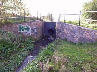
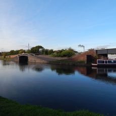
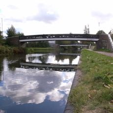
Bradley Branch, Canal branch in West Midlands, England.

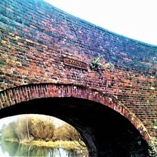
Bradley Branch is a canal section in the West Midlands that runs from Wednesbury Oak to Moorcroft Junction, controlled by a series of locks. The route passes through areas shaped by coal mining and industrial activity, where the landscape still shows traces of its working past.

The canal was built in the 1840s as part of the Birmingham Canal Navigations network to carry coal and goods from local mines to factories. This connection was crucial to the region's industrial growth at that time.

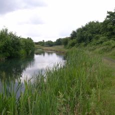
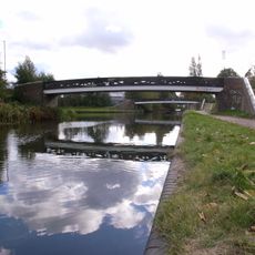
The waterway has become a gathering place where local boaters and walkers use it as a community hub. You can see people spending their afternoons by the water, enjoying the space as a quiet escape from urban life.

The canal is best explored on foot or by boat, with regular paths and mooring points along the route. Wear suitable footwear, as some sections of the towpath can be muddy or uneven, especially after rain.

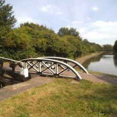
The locks here use an unusual design with single gates at each end instead of the typical paired gates, which is a local engineering quirk. This feature is a rare example of alternative lock construction from that period.

The community of curious travelers

AroundUs brings together thousands of curated places, local tips, and hidden gems, enriched daily by 60,000 contributors worldwide.

Start exploring
GPS coordinates
52.55060,-2.05090
Latest update
December 14, 2025 09:45
Around this place
Bilston Craft Gallery
United Kingdom

Bilston Craft Gallery

2.4 km
Wednesbury Oak Loop
United Kingdom

Wednesbury Oak Loop

1.1 km
Wednesbury Museum and Art Gallery
United Kingdom

Wednesbury Museum and Art Gallery

2.1 km
Greyhound and Punchbowl Inn
United Kingdom

Greyhound and Punchbowl Inn

2.5 km
Bilston Town Hall
United Kingdom

Bilston Town Hall

2.4 km
The Robin
United Kingdom

The Robin

2.5 km
Christ Church
United Kingdom

Christ Church

2 km
Wednesbury Town Hall
United Kingdom

Wednesbury Town Hall

2 km
Church of St Mary
United Kingdom

Church of St Mary

1.9 km
Church of St Lawrence
United Kingdom

Church of St Lawrence

2.3 km
Church of St Bartholomew
United Kingdom

Church of St Bartholomew

2.2 km
Church of St John
United Kingdom

Church of St John

1.4 km
Church of St Leonard
United Kingdom

Church of St Leonard

2.4 km
1 and 2, Church Street
United Kingdom

1 and 2, Church Street

2.3 km
Wednesbury Museum and Art Gallery
United Kingdom

Wednesbury Museum and Art Gallery

2 km
Darlaston War Memorial
United Kingdom

Darlaston War Memorial

2.4 km
St Mark
United Kingdom

St Mark

980 m
St Paul
United Kingdom

St Paul

2.1 km
Old Blue Ball Public House
United Kingdom

Old Blue Ball Public House

2.1 km
Wednesbury Library
United Kingdom

Wednesbury Library

2.3 km
Glebefields Library
United Kingdom

Glebefields Library

1.2 km
Towpath Bridge Over Entrance To Canal Basin (Approximately 150 Metres West Of Watery Lane) Birmingham Canal Birmingham Level
United Kingdom

Towpath Bridge Over Entrance To Canal Basin (Approximately 150 Metres West Of Watery Lane) Birmingham Canal Birmingham Level

2.6 km
Footbridge To North Of Junction With Tame Valley Canal, East Of Bayleys Lane Walsall Canal
United Kingdom

Footbridge To North Of Junction With Tame Valley Canal, East Of Bayleys Lane Walsall Canal

1.6 km
Hempole Lane Bridge, Eagles Lane Walsall Canal
United Kingdom

Hempole Lane Bridge, Eagles Lane Walsall Canal

2.1 km
Footbridge To South Of Junction With Tame Valley Canal, East Of Bayleys Lane Walsall Canal
United Kingdom

Footbridge To South Of Junction With Tame Valley Canal, East Of Bayleys Lane Walsall Canal

1.6 km
Bottom Lock And Attached Cantilever Footbridge, Factory Locks (Approximately 50 Meters North Of Furnace Parade) Birmingham Canal Birmingham Level
United Kingdom

Bottom Lock And Attached Cantilever Footbridge, Factory Locks (Approximately 50 Meters North Of Furnace Parade) Birmingham Canal Birmingham Level

2.5 km
Wednesbury Old Post Office
United Kingdom

Wednesbury Old Post Office

2 km
Wednesbury Adult Education Centre
United Kingdom

Wednesbury Adult Education Centre

2 km
Show the full map
Reviews
Share your experience

No review yet

Discussions
Start a discussion...

No discussion yet

« Bradley Branch - Canal branch in West Midlands, England » is provided by Around Us (aroundus.com). Images and texts are derived from Wikimedia project under a Creative Commons license. You are allowed to copy, distribute, and modify copies of this page, under the conditions set by the license, as long as this note is clearly visible.

Discover hidden gems everywhere you go!

From secret cafés to breathtaking viewpoints, skip the crowded tourist spots and find places that match your style. Our app makes it easy with voice search, smart filtering, route optimization, and insider tips from travelers worldwide. Download now for the complete mobile experience.

Around Us App Screenshot

A unique approach to discovering new places

Le Figaro

All the places worth exploring

France Info

A tailor-made excursion in just a few clicks

20 Minutes

Around Us
Travel Guide & Maps
Download

Send to your phone

QR Code
1

Open the camera app on your mobile.

2

Point at the QR code with your camera. A notification will appear.

3

Tap the notification to open the link.