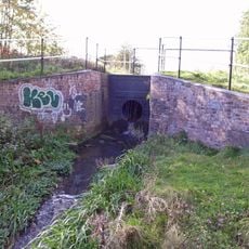
Wednesbury Oak Loop, Industrial canal route in West Midlands, England
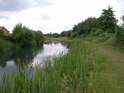
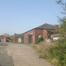
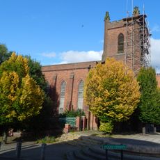
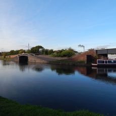
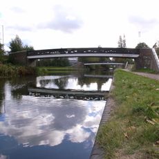
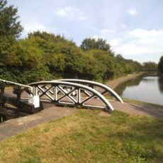
The Wednesbury Oak Loop is a canal route connecting Bloomfield Junction to Deepfields Junction within the Birmingham Canal Navigations system. The northern section remains navigable with access to historic workshop facilities along its course.
The canal opened in 1769 following parliamentary approval the year before. It was built primarily to transport coal from nearby mines and establish a trade connection to Birmingham.
The waterway shaped how people and goods moved through the industrial heartland. Today you can still see how the canal connected communities and drove local commerce.
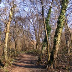
The northern section is accessible for walking along the water and exploring the surroundings. Dry weather makes the towpath easier to traverse and more enjoyable for visitors.
The canal was engineered to follow a specific elevation contour, minimizing the number of locks needed along the route. This clever design allowed cargo to move more efficiently between different industrial zones.
GPS coordinates: 52.55360,-2.06610
Latest update: December 14, 2025 12:23
Bradley Branch
1.1 km
Bilston Craft Gallery
1.7 km
Greyhound and Punchbowl Inn
1.5 km
Bilston Town Hall
1.5 km
The Robin
1.7 km
The Boat Gauging House, Tipton Canal Basin (Off Factory Road) Birmingham Canal Birmingham Level
2.5 km
Christ Church
1.3 km
Wednesbury Town Hall
3 km
Peascroft Wood
2 km
Church of St Martin and St Paul
2.6 km
Church of St Mary
1.2 km
Church of St Lawrence
2.7 km
Church of St Mary
2.9 km
Church of St Leonard
1.6 km
Church of St Matthew
2.9 km
Church of St John
1.5 km
1 and 2, Church Street
2.7 km
Wednesbury Museum and Art Gallery
3 km
St Mark
1.9 km
Darlaston War Memorial
2.8 km
The Fountain Inn Public House
2.8 km
Old Blue Ball Public House
3 km
Glebefields Library
1.6 km
Towpath Bridge Over Entrance To Canal Basin (Approximately 150 Metres West Of Watery Lane) Birmingham Canal Birmingham Level
2.7 km
Footbridge To South Of Junction With Tame Valley Canal, East Of Bayleys Lane Walsall Canal
2.6 km
Abraham Darby sculpture
2.8 km
Footbridge To North Of Junction With Tame Valley Canal, East Of Bayleys Lane Walsall Canal
2.6 km
Bottom Lock And Attached Cantilever Footbridge, Factory Locks (Approximately 50 Meters North Of Furnace Parade) Birmingham Canal Birmingham Level
2.5 kmVisited this place? Tap the stars to rate it and share your experience / photos with the community! Try now! You can cancel it anytime.
Discover hidden gems everywhere you go!
From secret cafés to breathtaking viewpoints, skip the crowded tourist spots and find places that match your style. Our app makes it easy with voice search, smart filtering, route optimization, and insider tips from travelers worldwide. Download now for the complete mobile experience.
A unique approach to discovering new places❞
— Le Figaro
All the places worth exploring❞
— France Info
A tailor-made excursion in just a few clicks❞
— 20 Minutes