Enable Location

We need your location to show you interesting places around you

Discover nearby places

Find interesting locations and hidden gems around you

Precise directions

Get accurate directions and distances to places

Your location is never shared with other users. It's only used when you tap the location button.

St Olave Silver Street

Log in to your account

Start exploring — it's free

Trusted by 61,443 travelers worldwide

Continue with Google
Continue with Apple
or

We will send you a code to connect

By continuing, you accept our Terms and Conditions and our Privacy Policy

Check your inbox

We've sent a pincode in your inbox. Please enter the code below.

St Olave Silver Street

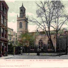
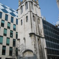
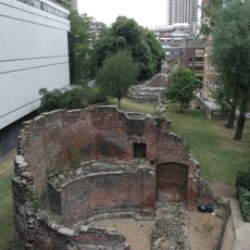
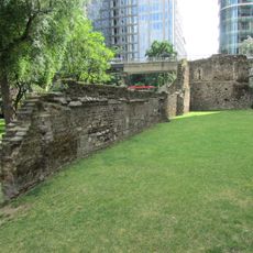
St Olave Silver Street, Medieval church ruins in City of London, England

Description

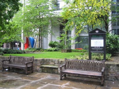
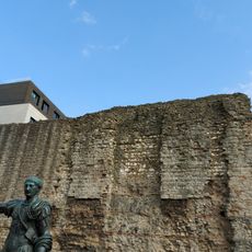
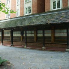
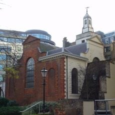
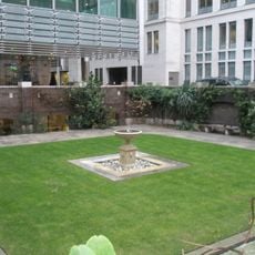
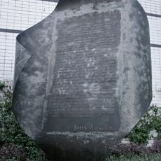
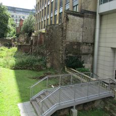
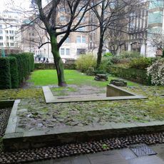
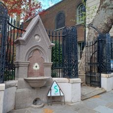
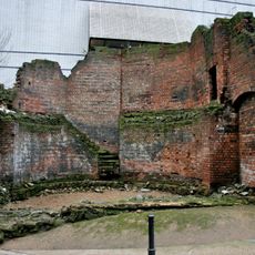
St Olave Silver Street is a church ruin in the City of London, now open as a public garden. Stone tablets and gravestones remain on the site, providing traces of the original building and its role in the neighborhood.

History

The church, originally called St Olave de Mukewellestrate in the 12th century, served the neighborhood until the Great Fire of London destroyed it in September 1666. The fire left only traces of the structure, which became the public space we see today.

Culture

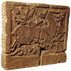
The site honors St Olaf, the first Christian King of Norway, showing the medieval Norwegian community's role in London's religious life. This Scandinavian connection shaped the identity of this corner of the city.

Practical

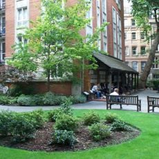
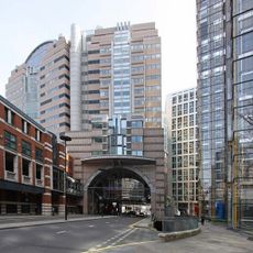
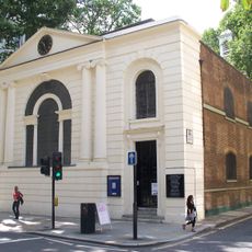
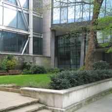
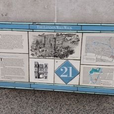
The site sits near London Wall and functions as an accessible public garden open to visitors. It offers a green space where you can walk among the remnants and read historical markers.

Did you know?

The churchyard served as burial ground for bodies dissected at Barber-Surgeons Hall, earning the nickname 'anatomizer's ground'. This practical role in London's medical history is little known today, yet it marks a hidden chapter in the site's past.

Location
GPS coordinates
51.51730,-0.09530
Latest update
December 14, 2025 12:27

AroundUs brings together thousands of curated places, local tips, and hidden gems, enriched daily by 60,000 contributors worldwide. Discover all places nearby (City of London).

Around this place
London Wall
United Kingdom

London Wall

116 m
Postman's Park
United Kingdom

Postman's Park

172 m
St Giles-without-Cripplegate
United Kingdom

St Giles-without-Cripplegate

180 m
Memorial to Heroic Self-Sacrifice
United Kingdom

Memorial to Heroic Self-Sacrifice

185 m
125 London Wall
United Kingdom

125 London Wall

106 m
St Mary Aldermanbury
United Kingdom

St Mary Aldermanbury

178 m
Goldsmiths' Hall
United Kingdom

Goldsmiths' Hall

183 m
St Alban, Wood Street
United Kingdom

St Alban, Wood Street

113 m
St Anne and St Agnes
United Kingdom

St Anne and St Agnes

126 m
200 Aldersgate
United Kingdom

200 Aldersgate

166 m
St Botolph's Aldersgate
United Kingdom

St Botolph's Aldersgate

136 m
St John Zachary
United Kingdom

St John Zachary

135 m
St Mary Staining
United Kingdom

St Mary Staining

70 m
Monkwell Square
United Kingdom

Monkwell Square

103 m
English Runic Inscription 2
United Kingdom

English Runic Inscription 2

79 m
Unity
United Kingdom

Unity

138 m
London Wall: section of Roman and medieval wall and bastions, west and north of Monkwell Square
United Kingdom

London Wall: section of Roman and medieval wall and bastions, west and north of Monkwell Square

105 m
London Wall: the west gate of Cripplegate fort and a section of Roman wall in London Wall underground car park, adjacent to Nobl
United Kingdom

London Wall: the west gate of Cripplegate fort and a section of Roman wall in London Wall underground car park, adjacent to Nobl

24 m
London Wall: section of Roman and medieval wall and bastion at Noble Street
United Kingdom

London Wall: section of Roman and medieval wall and bastion at Noble Street

56 m
Wood Street Police Station
United Kingdom

Wood Street Police Station

125 m
Aldersgate Flame
United Kingdom

Aldersgate Flame

82 m
London Wall: section of Roman wall and Roman, medieval and post-medieval gateway at Aldersgate
United Kingdom

London Wall: section of Roman wall and Roman, medieval and post-medieval gateway at Aldersgate

123 m
Footings To Former Church Of St Mary The Virgin
United Kingdom

Footings To Former Church Of St Mary The Virgin

165 m
Gate And Railings To Former Churchyard Of Church Of St Botolph
United Kingdom

Gate And Railings To Former Churchyard Of Church Of St Botolph

127 m
General Post Office North
United Kingdom

General Post Office North

169 m
Police Call Box At North East Angle Of Number 1
United Kingdom

Police Call Box At North East Angle Of Number 1

131 m
Brewers' Hall
United Kingdom

Brewers' Hall

184 m
Bastion 14, London Wall
United Kingdom

Bastion 14, London Wall

53 m
Show the full map
« St Olave Silver Street - Medieval church ruins in City of London, England » is provided by Around Us (aroundus.com). Images and texts are derived from Wikimedia project under a Creative Commons license. You are allowed to copy, distribute, and modify copies of this page, under the conditions set by the license, as long as this note is clearly visible.

Discover hidden gems everywhere you go!

From secret cafés to breathtaking viewpoints, skip the crowded tourist spots and find places that match your style. Our app makes it easy with voice search, smart filtering, route optimization, and insider tips from travelers worldwide. Download now for the complete mobile experience.

Around Us App Screenshot

A unique approach to discovering new places

Le Figaro

All the places worth exploring

France Info

A tailor-made excursion in just a few clicks

20 Minutes

Around Us
Travel Guide & Maps
Download

Send to your phone

QR Code
1

Open the camera app on your mobile.

2

Point at the QR code with your camera. A notification will appear.

3

Tap the notification to open the link.